Map icon display method and device

A display method and icon technology, applied in geographic information databases, structured data retrieval, etc., can solve problems such as inability to obtain information intuitively, and achieve the effect of avoiding homogenization

Inactive Publication Date: 2020-01-03
BEIJING QIHOO TECH CO LTD
View PDF5 Cites 1 Cited by
  • Summary
  • Abstract
  • Description
  • Claims
  • Application Information

AI Technical Summary

Problems solved by technology

These problems make it impossible for users to intuitively obtain information in a city or region on the map, and users need to make detailed inquiries on the Internet to know the map data they want to know

Method used


Image

  • Map icon display method and device
  • Map icon display method and device
  • Map icon display method and device

Examples


Embodiment Construction

[0063] Exemplary embodiments of the present disclosure will be described in more detail below with reference to the accompanying drawings. Although exemplary embodiments of the present disclosure are shown in the drawings, it should be understood that the present disclosure may be embodied in various forms and should not be limited by the embodiments set forth herein. Rather, these embodiments are provided for more thorough understanding of the present disclosure and to fully convey the scope of the present disclosure to those skilled in the art.

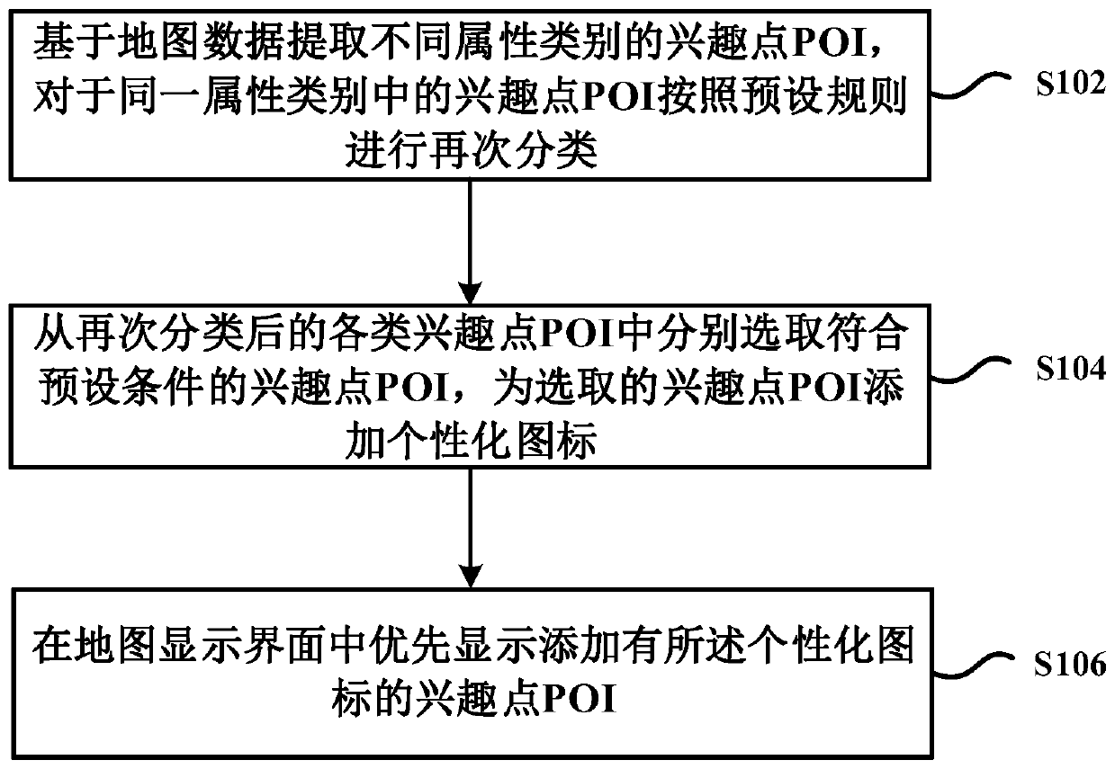
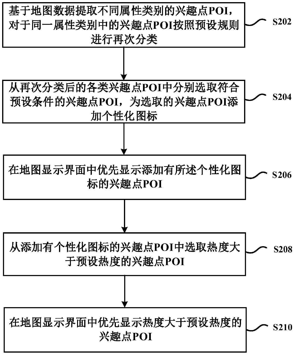
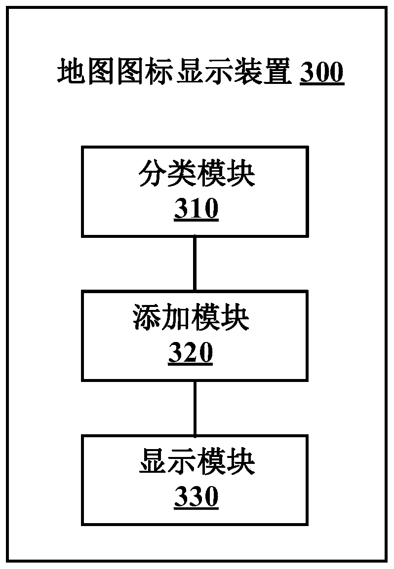
[0064] In order to solve the above technical problems, an embodiment of the present invention provides a method for displaying map icons, which is applied to map applications. figure 1 A schematic flowchart of a method for displaying map icons according to an embodiment of the present invention is shown. see figure 1 , the method at least includes step S102 to step S106.

[0065] Step S102, extract POIs of different attribute cat...


PUM


Abstract

The invention provides a map icon display method and device. The method comprises the following steps: extracting POIs of different attribute categories based on map data; classifying the POIs in thesame attribute category again according to a preset rule; and then, respectively selecting the POIs meeting preset conditions from the classified POIs, adding personalized icons to the selected POIs,and further preferentially displaying the POIs added with the personalized icons in a map display interface. According to the embodiment of the invention, the POIs in the map are finely classified, and the personalized striking icons are added to the selected POIs, so that the POIs can be clearly and strikingly displayed on the map, and the homogenization among brands corresponding to the POIs canbe avoided. Furthermore, the scheme is also helpful for the user to add personalized icons through POIs (Point Of Interest) of each region on the map, and the feature information of each region can be quickly known.

Description

technical field [0001] The invention relates to the technical field of map data, in particular to a method and device for displaying map icons. Background technique [0002] When traditional maps display map data, they usually display points of interest (Point of Interest, POI) according to categories. Although there are icons and text forms when displaying POIs, they are not too eye-catching, and the problem of homogeneity is serious. These problems make it impossible for users to intuitively obtain information in a city or region on the map, and users need to make detailed inquiries on the Internet to know the map data they want to know. Therefore, how to enable the user to quickly know the characteristic information (such as brand information) in the current city or region through the map is a technical problem currently faced. Contents of the invention [0003] In view of the above problems, the present invention is proposed to provide a method and device for displayi...

Claims


Application Information

Patent Timeline
Patent Type & Authority Applications(China)
IPC IPC(8): G06F16/29
Inventor 刘庆军罗军张志杰杨孝成
Owner BEIJING QIHOO TECH CO LTD
Why Eureka
Try Eureka