Geological survey map and pile foundation map fusion method based on Revit platform
A technology of geological survey and fusion method, applied in the direction of graphic image conversion, image data processing, 3D modeling, etc., can solve the problems of inability to explain the laws of spatial changes, inability to integrate pile foundation diagrams, and inconspicuous intuitive effects.
- Summary
- Abstract
- Description
- Claims
- Application Information
AI Technical Summary
Problems solved by technology
Method used
Image


Examples
Embodiment 1
[0042] In order to facilitate the understanding of those skilled in the art, the structure of the present invention will be further described in detail with the embodiments in conjunction with the accompanying drawings:
[0043] A method for merging geological survey maps and pile foundation maps based on the Revit platform, comprising the following steps:
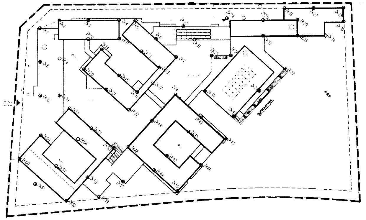
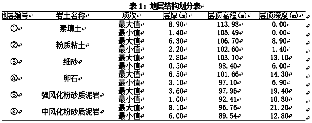
[0044] S1, planning a plurality of drilling points for the geology, conducting a drilling survey on the drilling points, and collecting the original data of the drilling, the original data of the drilling includes the first plane coordinate data of the rock and soil at different drilling points, the same The first elevation data of the drilling point at the top of the first layer of rock and soil in different strata;
[0045] S2, expanding the original drilling data with a cubic spline surface modeling method to generate a large amount of geological data, the geological data including a large number of layer bottom point d...
PUM
 Abstract
Description
Claims
Application Information
 - R&D Engineer
- R&D Manager
- IP Professional
- Industry Leading Data Capabilities
- Powerful AI technology
- Patent DNA Extraction
Browse by: Latest US Patents, China's latest patents, Technical Efficacy Thesaurus, Application Domain, Technology Topic.
© 2024 PatSnap. All rights reserved.Legal|Privacy policy|Modern Slavery Act Transparency Statement|Sitemap