A Path Planning Method for UAV with Endpoint Direction and Time Constraints
A time-constrained, track-planning technology, applied in navigation calculation tools and other directions, to improve the effect of routing problems
- Summary
- Abstract
- Description
- Claims
- Application Information
AI Technical Summary
Problems solved by technology
Method used
Image
Examples
Embodiment Construction
[0034] In order to make the objectives, technical solutions, and advantages of the embodiments of the present invention clearer and more specific, the present invention will be further described in detail below in conjunction with the accompanying drawings and implementation cases.
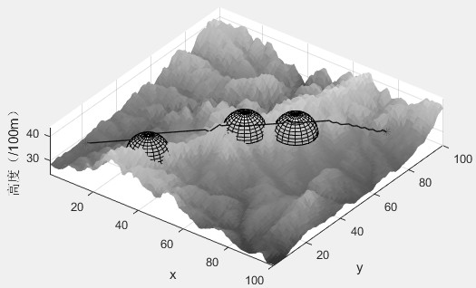
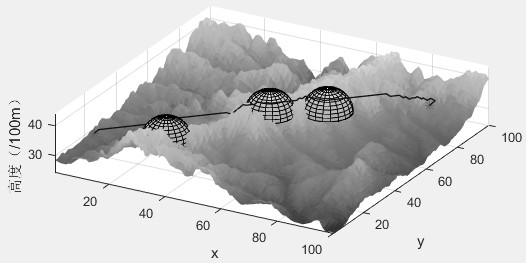
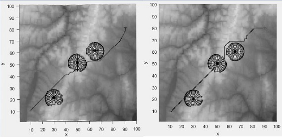
[0035] The present invention proposes a UAV track planning method with endpoint direction and time constraints, the flow chart of which is as follows figure 1 As shown, the specific steps are as follows:
[0036] (1) Build the environment and divide the space: load the .mat terrain file, which stores the three-dimensional coordinate points of the terrain, the maximum coordinate values MAX_X, MAX_Y, and MAX_Z in the directions of X, Y, and Z axes, as well as the number and coordinates of the radar , minimum radius R min and a maximum radius R max , and generate the required terrain surface map, and then divide the space into regular grid units according to the minimum step size of the UAV fligh...
PUM
 Abstract
Description
Claims
Application Information
 - R&D
- Intellectual Property
- Life Sciences
- Materials
- Tech Scout
- Unparalleled Data Quality
- Higher Quality Content
- 60% Fewer Hallucinations
Browse by: Latest US Patents, China's latest patents, Technical Efficacy Thesaurus, Application Domain, Technology Topic, Popular Technical Reports.
© 2025 PatSnap. All rights reserved.Legal|Privacy policy|Modern Slavery Act Transparency Statement|Sitemap|About US| Contact US: help@patsnap.com


