

Sky-near space cooperative remote sensing system simulation test device and method
A system simulation and test device technology, which is applied in the field of remote sensing systems, can solve problems such as complexity, large investment, and large structure of the collaborative remote sensing system between the sky and the sky
Active Publication Date: 2020-10-16
NAT INNOVATION INST OF DEFENSE TECH PLA ACAD OF MILITARY SCI
View PDF5 Cites 4 Cited by
- Summary
- Abstract
- Description
- Claims
- Application Information
AI Technical Summary
Problems solved by technology
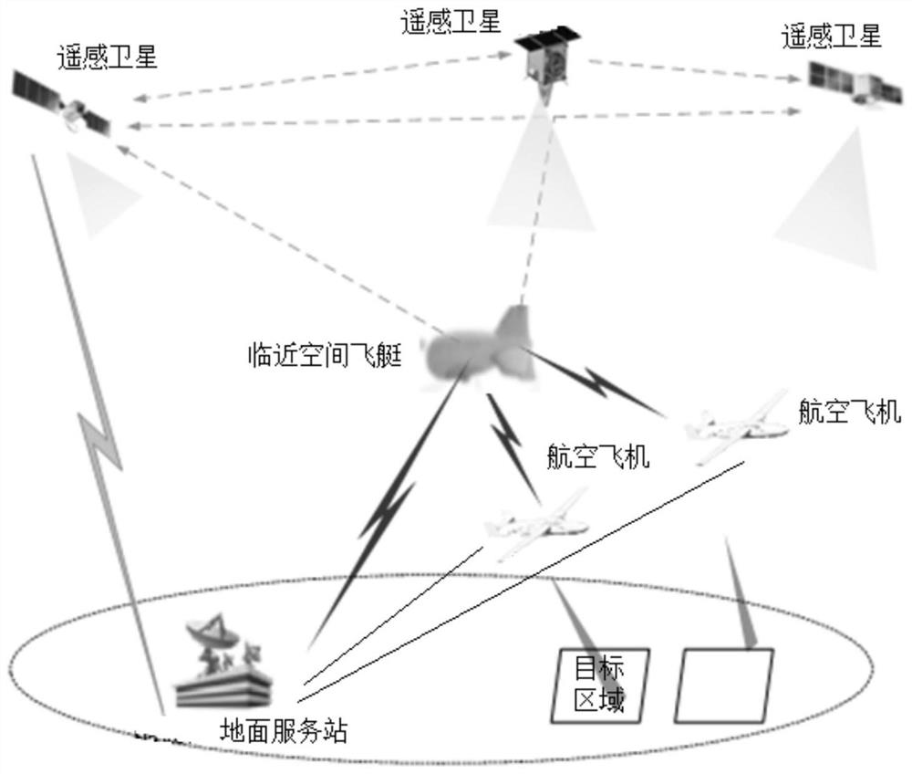
[0004] Due to the large and complex structure of the Tianlinkong collaborative remote sensing system, the construction of the system needs to launch multiple remote sensing satellites, configure multiple aerostats, multiple aviation aircraft and ground service stations, and invest a lot of money
In order to ensure that the Tianlingkong collaborative remote sensing system can run normally and meet the needs of use,
Method used
View moreImage
Smart ImageViewing Examples

Examples
 PUM
 Abstract
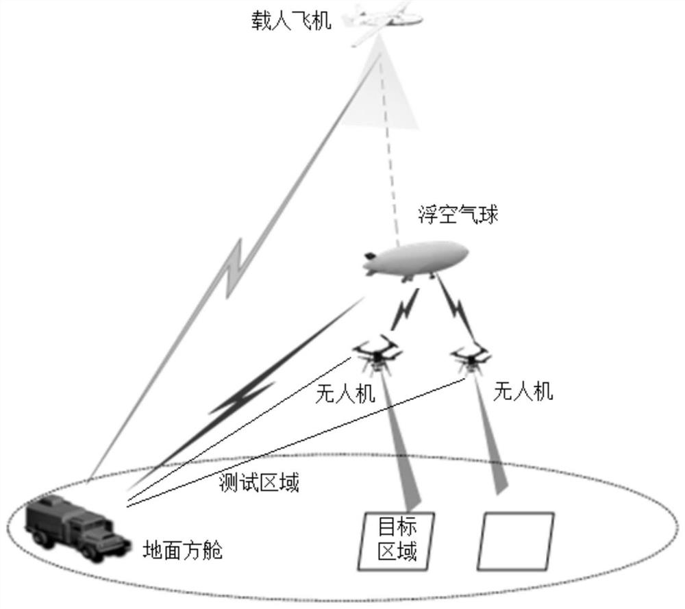
The invention discloses a sky-near space cooperative remote sensing system simulation test device and method. The device comprises a manned aircraft, a floating air ball, an unmanned aerial vehicle and a ground square cabin, wherein the manned aircraft is provided with a satellite remote sensing load, the floating air ball is provided with a near space airship remote sensing load, the unmanned aerial vehicle is provided with an aviation aircraft remote sensing load, and the ground square cabin is provided with an information processing system. The manned aircraft is connected with the floatingair ball and the ground square cabin in a wireless communication mode, the floating air ball is further connected with the unmanned aerial vehicle and the ground square cabin in a wireless communication mode, and the unmanned aerial vehicle is further connected with the ground square cabin in a wireless communication mode. According to the device and the method, the manned aircraft, the floatingair ball, the unmanned aerial vehicle, the ground square cabin and the test environment are arranged to simulate the sky-near space cooperative remote sensing system and the working scene thereof, thekey technology, the working process and the working efficiency of the sky-near space cooperative remote sensing system can be simulated and tested, and theoretical data support is provided for systemconstruction.
Description
technical field [0001] The invention relates to the technical field of remote sensing systems, in particular to a simulation test device and method for a sky-link and sky collaborative remote sensing system. Background technique [0002] With the development of remote sensing technology, a single satellite remote sensing method, limited by its maximum coverage and revisit cycle capabilities, can no longer meet people's real-time monitoring needs for all-weather and all-weather observation objects, especially in the military field. In order to achieve continuous monitoring of targets and all-round awareness of the situation on the battlefield, the single-satellite and satellite constellation observation method is currently adjusted to the multi-platform and multi-means collaborative observation method in the sky to achieve the above-mentioned requirements for continuous monitoring and all-round awareness . [0003] Tianlinkong multi-platform and multi-means collaborative obs...
Claims
Login to View More Application Information
Patent Timeline
 IPC IPC(8): G01D18/00
CPCG01D18/00
Inventor姜志杰
OwnerNAT INNOVATION INST OF DEFENSE TECH PLA ACAD OF MILITARY SCI