Roadway excavation adverse orientation solving method based on photogrammetry, BQ and RQDt

A technology of photogrammetry and roadway, which is applied in the field of solving unfavorable azimuths of roadway excavation based on photogrammetry, BQ and RQDt, and can solve problems such as RQD anisotropy cannot be reflected

Inactive Publication Date: 2020-12-25
SHAOXING UNIVERSITY
View PDF0 Cites 0 Cited by
  • Summary
  • Abstract
  • Description
  • Claims
  • Application Information

AI Technical Summary

Problems solved by technology

Deer proposed the concept of borehole RQD in 1964. Due to the following two shortcomings in the application of borehole RQD: whether the threshold value of 100 mm is reasonable for different engineering scale rock masses; the drilling direction of the borehole is limited, and the ob

Method used


Image

  • Roadway excavation adverse orientation solving method based on photogrammetry, BQ and RQDt
  • Roadway excavation adverse orientation solving method based on photogrammetry, BQ and RQDt
  • Roadway excavation adverse orientation solving method based on photogrammetry, BQ and RQDt

Examples


Embodiment Construction

[0212] The present invention will be further described below with reference to the accompanying drawings.

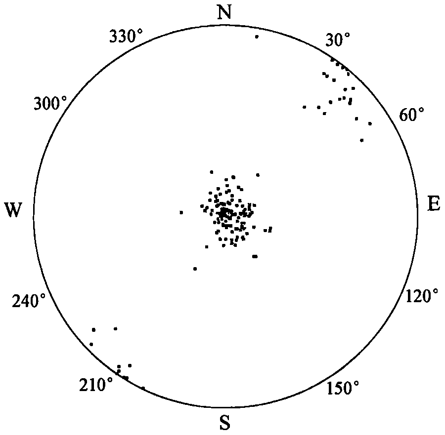
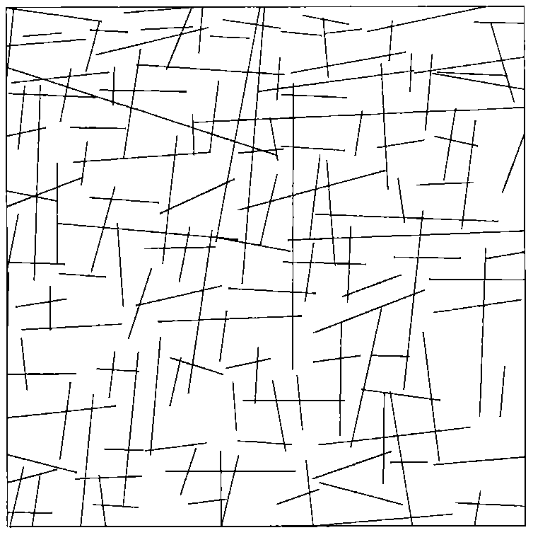
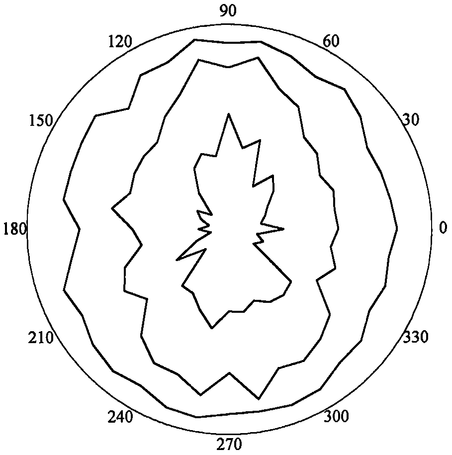
[0213] refer to Figure 1 to Figure 5 , a photogrammetric, BQ and RQD based t The method for solving the unfavorable azimuth of roadway excavation includes the following steps:

[0214] 1) Rapid acquisition of structural surface digital photogrammetry, the process is as follows:

[0215] 1.1: According to the scope and spatial position of the rock mass in the observation area, select the rock mass with well-developed surface joints and no obstacles as the photogrammetry area, and place the benchmark vertically on one side of the measurement area to calibrate the final generated 3D image the distance between any two points;

[0216] 1.2: Select an outcropping, relatively large area, and relatively smooth structural surface on the surface of the rock mass as a calibration point, use a compass to measure the inclination and inclination angle, and mark it, which is used t...


PUM


Abstract

A roadway excavation adverse orientation solving method based on photogrammetry, BQ and RQDt belongs to the field of roadway excavation orientations, and comprises the following steps: (1) rapidly obtaining structural plane digital photogrammetry; (2) drawing a structural surface pole diagram and a trend rose diagram; (3) performing rock mass quality calculation based on a BQ index; (4) generatingand sectioning a rock mass three-dimensional fracture network model; (5) drawing an RQDt anisotropy diagram; (6) performing an optimal threshold t solving method based on BQ inversion; (7) performinga space RQDt solving method; and (8) performing a roadway excavation unfavorable orientation solving method. According to the invention, the optimal threshold t of the RQDt is solved, the RQDt elliptic curve and the anisotropic ellipsoid are drawn, and the roadway excavation unfavorable orientation under the optimal threshold t is solved. The method is clear, the obtained optimal threshold t, elliptic curve and anisotropic ellipsoid can accurately reflect the RQDt anisotropic characteristics of the rock mass, and the obtained roadway excavation adverse orientation can be used for guiding roadway excavation construction application.

Description

technical field [0001] The present invention relates to a method based on photogrammetry, BQ and RQD t The unfavorable azimuth solution method of roadway excavation, especially the present invention is based on photogrammetry, fuzzy equivalent analysis, BQ index, fracture network model, generalized RQD theory and conic curve equation, inversion calculates RQD t The range of the optimal threshold t and the value of the optimal threshold t get the RQD under the optimal threshold t t Elliptic curve and anisotropic ellipsoid, get the unfavorable orientation of roadway excavation under the optimal threshold t, and provide a method based on photogrammetry, BQ and RQD t The method for solving unfavorable azimuths of roadway excavation belongs to the field of roadway excavation azimuths. Background technique [0002] In nature, anisotropy is ubiquitous. Rock masses exhibit very pronounced anisotropy, with properties that vary with viewing angle and measurement direction. The ori...

Claims


Application Information

Patent Timeline
IPC IPC(8): G06Q10/06G06K9/62G06F30/20G06F30/13G06F7/58G01C11/12G06T11/20G06T17/00
CPCG06Q10/06393G06Q10/06395G06F30/20G06T17/00G06F7/588G06T11/203G06T11/206G06F30/13G01C11/12G06F18/22G06F18/23
Inventor 胡高建
Owner SHAOXING UNIVERSITY
Why Eureka
Try Eureka