
Iterative determination method of distance between piles based on sonar point cloud data

A point cloud data and determination method technology, applied in the direction of sound wave re-radiation, instruments, measuring devices, etc., can solve the problem that the prefabricated shape of the pile sleeve of the three bases cannot be guaranteed according to the distance to the underwater pile body, which affects the accuracy of the pile body positioning Determination of problems, large cost risks, installation risks, etc., to achieve the effects of reducing time-consuming implementation, improving operational efficiency, and facilitating implementation

Active Publication Date: 2021-12-10
CCCC THIRD HARBOR ENG
View PDF0 Cites 0 Cited by
  • Summary
  • Abstract
  • Description
  • Claims
  • Application Information

AI Technical Summary

Problems solved by technology

Although this method can obtain the absolute coordinates of the pile body, it needs to set up a reference station and need radio data transmission, and the construction in the distant sea area and the foggy sea area will seriously affect the distance of RTK radio data transmission, and then seriously affect the pile body The accuracy of positioning and the determination of the distance between the piles; the distance measurement of the total station is relative positioning, and the three base sets to be established are determined by measuring the geometric distance between the piles; but because it is a relative measurement, the distance between the piles cannot be given. The triangle shape determined by the connection
[0004] Therefore, both the GNSS RTK measurement and the relative measurement of the total station pile spacing measure the distance when the pile body is not driven into the water surface. , Inconsistency between the pile surface and the water surface, etc. Based on the measurement results on the water surface, it will not be possible to ensure that the prefabricated shape of the three-pedestal pile sleeves can be matched to the underwater pile body, which will bring greater cost risks and installation risks. And then bring greater losses to the construction cost and time

Method used


Image

  • Iterative determination method of distance between piles based on sonar point cloud data
  • Iterative determination method of distance between piles based on sonar point cloud data
  • Iterative determination method of distance between piles based on sonar point cloud data

Examples


Embodiment Construction

[0066] In order to make the purpose, technical solutions and advantages of the embodiments of the present invention clearer, the following will clearly and completely describe the technical solutions in the embodiments of the present invention in conjunction with the accompanying drawings of the present invention. Obviously, the described embodiments are part of the present invention Examples, not all examples. Based on the embodiments of the present invention, all other embodiments obtained by persons of ordinary skill in the art without making creative efforts belong to the protection scope of the present invention.

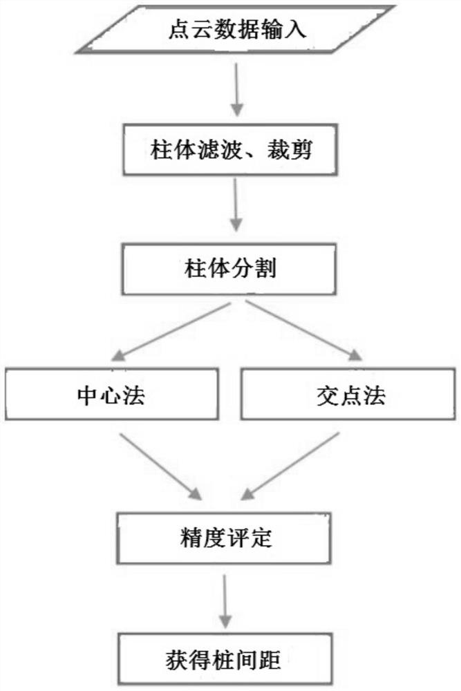
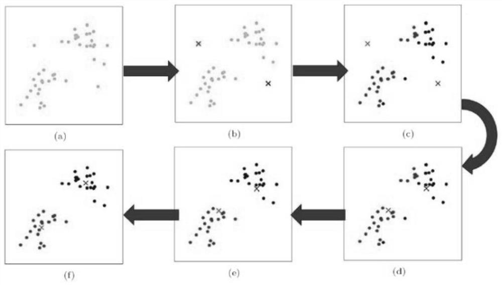
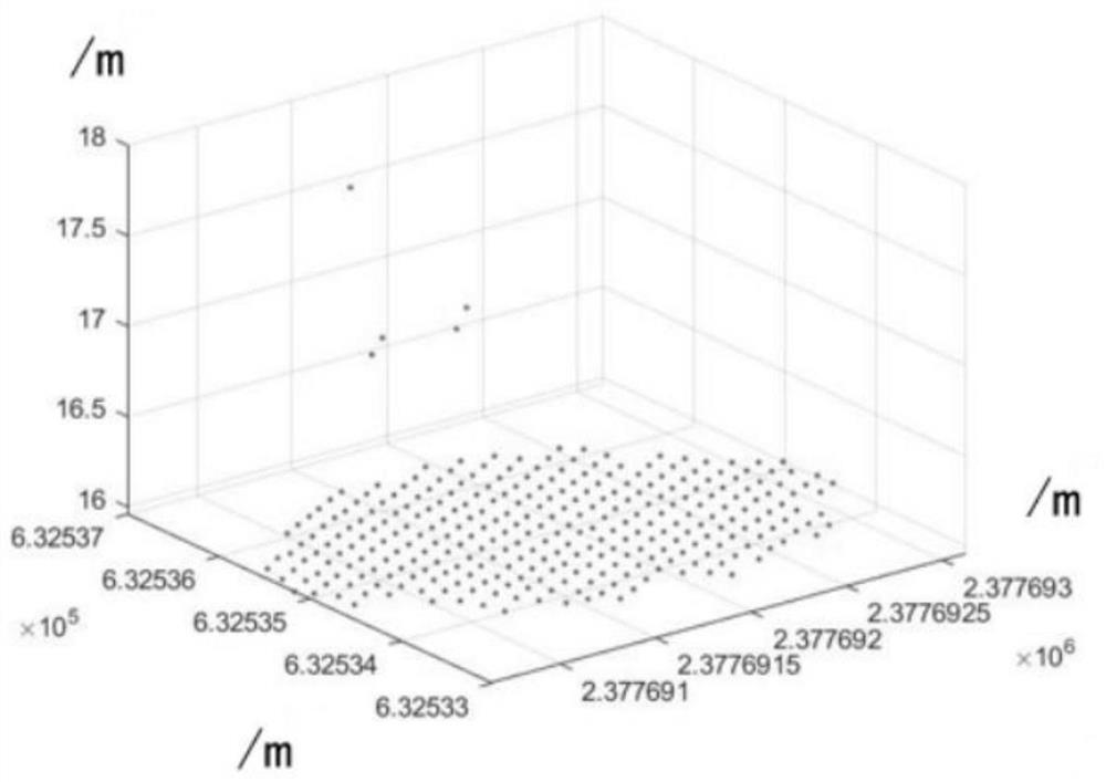
[0067] refer to Figure 1-3 , an iterative method for determining the distance between piles based on sonar point cloud data is used to determine the spatial relationship between underwater piles and the distance between piles, and to solve the problem of prefabrication and installation of the three foundations of offshore wind power stations. Compared with th...


PUM


Abstract

An iterative method for determining the distance between piles based on sonar point cloud data. This method uses sonar point cloud, and through algorithm research such as iterative fitting, the distance between centimeter-level piles is determined and the accuracy of the distance between piles is improved. The specific process is as follows: , first read the point cloud data of the survey line by inputting, then filter and cut the point cloud data of the pile body and the surrounding area, then determine the three-dimensional coordinates of the center of the top surface of the pile body, calculate the distance between the piles, and finally evaluate the accuracy and consider the pile body. The spacing between piles is determined with geometric invariance. This method can be used to determine the spatial relationship between underwater piles and the distance between piles, and solve the problem of prefabrication and installation of three bases for offshore wind power plants. Compared with traditional methods, it has the advantages of high precision, high efficiency, low cost, low risk and implementation convenience and so on.

Description

technical field [0001] The invention relates to the technical field of underwater pile positioning, in particular to an iterative determination method for the distance between piles based on sonar point cloud data. Background technique [0002] In the construction of marine engineering such as offshore wind power and offshore bridges, it is first necessary to drive column piles into the seabed to form a basic engineering support structure. In deeper waters, three piles composed of three piles must be connected underwater. Therefore, the determination accuracy of the geometric distance between the three piles is directly related to the accuracy of the prefabrication of the three foundations and the engineering implementation and safety; the construction site of the underwater pile is far from the land, and the water depth of the pile top is still relatively small Most of the piles are buried by seawater, and it is difficult to determine their position by means of conventional...

Claims


Application Information

Patent Timeline
Patent Type & Authority Patents(China)
IPC IPC(8): G01S15/42
CPCG01S15/42
Inventor 张跃辉范文博董志芳练学标刘更孙红美
Owner CCCC THIRD HARBOR ENG
Learn More