Method for creating large-terrain simulation scene of unmanned aerial vehicle

A technology for simulating scenes and terrains, applied in the field of UAV simulation, which can solve problems such as long loading time and large amount of calculation

Pending Publication Date: 2020-12-29
中国人民解放军陆军炮兵防空兵学院
View PDF4 Cites 2 Cited by
  • Summary
  • Abstract
  • Description
  • Claims
  • Application Information

AI Technical Summary

Problems solved by technology

[0002] Traditional terrain generation methods generally use some commonly used parametric surfaces, such as Bezier surfaces and spline surfaces, to generate the required three-dimensional terrain through interpolation and surface fitting methods. This method uses computer geometry modeling [1] , using Euclidean geometry to describe the smooth surface and regular shape of the object, due to the complexity of its mathematical modeling, the amount of calculation is large and a large number of surface fittings are required [2] , the simulated elevation and images are randomly generated, which requires high-end computer hardware, and the loading time is too long, and the 3D terrain created in this way is too different from the actual terrain. [3] , there is no immersive feeling in the UAV simulation flight

Method used


Image

  • Method for creating large-terrain simulation scene of unmanned aerial vehicle
  • Method for creating large-terrain simulation scene of unmanned aerial vehicle
  • Method for creating large-terrain simulation scene of unmanned aerial vehicle

Examples


Embodiment Construction

[0019]A method for creating a UAV large terrain simulation scene, specifically including the following steps:

[0020](1) Data preparation

[0021]Prepare elevation data, image data, cultural feature data, 3D model data, and texture data required for simulated flight scenes;

[0022](2) Assignment and correction of vector

[0023]Import the elevation data, image data, cultural feature data, three-dimensional model data, and texture data in step (1) into vector data, and convert them into vector data with a special vector file format; because vector data is represented as actual three-dimensional entities, Assign specific information to the above-mentioned vector data, assign values ​​according to usage, and construct a feature model;

[0024](3) Terrain parameter setting

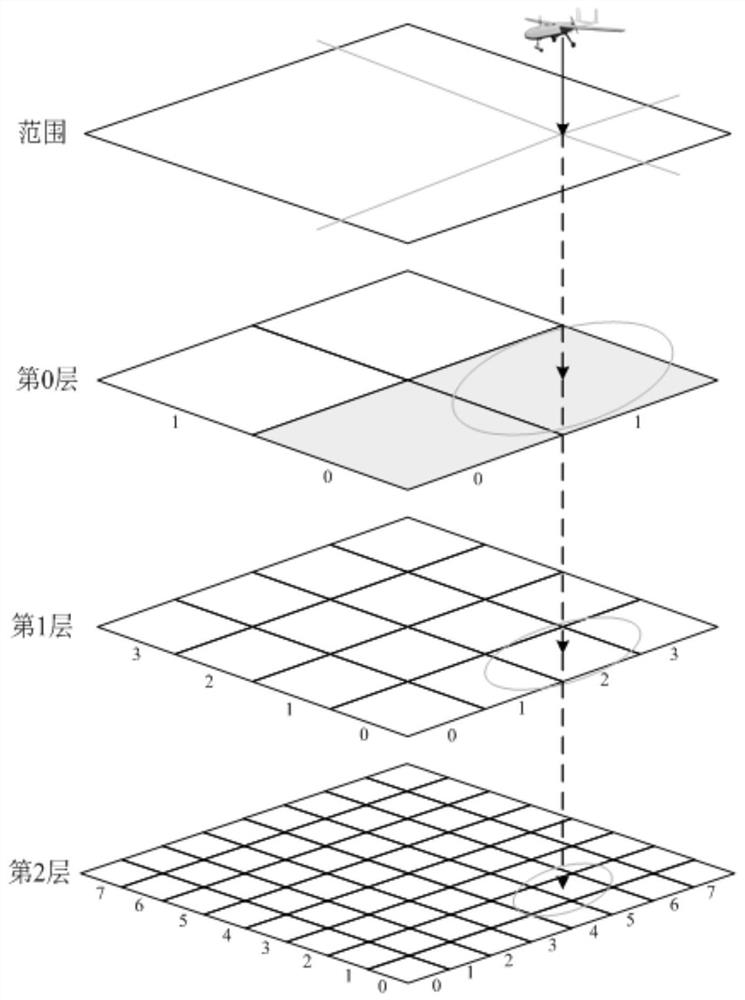
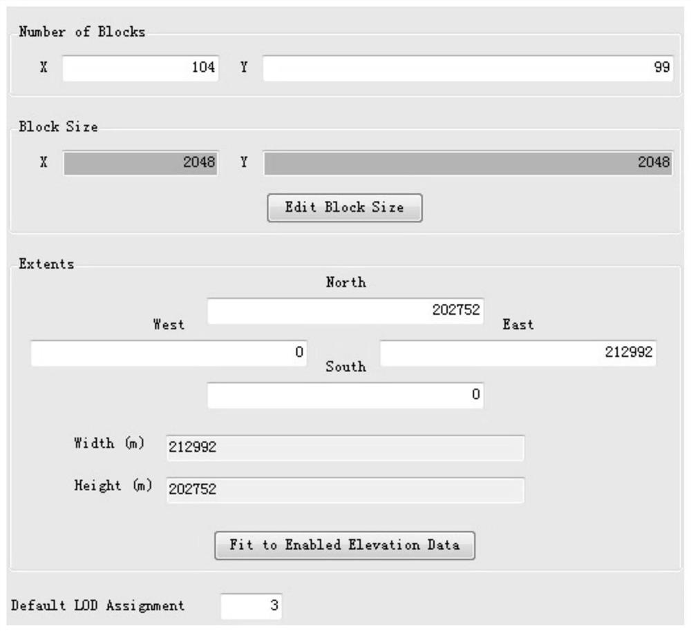
[0025]Such asfigure 2 As shown, the number and distance of the LOD, the grid sampling interval and the size of the virtual texture are determined according to the size of the area and the accuracy of the texture and the flying heig...


PUM


Abstract

The invention discloses a method for creating a large-terrain simulation scene of an unmanned aerial vehicle. The method comprises the following steps: preparing elevation data, image data, cultural feature data, three-dimensional model data and texture data required for simulating a flight scene; importing the prepared data into vector data, and converting the vector data into vector data with aspecial vector file format; giving specific information to the vector data, assigning values according to purposes, and constructing a ground object model; determining the number and distance of LOD,the grid sampling interval and the size of virtual texture according to the size of the area, the precision of the texture and the flight height during flight simulation of the unmanned aerial vehicle; and generating a terrain model suitable for hardware rendering through the MetaFlight data model. The unmanned aerial vehicle simulation scene created by the method is basically consistent with an actual flight scene, any cultural characteristic data can be added, an infinite simulation flight scene can be theoretically manufactured, and the average loading and displaying time is within 30 seconds.

Description

Technical field[0001]The invention relates to the field of drone simulation technology, in particular to a method for creating a large terrain simulation scene of the drone.Background technique[0002]The traditional terrain generation method generally uses some commonly used parametric surfaces, such as Bezier surfaces and spline surfaces to generate the required three-dimensional terrain through interpolation and surface fitting methods. This method uses computer geometric modeling.[1], Using European geometry to describe the smooth surface and regular shape of the object. Due to the complexity of its mathematical modeling, the amount of calculation is large and a large number of surface fittings are required[2], The simulated elevations and images are randomly generated, so you need to configure higher computer hardware, the loading time is too long, and the 3D terrain created in this way is too different from the actual terrain[3], There is no immersive experience in the drone fli...

Claims


Application Information

Patent Timeline
Patent Type & Authority Applications(China)
IPC IPC(8): G06T15/04G06T17/00G06T17/05
CPCG06T17/05G06T15/04G06T17/005
Inventor 张明义李猛李晓明王涛汪玉美王东黄克明王刘军郑臣
Owner 中国人民解放军陆军炮兵防空兵学院
Why Eureka
Try Eureka