Ground-based augmentation system integrity fault identification method and system

A ground-based enhancement system and fault identification technology, applied in the field of satellite navigation, can solve the problems of inability to better identify integrity faults and low accuracy of fault identification methods, and achieve the effect of realizing the needs of integrity fault identification.

Active Publication Date: 2021-03-19
BEIHANG UNIV
View PDF17 Cites 2 Cited by
  • Summary
  • Abstract
  • Description
  • Claims
  • Application Information

AI Technical Summary

Problems solved by technology

[0004] In view of the above analysis, the embodiment of the present invention aims to provide a ground-based augmentation system integrity fault identificatio

Method used


Image

  • Ground-based augmentation system integrity fault identification method and system
  • Ground-based augmentation system integrity fault identification method and system
  • Ground-based augmentation system integrity fault identification method and system

Examples


Embodiment Construction

[0049] Preferred embodiments of the present invention will be specifically described below in conjunction with the accompanying drawings, wherein the accompanying drawings constitute a part of the application and together with the embodiments of the present invention are used to explain the principle of the present invention, but not to limit the scope of the present invention.

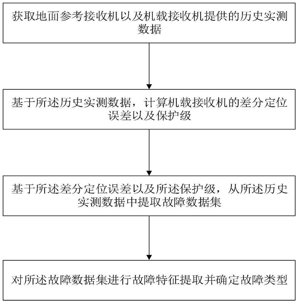
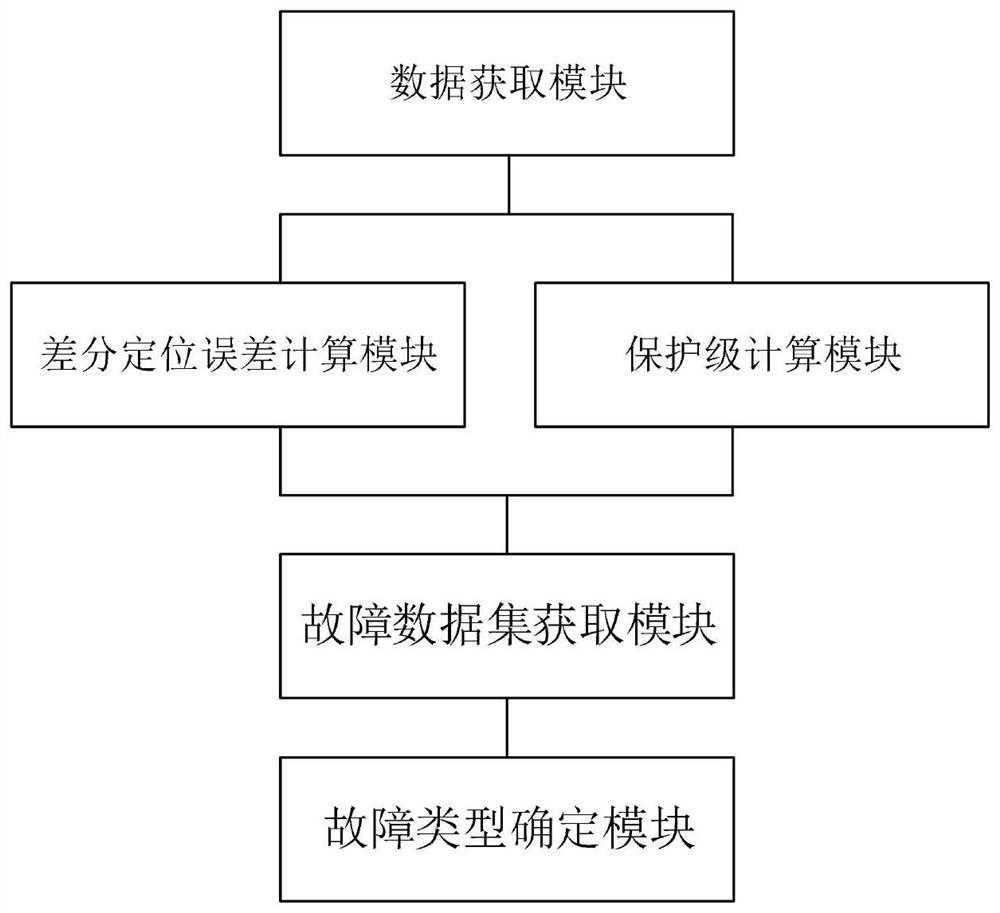
[0050] On the one hand, this application discloses a ground-based augmentation system integrity fault identification method, such as figure 1 shown. The method includes:

[0051] Step S1: Obtain the historical measured data provided by the ground reference receiver and the airborne receiver;

[0052] Step S2: Based on the historical measured data, calculate the differential positioning error and protection level of the onboard receiver;

[0053] Step S3: Based on the differential positioning error and the protection level, extract a fault data set from the historical measured data;

[0054] Step S4: ...


PUM


Abstract

The invention relates to a ground-based augmentation system integrity fault identification method and system, belongs to the technical field of satellite navigation, and solves problems that a fault identification method in the prior art is low in precision and cannot better identify potential integrity faults. The method comprises the following steps: acquiring historical measured data provided by a ground reference receiver and an airborne receiver; calculating a differential positioning error and a protection level of the airborne receiver based on the historical measured data; extracting afault data set from the historical measured data based on the differential positioning error and the protection level; and performing fault feature extraction on the fault data set and determining afault type. The accuracy of fault detection and identification is improved, and the requirement for higher-level integrity fault identification is met.

Description

technical field [0001] The invention relates to the technical field of satellite navigation, in particular to a ground-based augmentation system integrity fault identification method and system. Background technique [0002] With the satellite navigation system entering the modern development environment, the civilian demand for satellite navigation has gradually become an important application direction. However, to apply the satellite navigation system to civil aviation, it must first meet the performance requirements of civil aviation for navigation systems, including four aspects: accuracy, integrity, continuity and availability. [0003] The GBAS airborne equipment calculates the protection level of the onboard differential positioning error according to the parameters in the message broadcast by the ground station in real time, and decides whether to send an alarm by comparing the protection level with the warning line. When the GNSS signal is affected by multiple fac...

Claims


Application Information

Patent Timeline
IPC IPC(8): G01S19/08G01S19/23
CPCG01S19/08G01S19/23
Inventor 薛瑞王康
Owner BEIHANG UNIV
Why Eureka
Try Eureka