Space target guided imaging task planning method based on agile optical remote sensing satellite
A technology for space targets and remote sensing satellites, applied in the field of space remote sensing imaging, can solve the problems of costing more money and manpower, high R&D cost of space-based observation equipment, and difficulty in manufacturing
- Summary
- Abstract
- Description
- Claims
- Application Information
AI Technical Summary
Problems solved by technology
Method used
Image
Examples
Embodiment Construction
[0120] Embodiments of the present invention will be further described below in conjunction with the accompanying drawings.
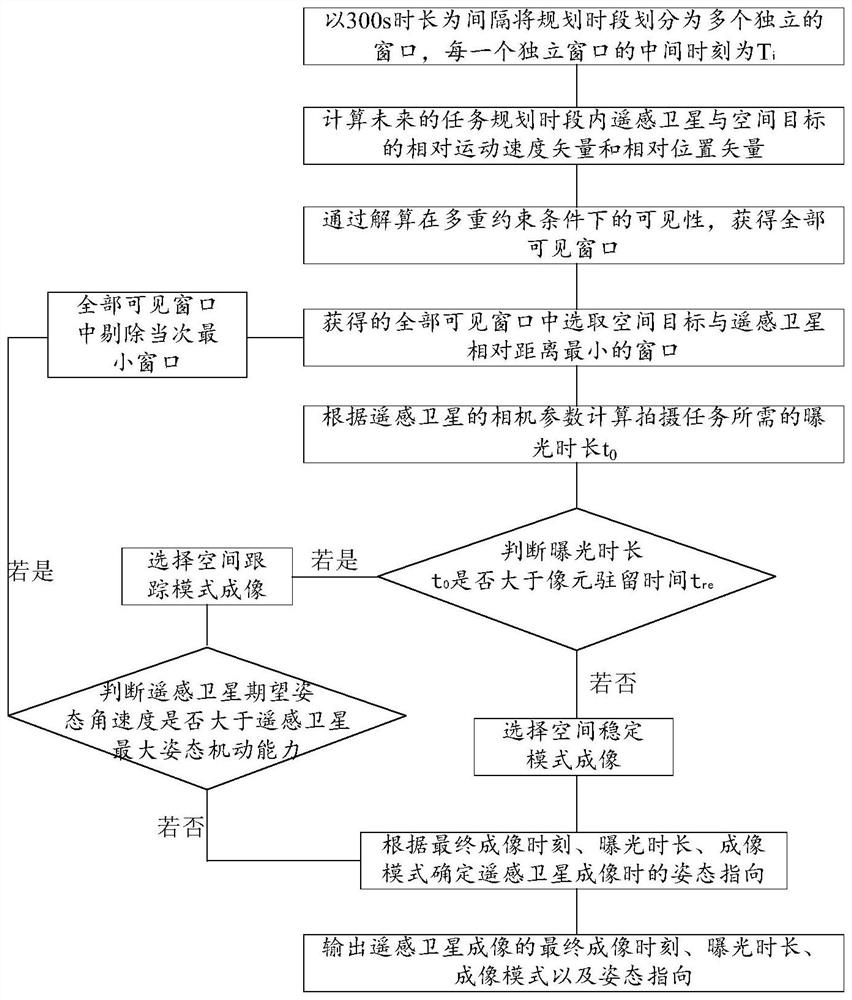
[0121] See attached figure 1 , the space target guided imaging task planning method based on agile optical remote sensing satellite of the present invention comprises the following steps:
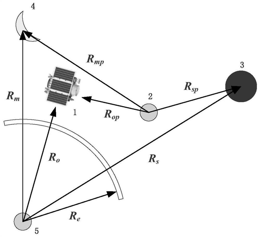
[0122] Step 1: The orbit data of the shooting space object 2 is known in advance, and the planning period is divided into multiple independent windows at intervals of 300s, and the middle time of each independent window is T i =1, 2, 3, 4..., recursively calculate the relative motion velocity vector and the relative position vector of the remote sensing satellite 1 and the space target 2 in the future task planning period;
[0123] Step 2: Obtain all visible windows by calculating the visibility of the geometric relationship between the space object 2, the remote sensing satellite 1, the earth 5, the moon 4 and the sun 3 under multiple constraints;
[0124] Step 3: ...
PUM
 Abstract
Description
Claims
Application Information
 - R&D
- Intellectual Property
- Life Sciences
- Materials
- Tech Scout
- Unparalleled Data Quality
- Higher Quality Content
- 60% Fewer Hallucinations
Browse by: Latest US Patents, China's latest patents, Technical Efficacy Thesaurus, Application Domain, Technology Topic, Popular Technical Reports.
© 2025 PatSnap. All rights reserved.Legal|Privacy policy|Modern Slavery Act Transparency Statement|Sitemap|About US| Contact US: help@patsnap.com


