
A forest fire localization method and system based on multi-sensor data fusion of UAV

A data fusion and multi-sensor technology, applied in satellite radio beacon positioning system, radio wave measurement system, image data processing, etc., can solve the problem that the actual location of forest fire cannot be monitored timely and accurately, and achieve high timeliness and prevent The effect of resurgence and precise spatial location information

Active Publication Date: 2021-12-17
NORTHEAST FORESTRY UNIVERSITY
View PDF22 Cites 0 Cited by
  • Summary
  • Abstract
  • Description
  • Claims
  • Application Information

AI Technical Summary

Problems solved by technology

[0003] In view of the above problems, the present invention proposes a forest fire positioning method and system based on multi-sensor data fusion of UAVs to solve the problem that the existing forest fire positioning methods cannot monitor the actual location of forest fires in a timely and accurate manner

Method used


Image

  • A forest fire localization method and system based on multi-sensor data fusion of UAV
  • A forest fire localization method and system based on multi-sensor data fusion of UAV
  • A forest fire localization method and system based on multi-sensor data fusion of UAV

Examples


Embodiment Construction

[0051] In order to enable those skilled in the art to better understand the solutions of the present invention, exemplary implementations or embodiments of the present invention will be described below in conjunction with the accompanying drawings. Apparently, the described embodiments or examples are only part of the embodiments or embodiments of the present invention, not all of them. Based on the implementation modes or examples in the present invention, all other implementation modes or examples obtained by persons of ordinary skill in the art without creative efforts shall fall within the protection scope of the present invention.

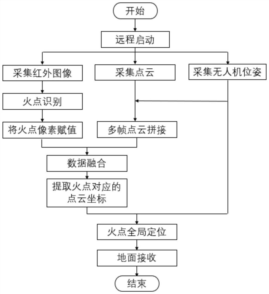
[0052] The present invention provides a forest fire positioning method based on multi-sensor data fusion of unmanned aerial vehicles, such as figure 1 As shown, the method mainly includes the following steps:

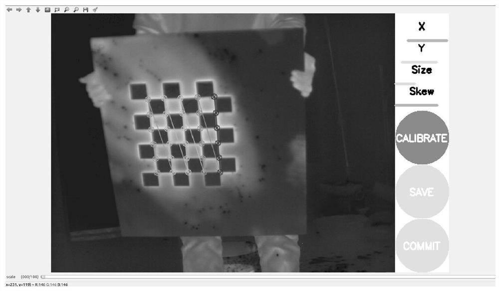
[0053] Step 1. Calibrate the internal reference of the thermal imaging camera on the UAV to obtain the internal reference matrix;

...


PUM


Abstract

A forest fire positioning method and system based on multi-sensor data fusion of drones, which belongs to the field of forest fire intelligent monitoring and prevention and control technology, and is used to solve the problem that the existing forest fire positioning methods cannot timely and accurately monitor the forest fire location . The technical points of the present invention include: collecting images, drone poses and point cloud data through multiple sensors mounted on the drone, and processing the above-mentioned data with a corresponding relationship in time to obtain the world coordinates of the fire point The position coordinates under the system are the specific positions of forest fires; among them, the point cloud splicing is completed by using the pose relationship between the UAV pose data, the inertial navigation coordinate system and the radar coordinate system to obtain a dense point cloud, which solves the problem of point cloud and image The problem of sparse or even missing point clouds in the process of data fusion makes the spatial position information of fire points in the radar coordinate system more accurate. The invention is suitable for real-time monitoring of forest fires, and can obtain the precise location of forest fire occurrences.

Description

technical field [0001] The invention relates to the technical field of forest fire intelligent monitoring and prevention and control, in particular to a forest fire location method and system based on multi-sensor data fusion of an unmanned aerial vehicle. Background technique [0002] With the development of drone technology, drones are widely used in various fields. In the intelligent monitoring and prevention of forest fires, UAV platforms equipped with vision and various intelligent sensors have begun to be widely used. Their low cost and quick response have extremely important development prospects in the field of intelligent monitoring and prevention of forest fires. . However, most of the existing UAV forest fire monitoring equipment only has the function of shooting, but does not have the function of locating the fire point. No matter it is a visible light camera, an infrared camera or a binocular camera, it cannot locate the fire point in the global coordinate syst...

Claims


Application Information

Patent Timeline
Patent Type & Authority Patents(China)
IPC IPC(8): G01S17/06G01C21/16G01S19/42G01J5/00G06T7/90
CPCG01S17/06G01C21/165G01S19/42G01J5/00G06T7/90G01J2005/0077
Inventor 李兴东肖旭陈显东张时雨刘九庆
Owner NORTHEAST FORESTRY UNIVERSITY
Learn More