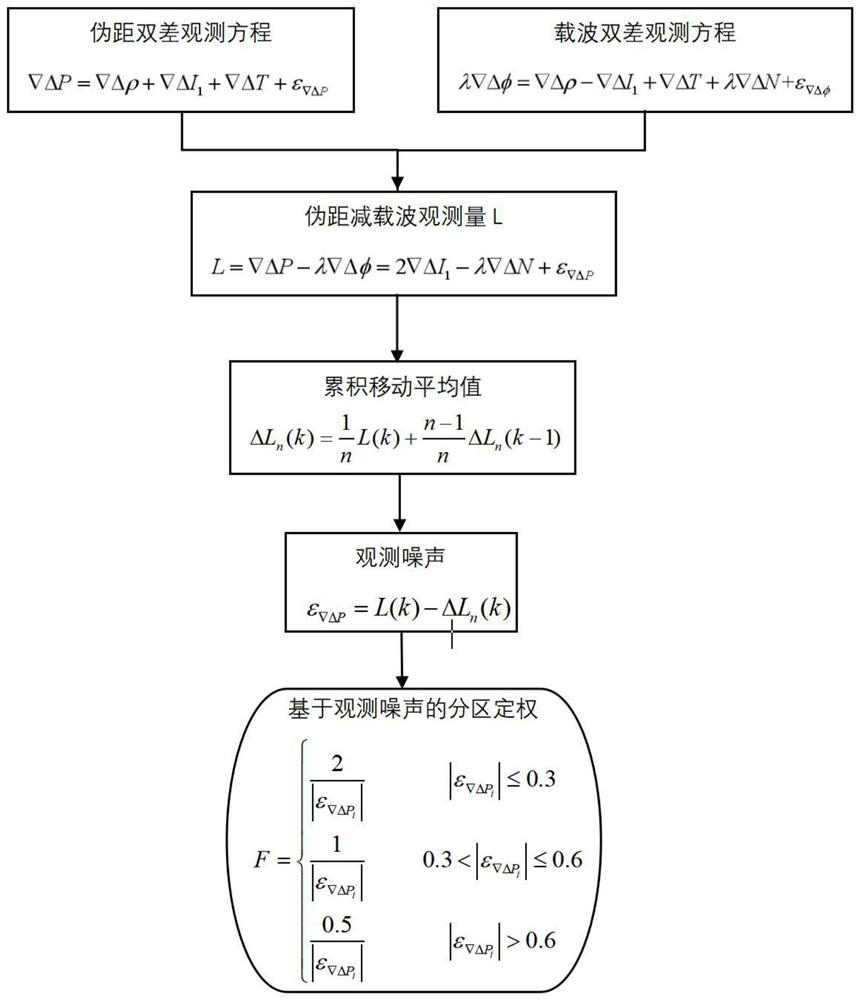
Pseudo-range differential positioning partition weighting method based on pseudo-range observation noise
A technology of pseudo-range observation and observation noise, which is applied in the field of global navigation satellite positioning, and can solve problems such as inability to accurately evaluate the quality of observation values
- Summary
- Abstract
- Description
- Claims
- Application Information
AI Technical Summary
Problems solved by technology
Method used
Image
Examples
Embodiment 1
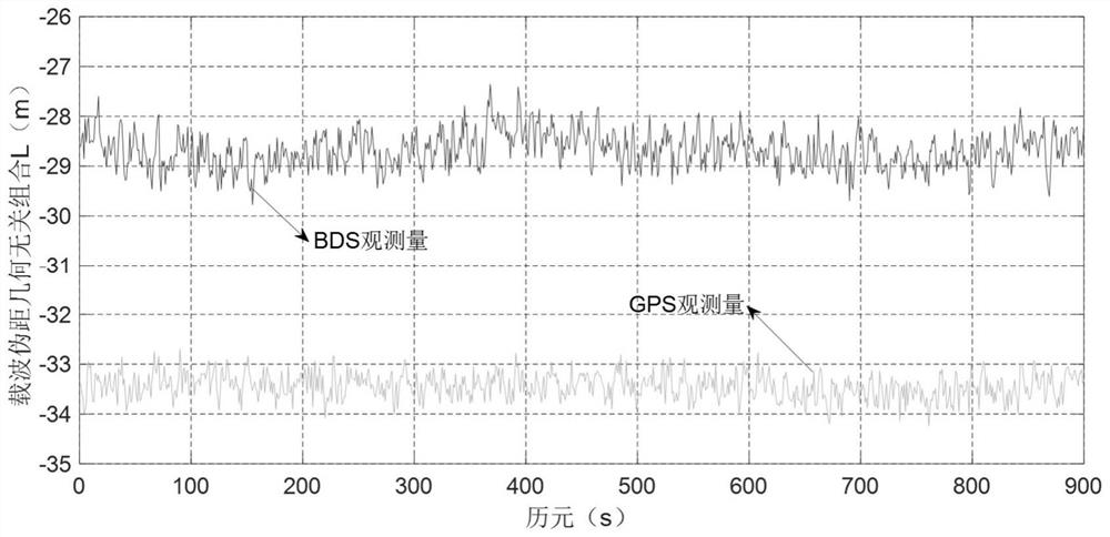
[0055] Embodiment 1: The real observation data of Beidou / GPS is selected to verify the reliability of the present invention. In the experiment, the two receivers were placed on stations A and B with known accurate coordinates, where station A was used as the reference station, and station B was used as the point to be fixed. The distance between the two stations was 61km. The continuous observation time was 15 minutes, and the data sampling rate was 1 second, totaling 900 epoch. In the following, the method of the present invention will be used to construct the pseudo-range difference partition weighting based on the satellite pseudo-range observation noise, and at the same time combine the pseudo-range difference positioning model to solve the coordinates of station B in a single epoch, and compare it with the known accurate value.
[0056] 1. Construct geometry-independent combined observations L
[0057] Combine the Beidou / GPS carrier and pseudo-range double-difference obs...
Embodiment 2
[0080] Embodiment 2: In order to further test the applicability of pseudo-range observation noise weighting, the experiment is verified and analyzed from the positioning of baselines with different lengths. Select four reference stations szjt, jint, taoy and snan in Suzhou CORS, among which szjt is used as the reference station (with known coordinates), and the other three reference stations are used as undetermined points to form three baselines with lengths of 28km, 46km and 76km respectively; and The 25-minute GNSS observation data with a sampling rate of 1s is selected, and a total of 12 Beidou satellites can be observed during this period, of which the C08 satellite has the largest elevation angle and is selected as the reference satellite in the calculation.
[0081] Table 1 lists the root mean square errors of the three weighting methods in the N, E, and U directions and the final point P under different lengths and distances. It can be seen that in the plane direction (...
PUM
 Abstract
Description
Claims
Application Information
 - R&D
- Intellectual Property
- Life Sciences
- Materials
- Tech Scout
- Unparalleled Data Quality
- Higher Quality Content
- 60% Fewer Hallucinations
Browse by: Latest US Patents, China's latest patents, Technical Efficacy Thesaurus, Application Domain, Technology Topic, Popular Technical Reports.
© 2025 PatSnap. All rights reserved.Legal|Privacy policy|Modern Slavery Act Transparency Statement|Sitemap|About US| Contact US: help@patsnap.com


