Device and method for creating and using data on road map expressed by polygons

The technology of a map display device and display method, which is applied to road network navigators, maps/plans/charts, image data processing, etc., can solve the problem of not being able to fully and effectively use city maps, etc.

Inactive Publication Date: 2004-09-22
株式会社善邻 +1
View PDF4 Cites 1 Cited by
  • Summary
  • Abstract
  • Description
  • Claims
  • Application Information

AI Technical Summary

Problems solved by technology

However, as a result, the explored route is simply represented by a polyline connecting the center points of intersec...

Method used


Image

  • Device and method for creating and using data on road map expressed by polygons
  • Device and method for creating and using data on road map expressed by polygons
  • Device and method for creating and using data on road map expressed by polygons

Examples


Embodiment Construction

[0107] Hereinafter, one embodiment of the present invention will be specifically described with reference to the drawings.

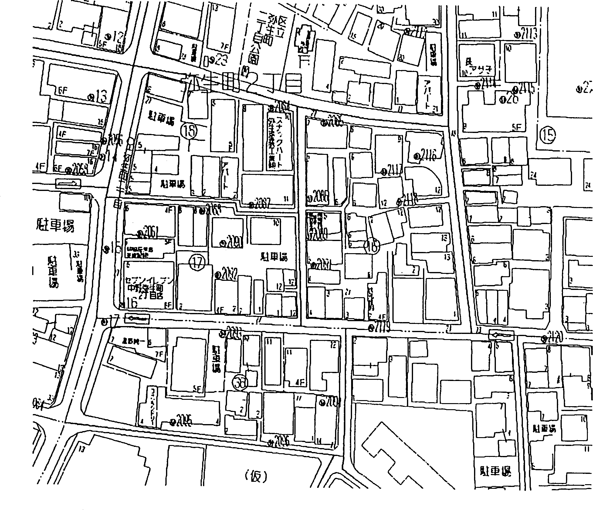
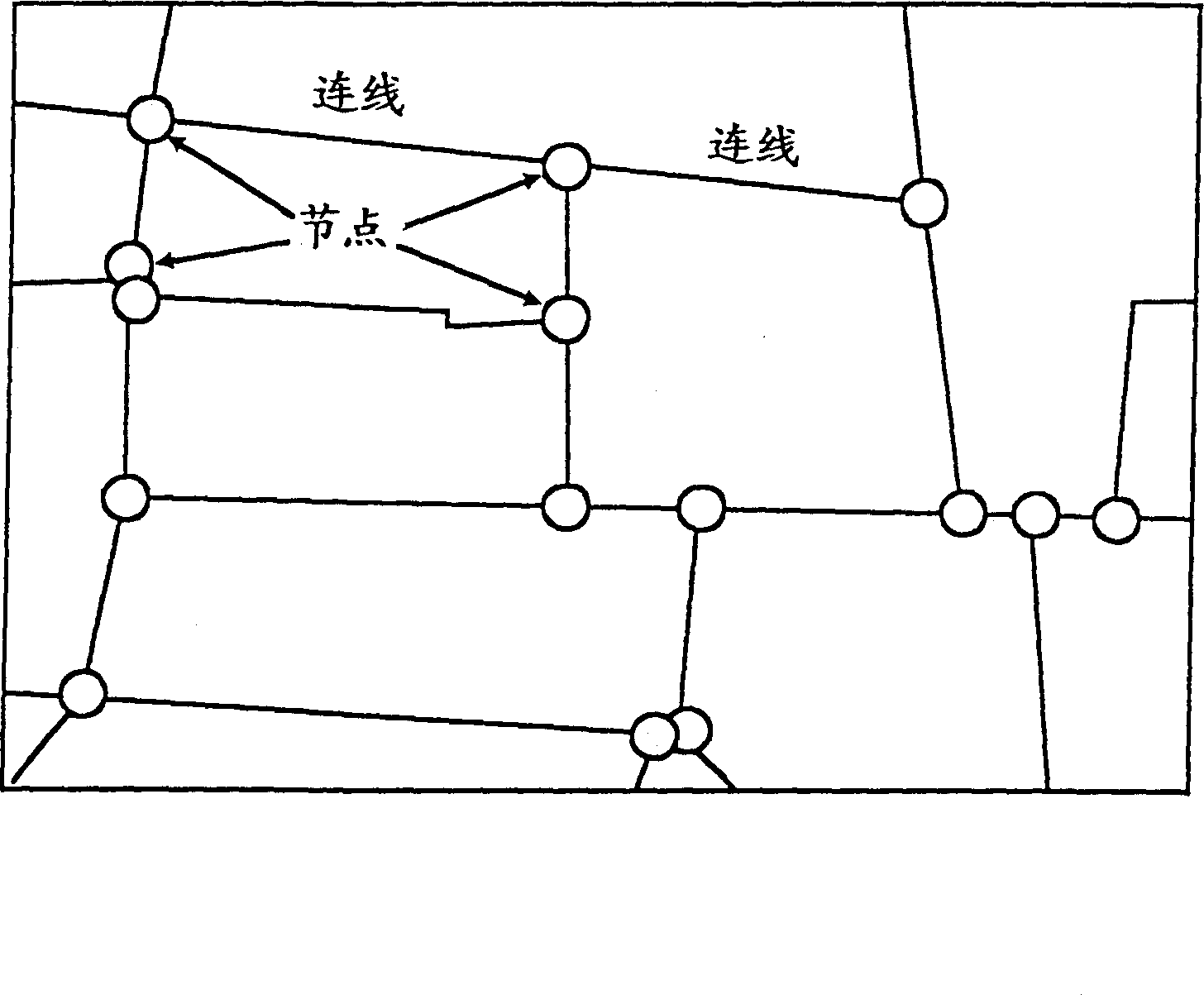
[0108] figure 1 An example of a city map showing detailed and accurate descriptions of houses and sidewalk shapes, etc. figure 2 An example of road network data is shown where intersections are used as nodes and roads are modeled as directional vectors (links) connecting nodes.

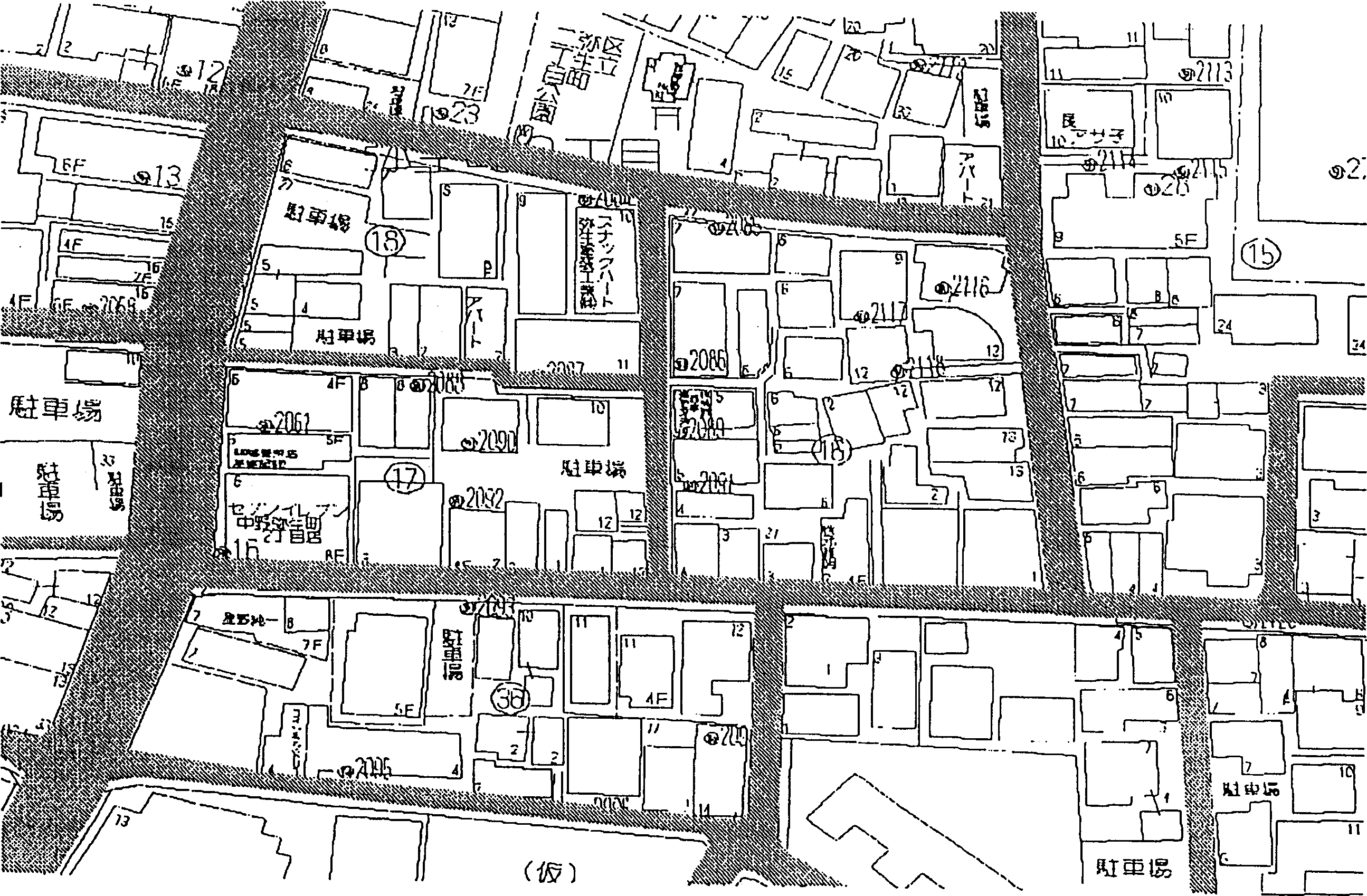
[0109] According to the principle of the present invention, by figure 2 The road network data as shown overlaps in figure 1 By performing the processing described in detail below on the downtown map shown, road polygon data that reproduces the road shape of the downtown map well can be generated. image 3 , to show that the road polygon data completed as above is filled with crosshatching, and the overlay is displayed on the figure 1 The example on the downtown map data. From image 3 It can be seen that it is possible to obtain road polygon data that exactly matches the...


PUM


Abstract

An object of the present invention is to accomplish the automatic preparation of road data in which roads and intersections are expressed by polygons that show accurate agreement with the complicated road shapes on city maps. In simple polygon preparation processing 3, the respective line segments of road network data 2 in which roads are expressed as line segments are expanded in the direction of the width dimension, thus producing simple road polygon data 4 which has a width that is slightly greater than the width of the roads in the city map data 5. Next, in scissors data preparation processing 6, scissors data 7 which defines the outlines of roads is prepared from the city map data 5 by connecting shape lines in the vicinity of roads. Next, in road polygon preparation processing 9, road polygon data 9 which shows good agreement with the shapes of roads in the city map data is prepared by trimming the simple road polygons along the road outlines defined by the scissors data.

Description

technical field [0001] The present invention relates to a map image processing technique using road map data, in particular to a road data creation device and method. Background technique [0002] Electronic map technology, which uses a computer to display digital map image data on the screen, can be used in various applications, mainly for car driving guidance. In general maps, when representing roads, it is not a problem to draw roads with simple lines regardless of their width on a small-scale map such as a wide-area map. However, in large scale maps like detailed downtown maps, roads need to show areas of the correct width. Of course, in electronic maps, various road data creation methods and display methods for displaying wide roads have been developed. For example, the methods described in JP-A-62-80774, JP-A-4-303271, JP-A-4-303272 and JP-A-6-83931 are known. [0003] In the graphics processing device described in JP-A-62-80774, when making a road map with a width,...

Claims


Application Information

Patent Timeline
IPC IPC(8): G01C21/32G06T11/20G06T17/05G09B29/00
CPCG06T17/05G01C21/32G06T11/203G09B29/00G01C21/3819G01C21/3867G06T1/00
Inventor 纲田纯也服部弥平次小林大树岸川喜代成
Owner 株式会社善邻
Why Eureka
Try Eureka