Map data providing device
a technology of providing device and map data, which is applied in the direction of surveying and navigation, navigation instruments, instruments, etc., can solve the problem of inability to enhance the accuracy of existing road data, and achieve the effect of more accurate map data
- Summary
- Abstract
- Description
- Claims
- Application Information
AI Technical Summary
Benefits of technology
Problems solved by technology
Method used
Image
Examples
first embodiment
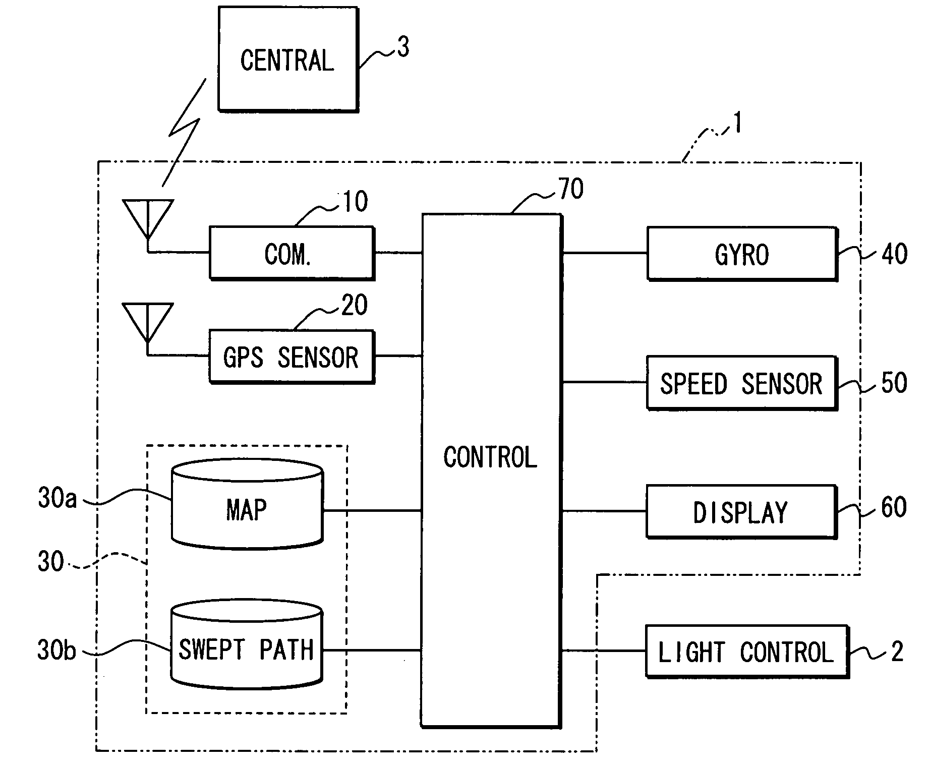
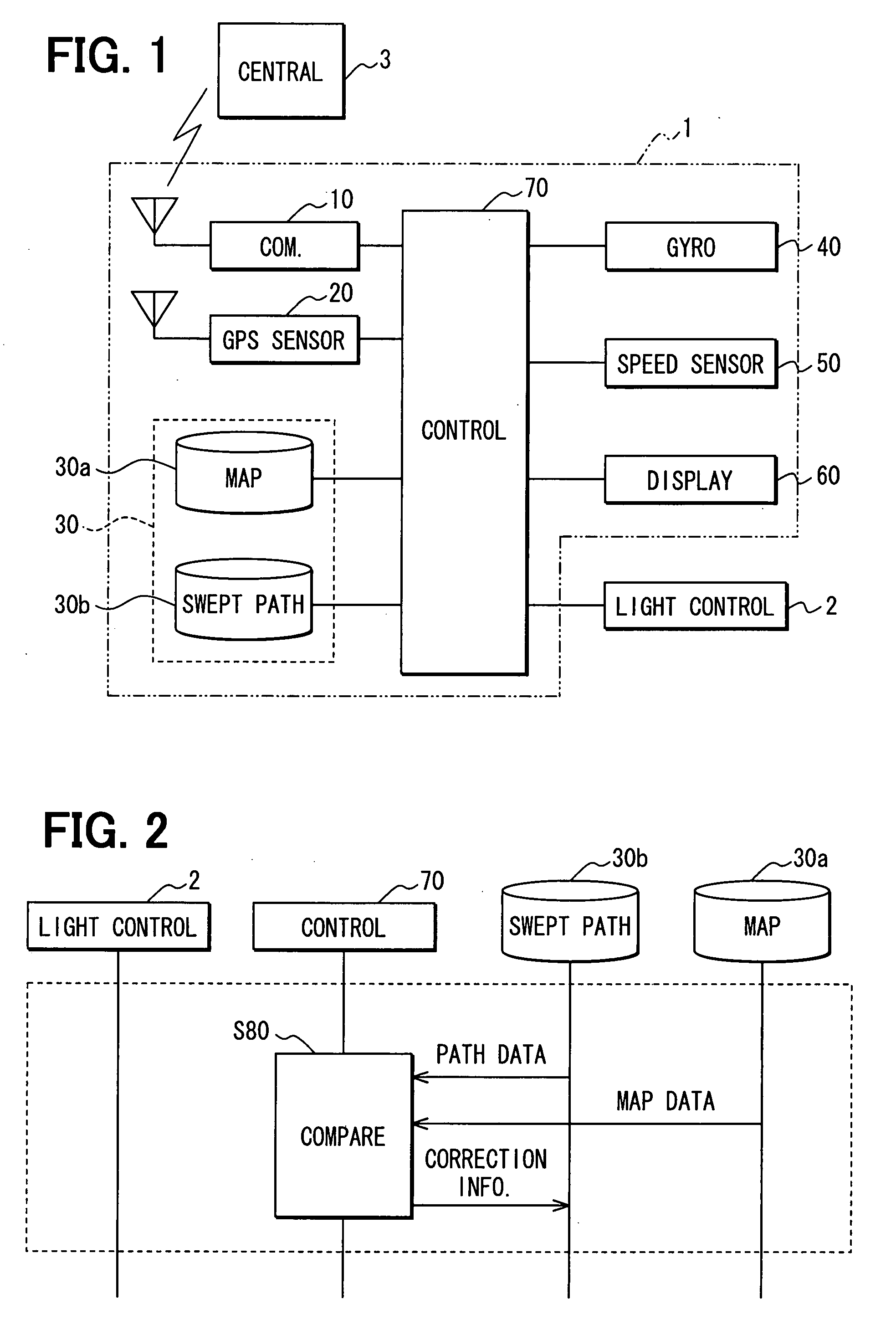
[0017]FIG. 1 illustrates the configuration of a map data providing device in a first embodiment of the invention. The map data providing device in this embodiment is constructed as an automobile navigation system 1.
[0018]The automobile navigation system 1 includes a communication unit 10, a GPS sensor 20, a storage unit 30, a gyro sensor 40, a vehicle speed sensor 50, a display unit 60, and a control unit 70. The control unit 70 is connected with a light control unit 2 that changes the direction of the light axis of a headlamp using map data provided from the automobile navigation system 1.
[0019]The communication unit 10 communicates with an external source through a radio communication line, and is so constructed that it can communicate data between it and an central facility 3 connected through the radio communication line.
[0020]The central facility 3 has a function of managing map data used in the automobile navigation system 1, and maintains map data and performs other similar p...
second embodiment
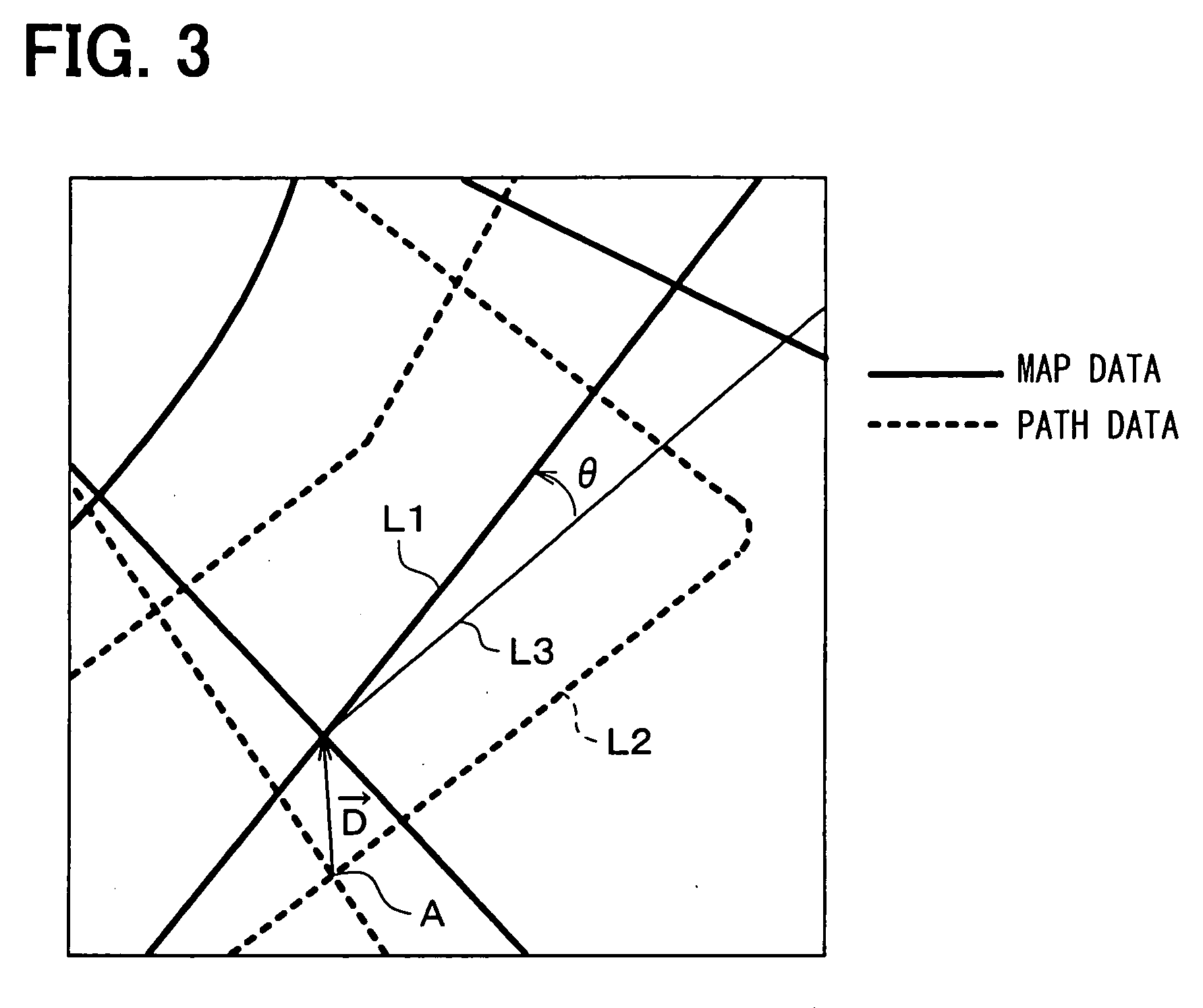
[0067]The description of the first embodiment takes up as an example a case where the following processing is carried out: electronic map data and vehicular swept path data are compared with each other to compute correction information that represents the amount of deviation between the electronic map data and the vehicular swept path data; electronic map data is corrected using the computed correction information; and the corrected electronic map data is presented to the light control unit 2. The second embodiment is so constructed that the following processing is carried out so that correction information computed at the automobile navigation system 1 of each vehicle can also be used at the automobile navigation systems 1 of other vehicles: the automobile navigation system 1 of each vehicle is caused to transmit correction information to a central facility 3; these pieces of correction information are accumulated at the central facility 3; and the accumulated correction informatio...
PUM
 Abstract
Description
Claims
Application Information
 - R&D
- Intellectual Property
- Life Sciences
- Materials
- Tech Scout
- Unparalleled Data Quality
- Higher Quality Content
- 60% Fewer Hallucinations
Browse by: Latest US Patents, China's latest patents, Technical Efficacy Thesaurus, Application Domain, Technology Topic, Popular Technical Reports.
© 2025 PatSnap. All rights reserved.Legal|Privacy policy|Modern Slavery Act Transparency Statement|Sitemap|About US| Contact US: help@patsnap.com


