Geographical location indexing

Inactive Publication Date: 2006-01-05
OATH INC
View PDF18 Cites 40 Cited by
  • Summary
  • Abstract
  • Description
  • Claims
  • Application Information

AI Technical Summary

Benefits of technology

[0005] The present invention seeks to provide an alternative method for spatial indexing of geographical data to allow results proximal to a target geographical location, i.e. determining from the target geographical location one or more nearby geographical locations or data concerning the nearby geographical locations. This allows the geographical data relating to the target geographical location or nearby geographical locations to be returned more easily. The method differs from traditional spatial indexing by m

Problems solved by technology

Indexing geographical location data which has a spatial component is becoming increasingly difficult as data volumes are increasing in size and service providers such as search engines and the like are attempting to organize geographical data for fast retrieval.
Problems occur when the bounded area is too small and consequently too little (or no) data is retrieved.
On

Method used


Image

  • Geographical location indexing
  • Geographical location indexing
  • Geographical location indexing

Examples


Example

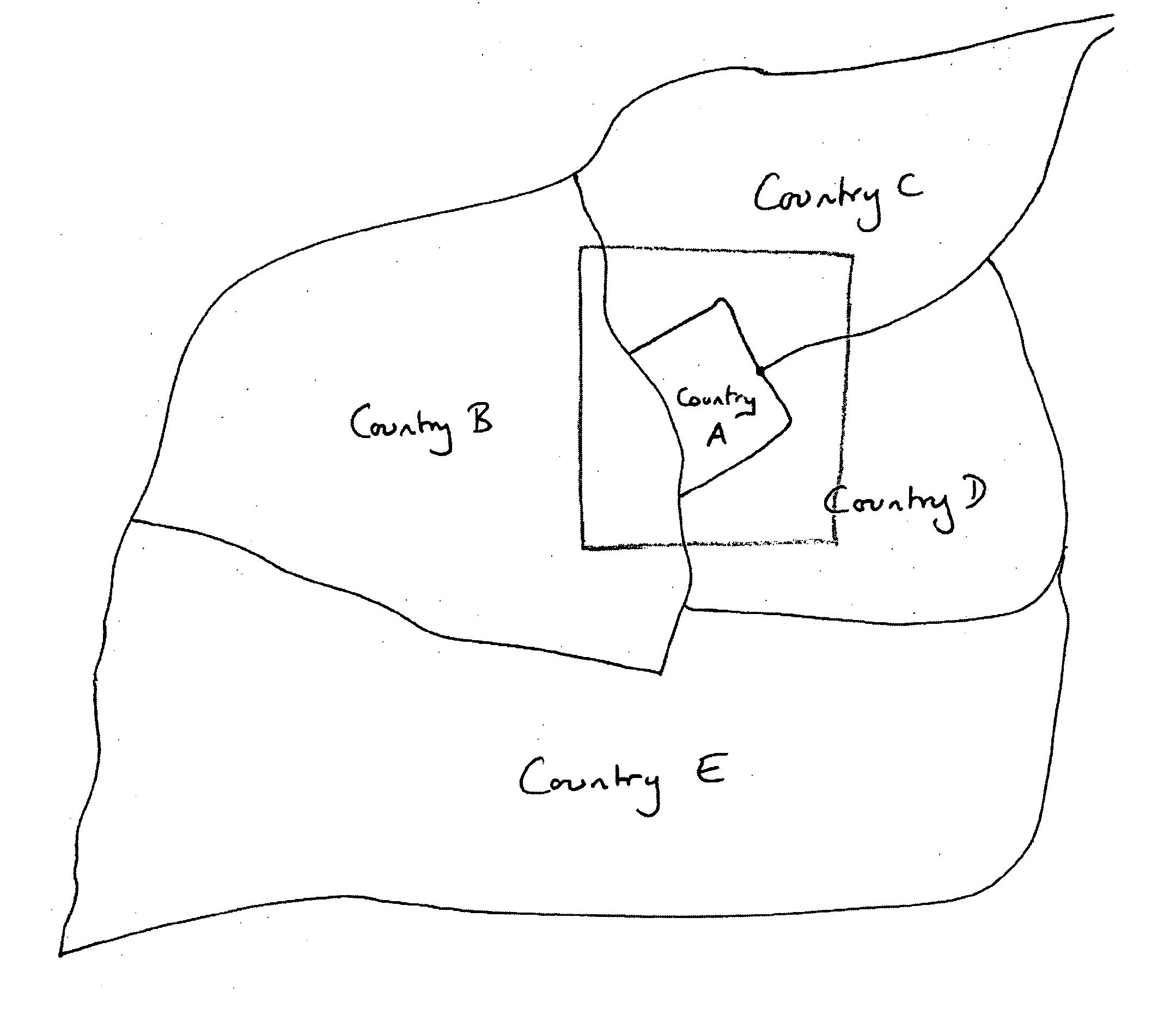
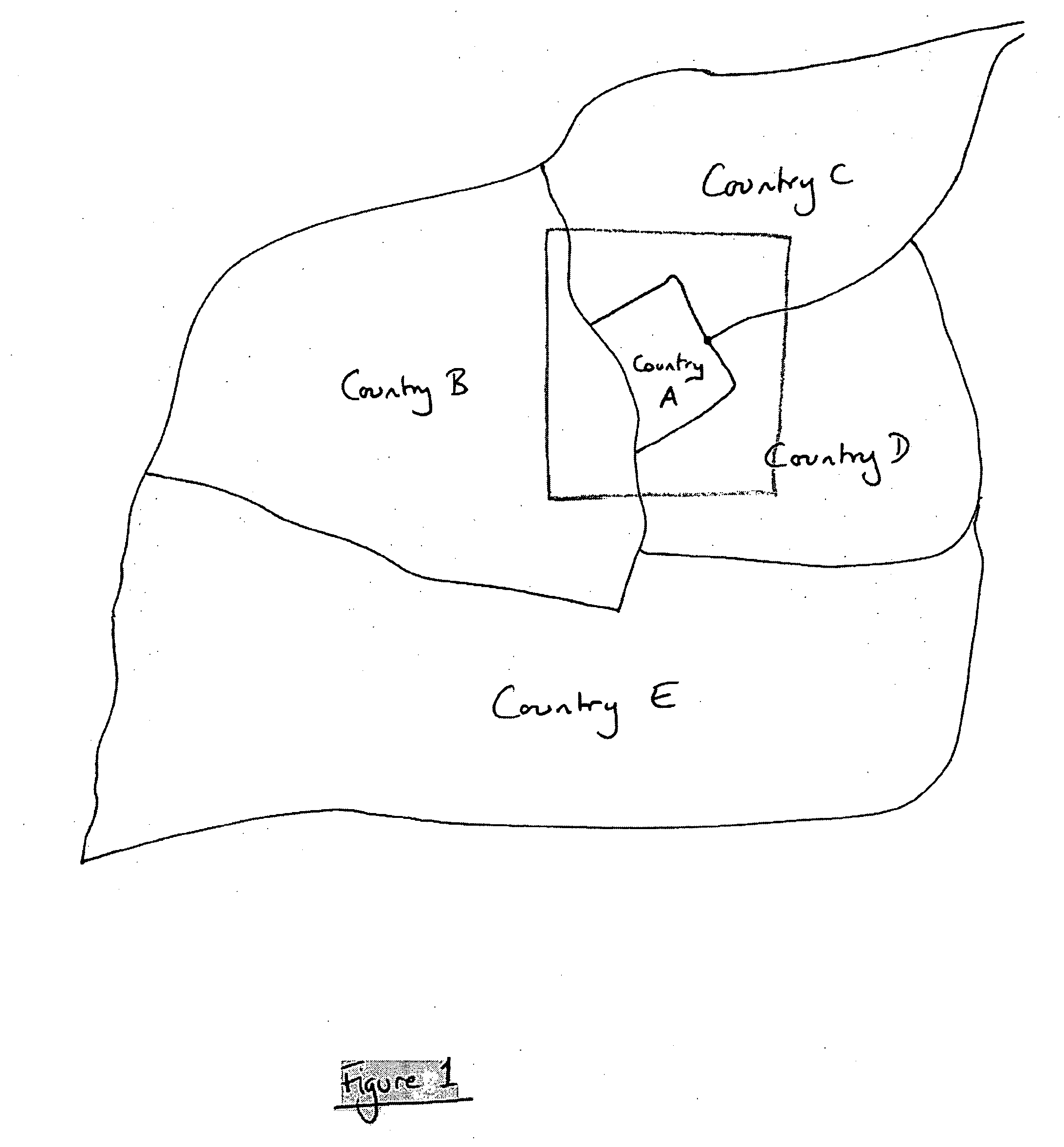
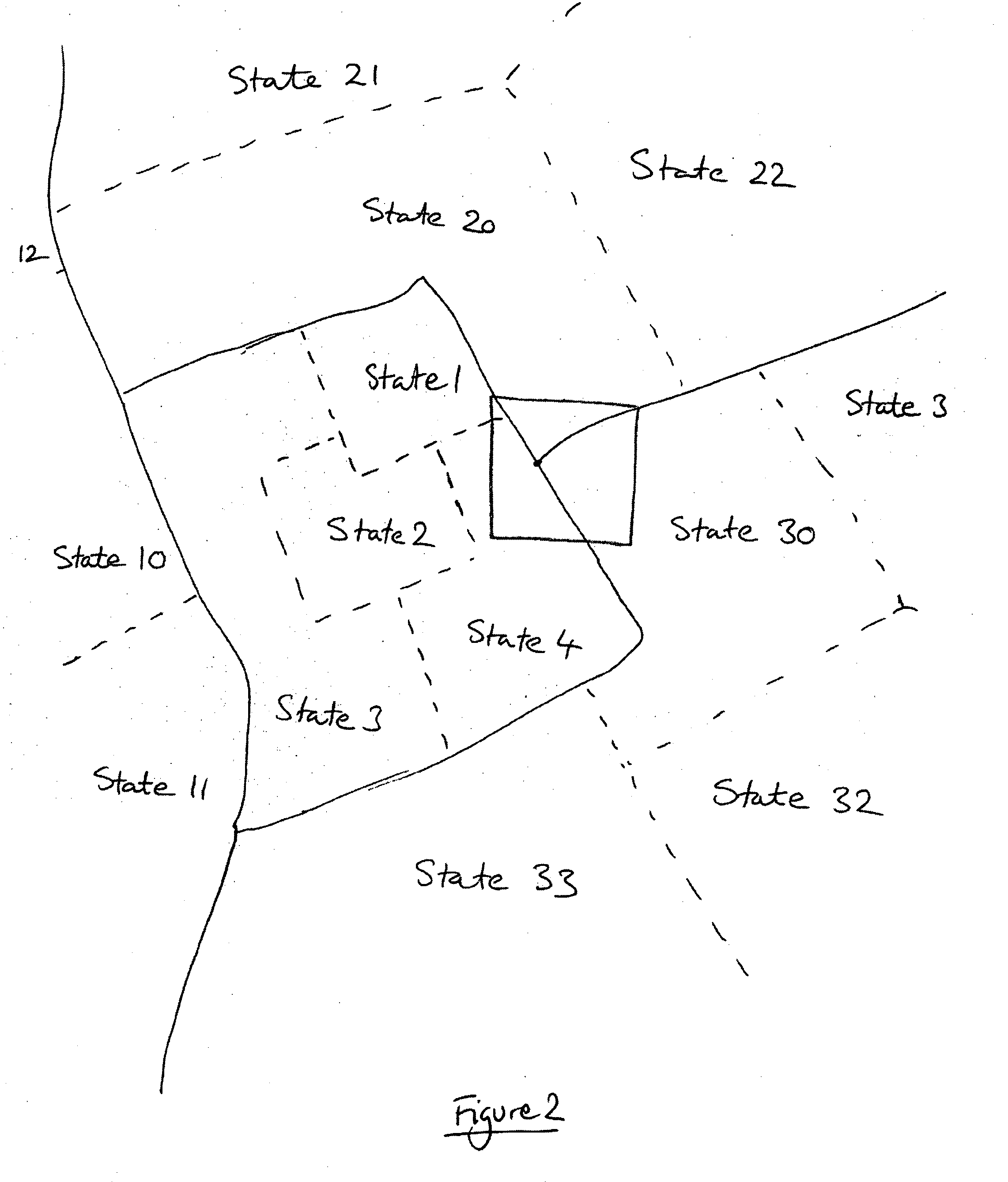
[0027] Referring to FIG. 1, a geographical area is divided into a system of discrete non-overlapping geographical zones. Each zone contains a plurality of geographical locations characterized by their geographical co-ordinates. Data relating to each of the geographical locations may be associated with each of the geographical locations.

[0028] Each zone is described as a polygon with an associated name (such as a country name in the case of FIG. 1) or identifier. In FIG. 1, the zones are described by their country names, Country1, Country2, etc. Preferably, each zone identifier is based on either a real world name but artificially generated names (such as sequential unique numbers) can also be used. The uniqueness of the identifier is only important for the efficiency of the system.

[0029] It is possible to form a finite list of the zones in a geographical area by listing all zones by their identification (e.g. in the case of FIG. 1, there is a finite list of countries). That list i...


PUM


Abstract

A geographical location index comprising a plurality of layers of geographical information concerning a geographical area, each layer comprising a division of the geographical area into a plurality of discrete zones which each have a zone identifier and associated geographical co-ordinates of one or more geographical locations contained within that zone.

Description

TECHNICAL FIELD [0001] This invention relates to a method of indexing data relating to geographical locations and a geographical location index produced by the method. BACKGROUND [0002] Indexing geographical location data which has a spatial component is becoming increasingly difficult as data volumes are increasing in size and service providers such as search engines and the like are attempting to organize geographical data for fast retrieval. For many applications dealing with geographical data, such as, but not limited to, “local” searches through the World Wide Web, the most important function is to query data concerning a given geographical point and then to return data ordered by its proximity to the given geographical point, starting with the data nearest to the given geographical point. [0003] A number of spatial indexing technologies allow the querying of objects within a bounded rectangle or circle and will return all data within the requested area. Problems occur when the...

Claims


Application Information

Patent Timeline
IPC IPC(8): G06F17/00G06F17/30
CPCG06F17/3087G06F16/9537
Inventor RIISE, SORENPATEL, DEVESHCAMPBELL, BRUCE ANDREW
Owner OATH INC
Why Eureka
Try Eureka