
Systems and methods for augmenting an inertial navigation system

a navigation system and inertial navigation technology, applied in the direction of navigation instruments, using reradiation, instruments, etc., can solve the problems of inaccurate machine position information, affecting the accuracy of machine position information over extended periods of time, and accumulating errors in such information, otherwise referred to as drift,

Active Publication Date: 2008-05-08
CATERPILLAR TRIMBLE CONTROL TECH
View PDF42 Cites 66 Cited by
  • Summary
  • Abstract
  • Description
  • Claims
  • Application Information

AI Technical Summary

Problems solved by technology

Thus, although attitude and position information may be obtained within an acceptable margin of error, the error in such information, otherwise referred to as “drift”, can accumulate over time to an unacceptable amount.
On a worksite, however, accurate machine position information is required over extended periods of time.
Accordingly, INS systems typically have not independently been used to determine positions of earthmoving machines.
Although location information can be accurately obtained, elevation information is considerably more inaccurate.
The combined GPS and fan laser system disclosed in Ohtomo et al., however, generates position and elevation information less frequently than desired for automatic real time control of a cutting implement, for example, a blade.

Method used


Image

  • Systems and methods for augmenting an inertial navigation system
  • Systems and methods for augmenting an inertial navigation system
  • Systems and methods for augmenting an inertial navigation system

Examples


Embodiment Construction

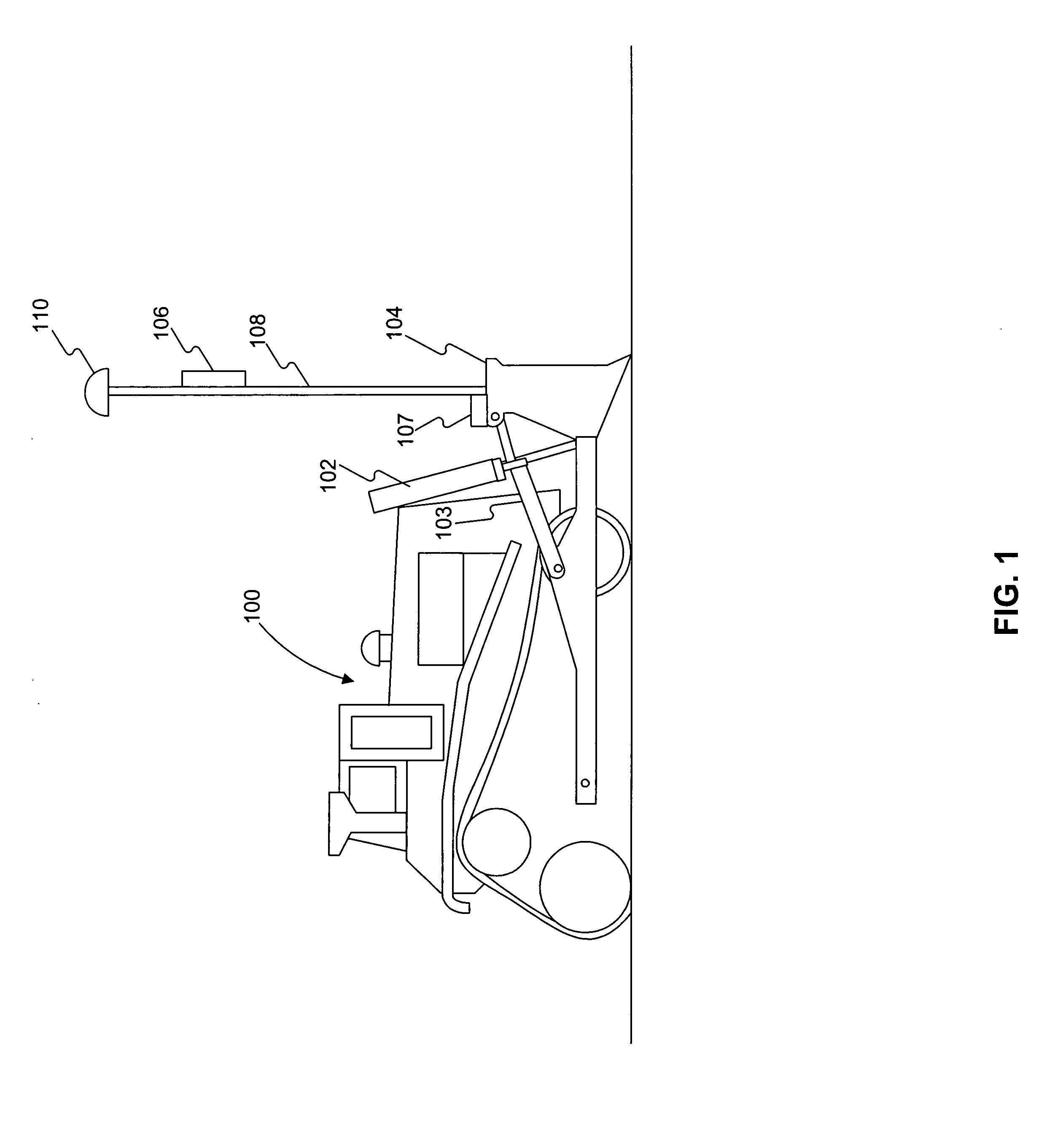
[0021]FIG. 1 illustrates an earthmoving machine 100, having hydraulic mechanisms 102 and 103, implement 104, sensor 106, post 108, INS 107, and receiver 110. While this disclosed embodiment is a track-type tractor, it should be understood that the disclosed system has broad application to a wide variety of mobile machines.

[0022]As machine 100 operates on a worksite, hydraulic mechanisms 102 and 103 may operate to direct a motion of implement 104, which may be a bulldozer blade. For example, hydraulic mechanism 102, which may include a lift actuator, moves implement 104 between an up position and a down position. In addition, hydraulic mechanism 103, which may include a tilt actuator, tilts implement 104 forward and backward. Hydraulic mechanisms 102 and 103 may operate in accordance with electrical signals supplied thereto from internal devices within machine 100 (not shown). For example, electrical signals may actuate hydraulic mechanism 102 to move up and down, while other electri...


PUM


Abstract

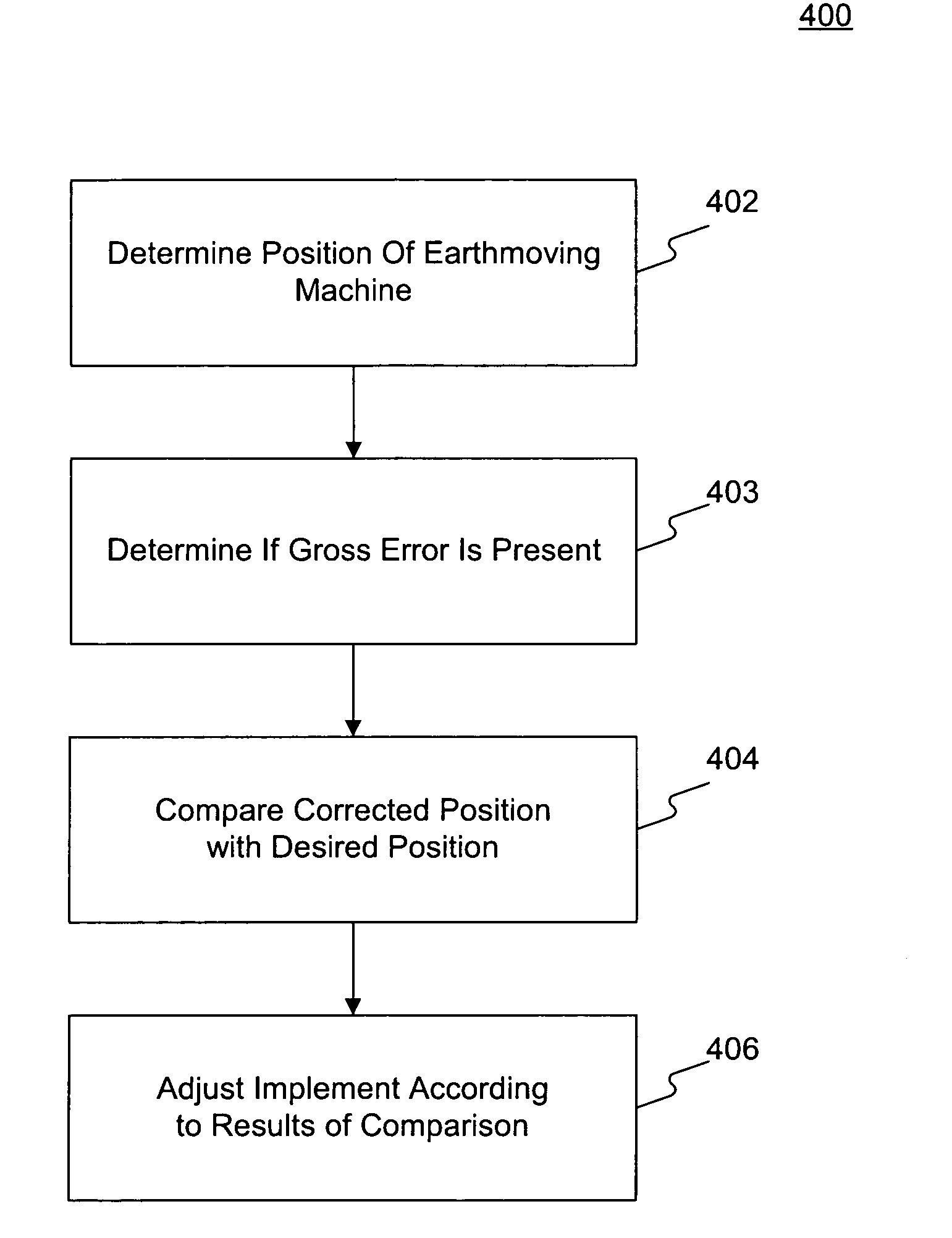
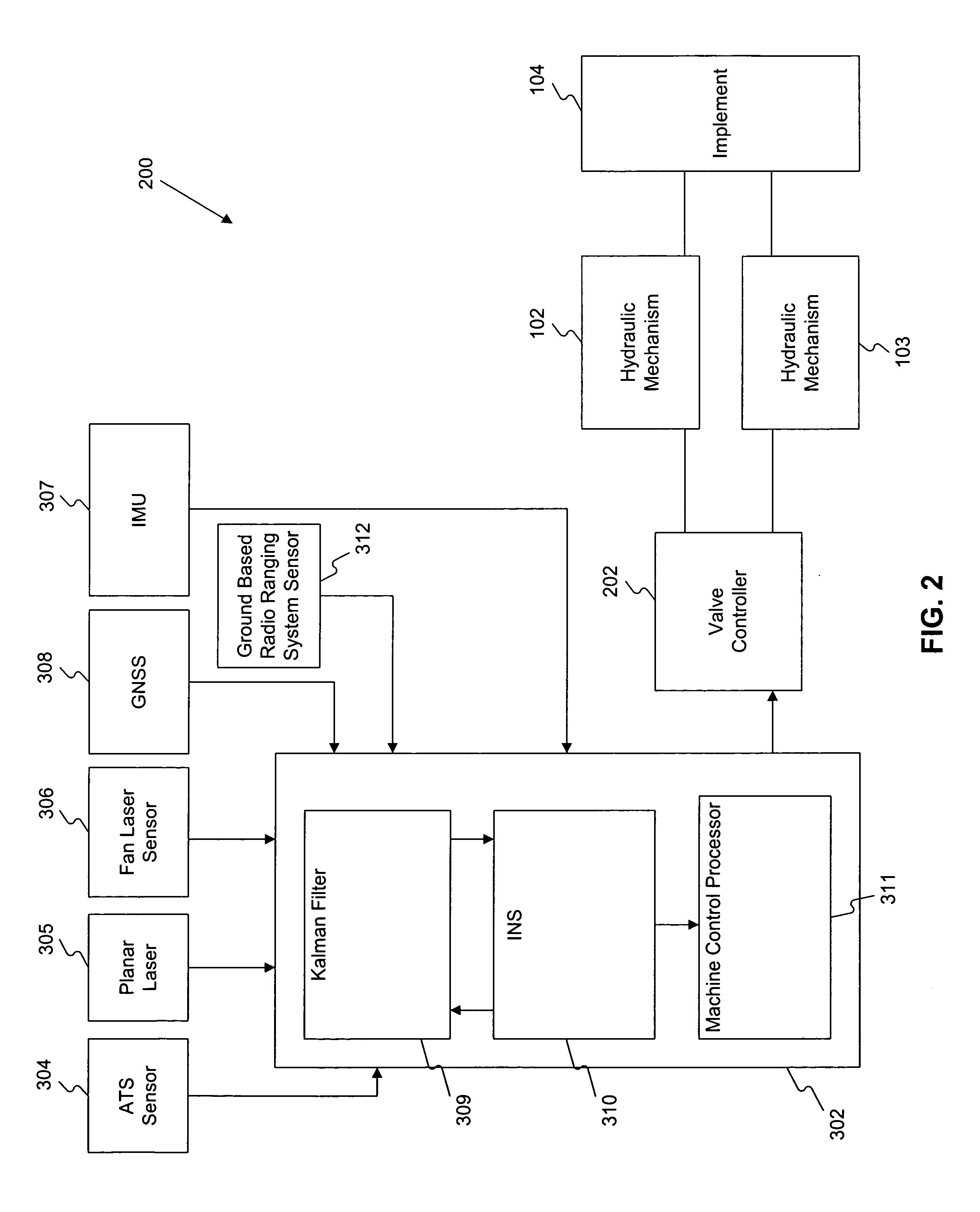
Systems and methods for augmenting an inertial navigation system (INS) include outputting from the INS position information associated with the implement and adjusting the implement based upon a comparison of the position information of the implement and a desired position of the implement. The INS is periodically re-initialized using error estimates generated by a kalman filter as a function of position information from one or more positioning (or measuring) devices, such as a fan laser, an automatic total station (ATS), a GNSS receiver, or a ground based radio positioning system, to correct a drift of the position information that may be caused by inherent characteristics of the INS.

Description

[0001]This disclosure relates generally to a system and method for providing position information with an inertial navigation system.BACKGROUND[0002]Earthmoving machines such as bulldozers, wheel loaders, and other earth moving equipment may alter a landscape of a worksite in accordance with a predetermined plan. The predetermined plan may specify certain dimensions and specifications of the worksite, and the earthmoving machines may alter the landscape accordingly. The predetermined plan may require work to be done by the earthmoving machines, such as covering the worksite with a particular material, excavating material from the worksite, or cutting the ground of the worksite to a finished predetermined profile. The machines may have an implement (e.g., a bulldozer blade) to carry out these actions.[0003]Earthmoving machines may contain devices to aid operators in performing work on the worksite. One such device relates to positioning equipment configured to intermittently receive ...

Claims


Application Information

Patent Timeline
IPC IPC(8): G01C21/16G01S19/04G01S17/86G01S19/10G01S19/44G01S19/46G05D1/02
CPCE02F3/842E02F3/847G01S19/49G01S17/023G01C21/165G01S17/86G01C21/1652
Inventor NICHOLS, MARK EDWARDGUDAT, ADAM JOHNPIEKUTOWSKI, RICHARD
Owner CATERPILLAR TRIMBLE CONTROL TECH
Learn More