
Method for evaluating measured electromagnetic data relating to a subsurface region

a technology of electromagnetic data and subsurface region, applied in seismology for waterlogging, instruments, reradiation, etc., can solve the problems of moving physical measurements, measurement error that can be estimated, and not typically of a type suitable for direct use by business decision makers

Inactive Publication Date: 2010-01-21
BHP BILLITON INNOVATION PTY LTD
View PDF4 Cites 5 Cited by
  • Summary
  • Abstract
  • Description
  • Claims
  • Application Information

AI Technical Summary

Benefits of technology

[0018]Using the described method, prior constraints can be introduced by the geoscientist on the input model(s) in terms of fundamental parameters (e.g. layer thickness), rather than on meta parameters such as resistivity which are not typically able to be directly estimated in a meaningful way. This is in contrast with previous methods in which arbitrary constraints hav...

Problems solved by technology

Furthermore, the measured data is also not typically of a type suitable for direct use by the business decision maker in making economic decisions regarding exploitation of the region, and the economic uncertainty information required by the business decision maker is likely to be more closely related to the parameters estimated by the geoscientist than to the measured physical data.
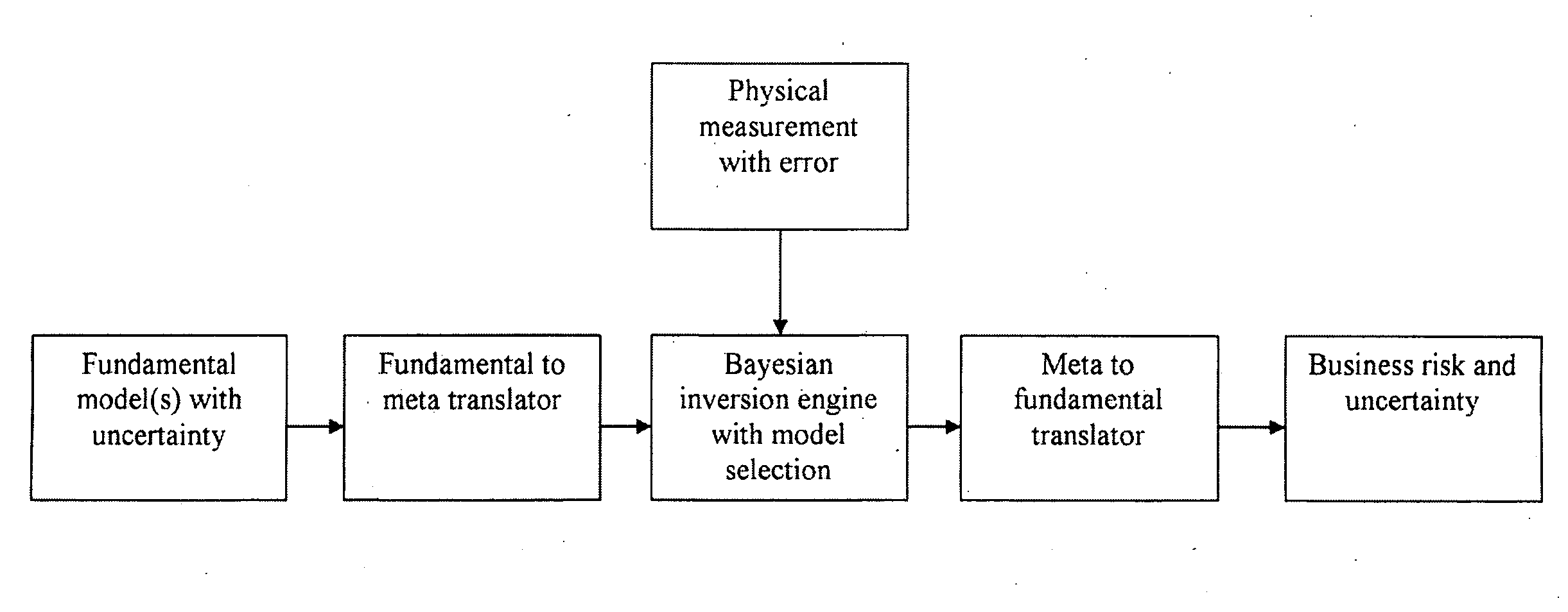
There is therefore a problem of how to move physical measurements that always have error into the risk and uncertainty needed by decision makers.
Both of these data have measurement error that can be estimated.

Method used


Image

  • Method for evaluating measured electromagnetic data relating to a subsurface region
  • Method for evaluating measured electromagnetic data relating to a subsurface region

Examples


Embodiment Construction

[0021]The described method for evaluating EM data can be embodied in many different forms. The disclosure and description of the method are illustrative and explanatory thereof, and various changes in the parameters used and the details of the process steps may be made without departing from the scope of the invention.

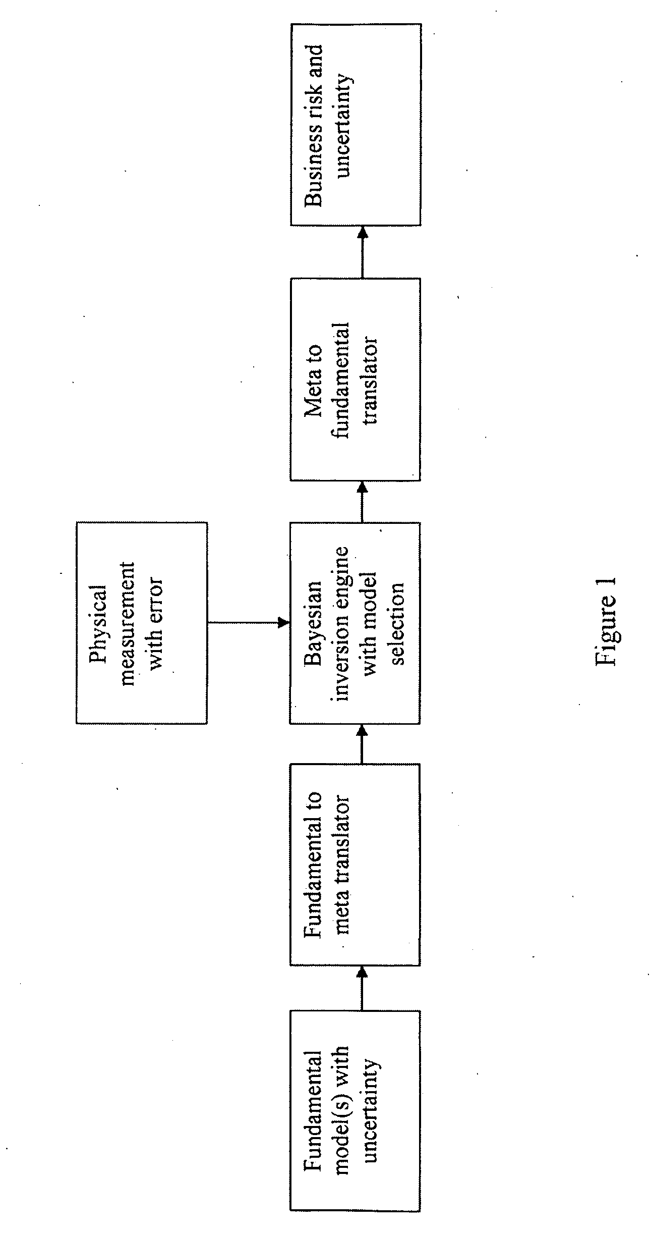
[0022]The main steps of the method are illustrated in FIG. 1. In an initial step, at least one model of a subsurface region is specified in terms of parameters which are referred to here as fundamental parameters with uncertainty. These are typically parameters that can directly be estimated by the geoscientist. In other words, this step allows the problem to be posed in such a way that the geoscientist can specify one or more alternative input models of the region in terms of parameters which he or she is able to estimate, but which are not directly measured properties of the region. Often, such parameters are also directly related to the economic value needed by the ...


PUM


Abstract

A method for evaluating measured electromagnetic (EM) data relating to a subsurface region, comprising the steps of: (a) specifying alternative models of the region in terms of input parameters with uncertainty; (b) receiving the measured EM data and an estimated error; and (c) carrying out a Bayesian inversion on the measured data using each of the alternative models to attribute a probability to each model on the basis of the measured data and estimated error. The method allows physical measurements with error to be translated into fundamental parameters which can be used to assess business risk and uncertainty for making decisions, and also provides for parameters and models which can typically be directly estimated by a geoscientist on a coarse spatial grid to be used as an input, and validated using the measured data with error.

Description

[0001]The present invention relates to the evaluation of measured electromagnetic data relating to a subsurface region, and in particular to the translation of physical measurements with error into parameters which may be used in the assessment of business risk and uncertainty for making decisions.BACKGROUND OF THE INVENTION[0002]In the acquisition and interpretation of data relating to subsurface regions, in particular for the appraisal of potential oil or gas reservoirs, the geoscientist will typically be able to provide an estimated model of the region in terms of certain physical parameters with specified estimated uncertainties. The parameters used by the geoscientist may include such properties as net-to-gross, water saturation, fluid type or porosity, and are usually only estimated in relation to a coarse spatial grid. However, these parameters typically differ from the properties of the region which are measured and collated in the form of survey data, which may include such...

Claims


Application Information

Patent Timeline
IPC IPC(8): G06F19/00G06F17/18
CPCG01V3/38
Inventor GLINSKY, MICHAEL EDWININAYAT-HUSSAIN, ANIS AHMADLIU, GUIMINROBB, TERRYBOGGS, DAVID BRIANGUNNING, JAMES STUART
Owner BHP BILLITON INNOVATION PTY LTD
Learn More