System and method for providing a live mapping display in a vehicle

a technology for live mapping and vehicle, applied in the field of live mapping display systems, can solve the problems of limited choice of hardware and software components, poor user experience, and inability to provide user-friendly information,

Inactive Publication Date: 2010-03-11
THALES AVIONICS INC
View PDF17 Cites 107 Cited by
  • Summary
  • Abstract
  • Description
  • Claims
  • Application Information

AI Technical Summary

Problems solved by technology

An IFES provider is severely restricted in choosing particular hardware and software components for these reasons.
However, the map information in

Method used


Image

  • System and method for providing a live mapping display in a vehicle
  • System and method for providing a live mapping display in a vehicle
  • System and method for providing a live mapping display in a vehicle

Examples


Embodiment Construction

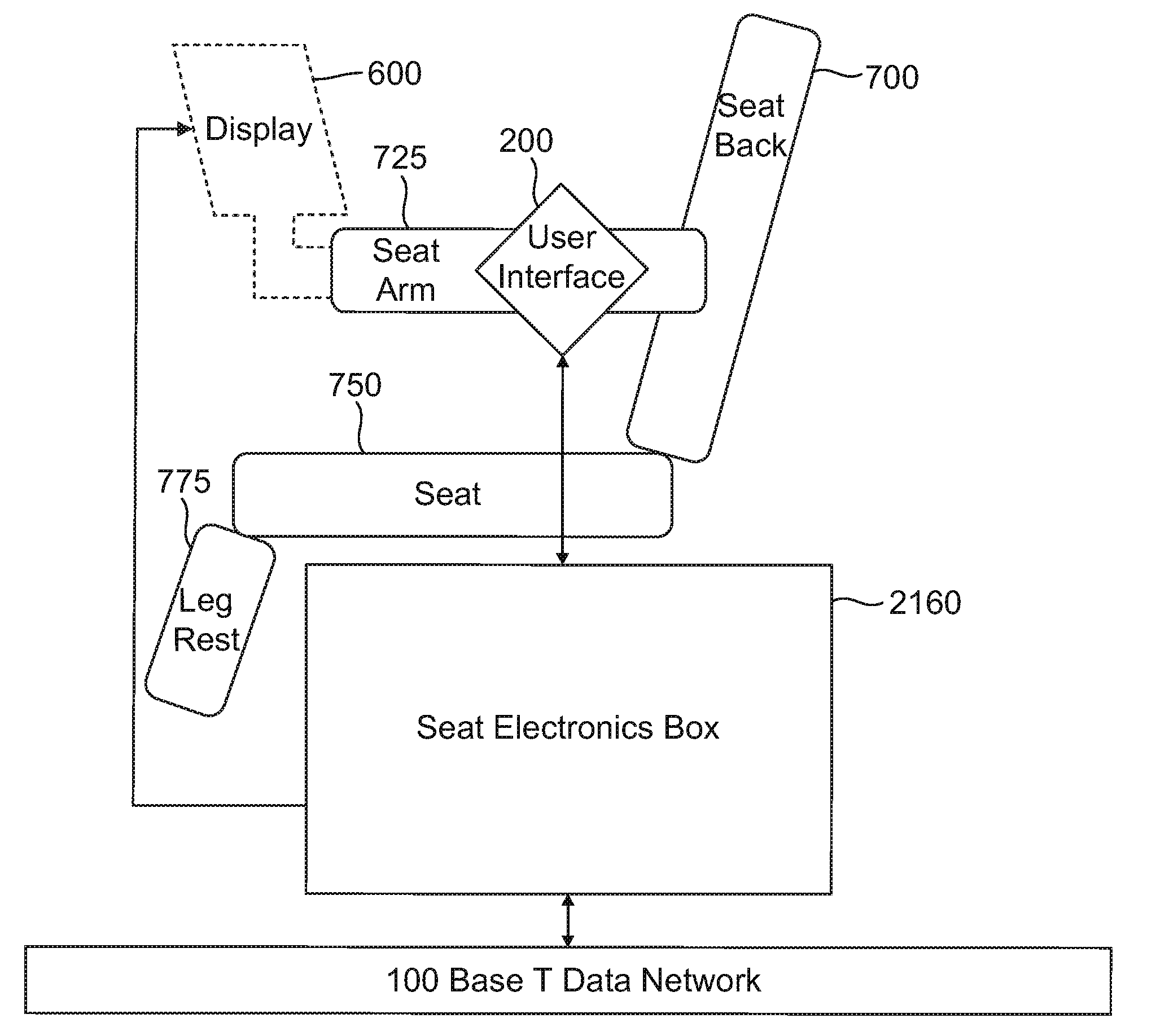
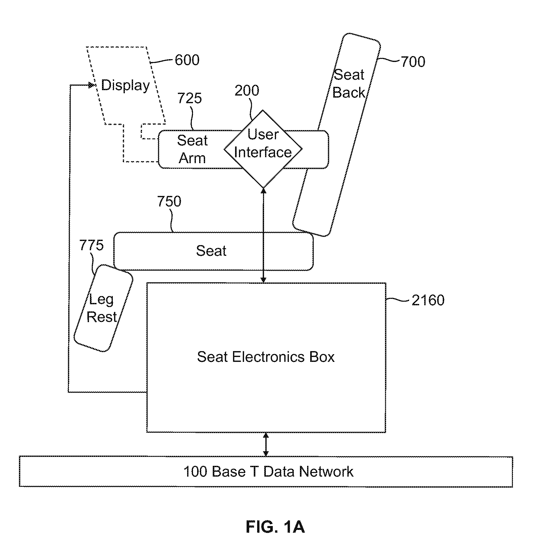
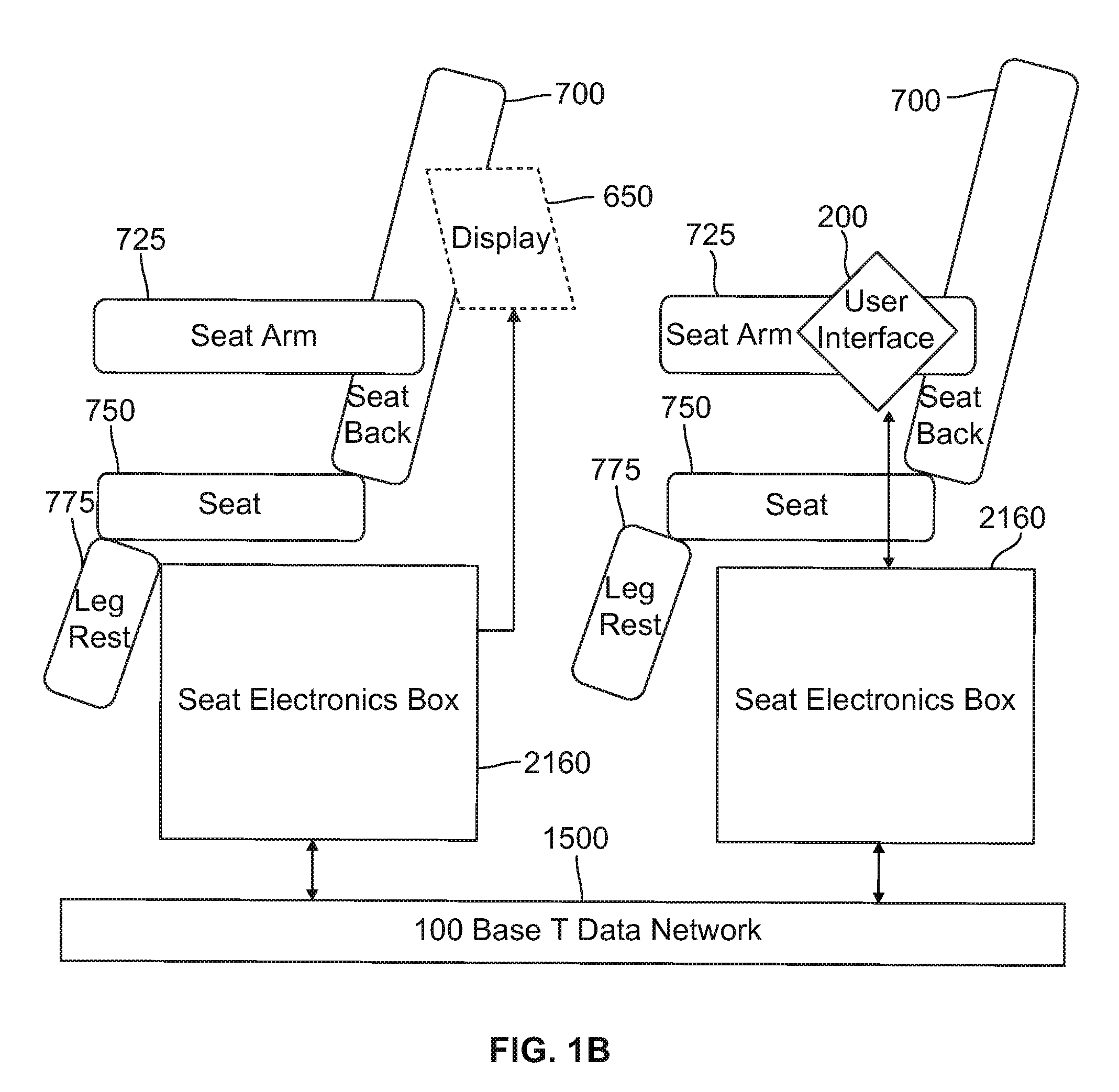
[0021]A live mapping display system for use in a vehicle, and an in-flight entertainment system infrastructure as an exemplary embodiment of the live mapping display system, are described herein. The live mapping display system may provide live updated information to a user about an area in which a vehicle is located. The infrastructure of the in-flight entertainment system may employ enhanced video technology in which images, such as digital video or still images (e.g., JPEG), are taken by one or more cameras mounted on the aircraft, and used to update or superimpose over stored images or maps relating to the current location of the aircraft. Information indicia, such as current aircraft altitude, position, attitude and speed, and location points of interest, as well as links or URLs pertaining to those points of interest or aircraft information, may be superimposed or otherwise overlayed on the images to present a still or moving updated map image of the landscape to passengers.

In...


PUM


Abstract

A live mapping display system onboard a vehicle may determine a geographic position of a vehicle, access stored image data corresponding to the geographic position, position a camera to direct the camera toward a target region proximate a geographic region corresponding to the accessed stored image data, receive live image data from the camera of a captured image of the target region, generate a display image including the stored image data combined with the live image data, and display the display image.

Description

CROSS-REFERENCE TO RELATED PATENT APPLICATIONS[0001]This application claims the priority benefit under 35 U.S.C. §119(e) from U.S. Provisional Patent Application No. 61 / 095,192 entitled “A System and Method for Providing a Live Mapping Display in a Vehicle” and filed Sep. 8, 2008, the entire content of which is incorporated herein by reference. This application is also related to co-pending U.S. patent application Ser. No. 11 / 057,662 entitled “Broadcast Passenger Flight Information System and Method for Using the Same” and filed on Feb. 14, 2005, which claims the priority benefit of U.S. Provisional Patent Application Ser. No. 60 / 545,125 filed on Feb. 17, 2004, and U.S. Provisional Patent Application Ser. No. 60 / 545,062 filed on Feb. 17, 2004, all of which are incorporated herein in their entirety by reference.BACKGROUND[0002]1. Field of the Invention[0003]The present invention relates to the field of live mapping display systems which provide geographic information to passengers in...

Claims


Application Information

Patent Timeline
IPC IPC(8): H04N5/28G08G1/123
CPCB64D11/0015B64D11/0624H04H60/51H04H20/62B64D11/00155B64D11/00153
Inventor SALAZAR, LORI
Owner THALES AVIONICS INC
Why Eureka
Try Eureka