System and method for updating, enhancing, or refining a geographic database using feedback
- Summary
- Abstract
- Description
- Claims
- Application Information
AI Technical Summary
Benefits of technology
Problems solved by technology
Method used
Image
Examples
Embodiment Construction
I. System Overview
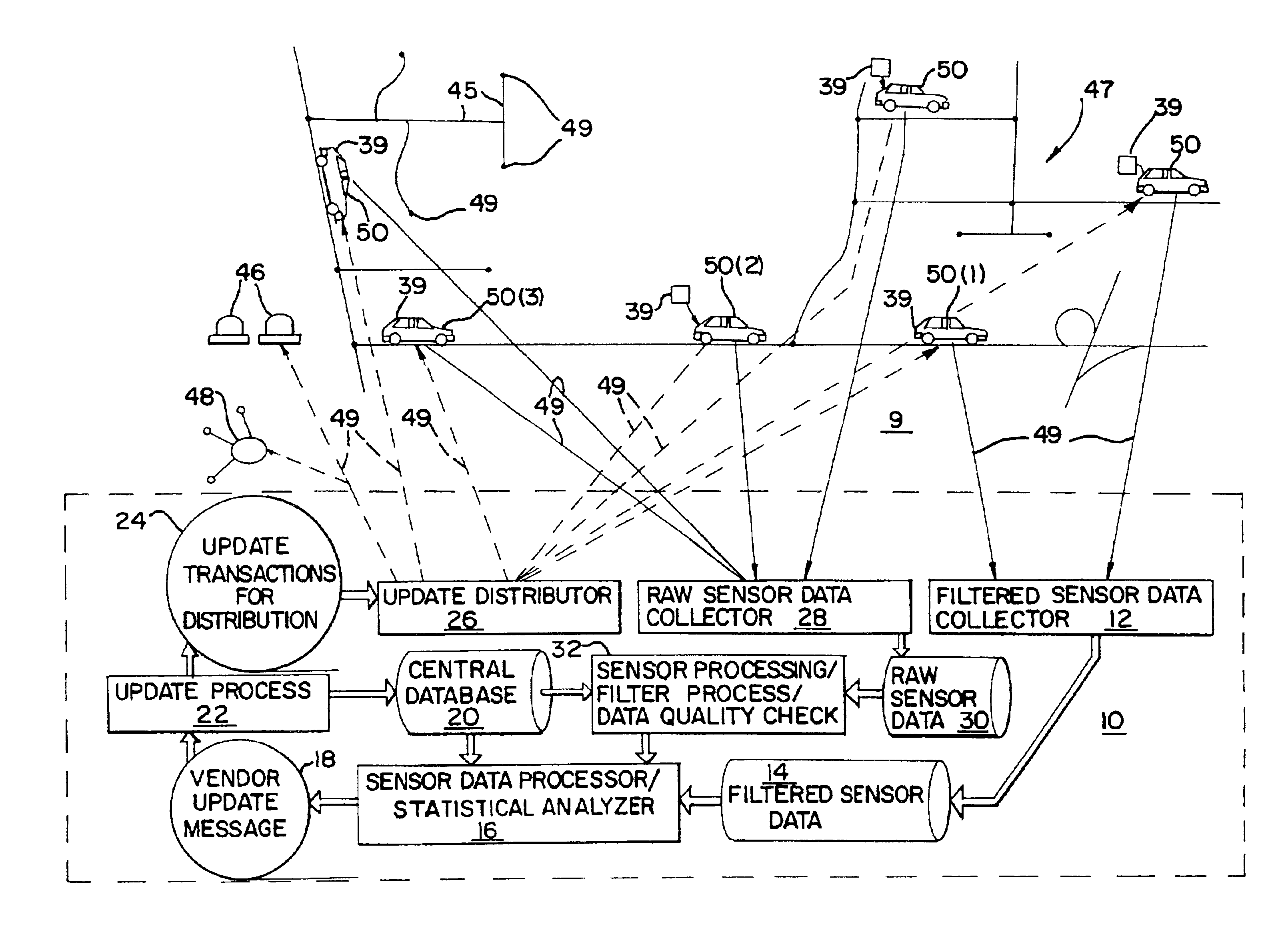
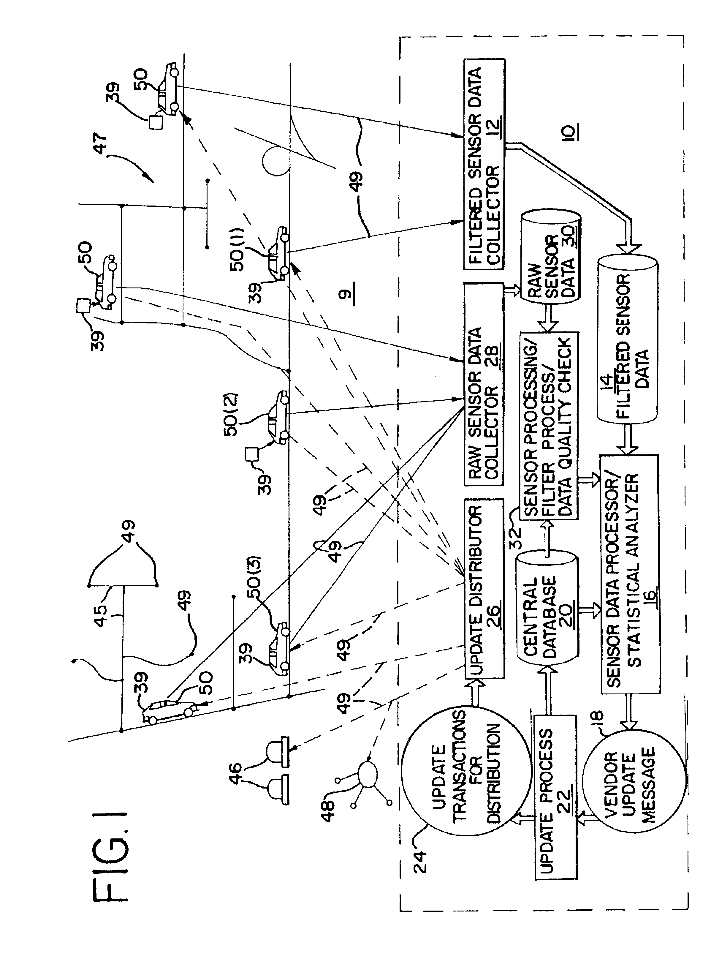
Referring to FIG. 1, a system 9 for updating and enhancing a geographic database includes a central geographic data manager 10. The central geographic data manager 10 includes a central geographic database 20. The geographic database 20 includes data that represents physical features in a geographical area 47. The central geographic database 20 may include data descriptive of position data in terms of points 44 on the map and of links, or segments of roads 45. The central geographic database 20 may also include data representing road gradients, road widths, lane widths and shoulder widths, and data that is descriptive of stationary objects such as stop signs, buildings, bridge supports, etc. The central geographic database 20 may include non-positional features such as speed limits, the direction of travel allowed on the roads and the directions of allowed turns. The central geographic database 20 may include other types of information as well, for example, types o...
PUM
 Abstract
Description
Claims
Application Information
 - R&D
- Intellectual Property
- Life Sciences
- Materials
- Tech Scout
- Unparalleled Data Quality
- Higher Quality Content
- 60% Fewer Hallucinations
Browse by: Latest US Patents, China's latest patents, Technical Efficacy Thesaurus, Application Domain, Technology Topic, Popular Technical Reports.
© 2025 PatSnap. All rights reserved.Legal|Privacy policy|Modern Slavery Act Transparency Statement|Sitemap|About US| Contact US: help@patsnap.com


