
System and method of integrating lane position monitoring with locational information systems

a technology of location information system and lane position monitoring, applied in traffic control system, navigation instruments, instruments, etc., can solve the problems of not being able to detect the lane the vehicle occupies, requiring a second layer of sophistication, and both systems having some limitations

Inactive Publication Date: 2012-05-03
REAGAN INVENTIONS
View PDF6 Cites 18 Cited by
  • Summary
  • Abstract
  • Description
  • Claims
  • Application Information

AI Technical Summary

Benefits of technology

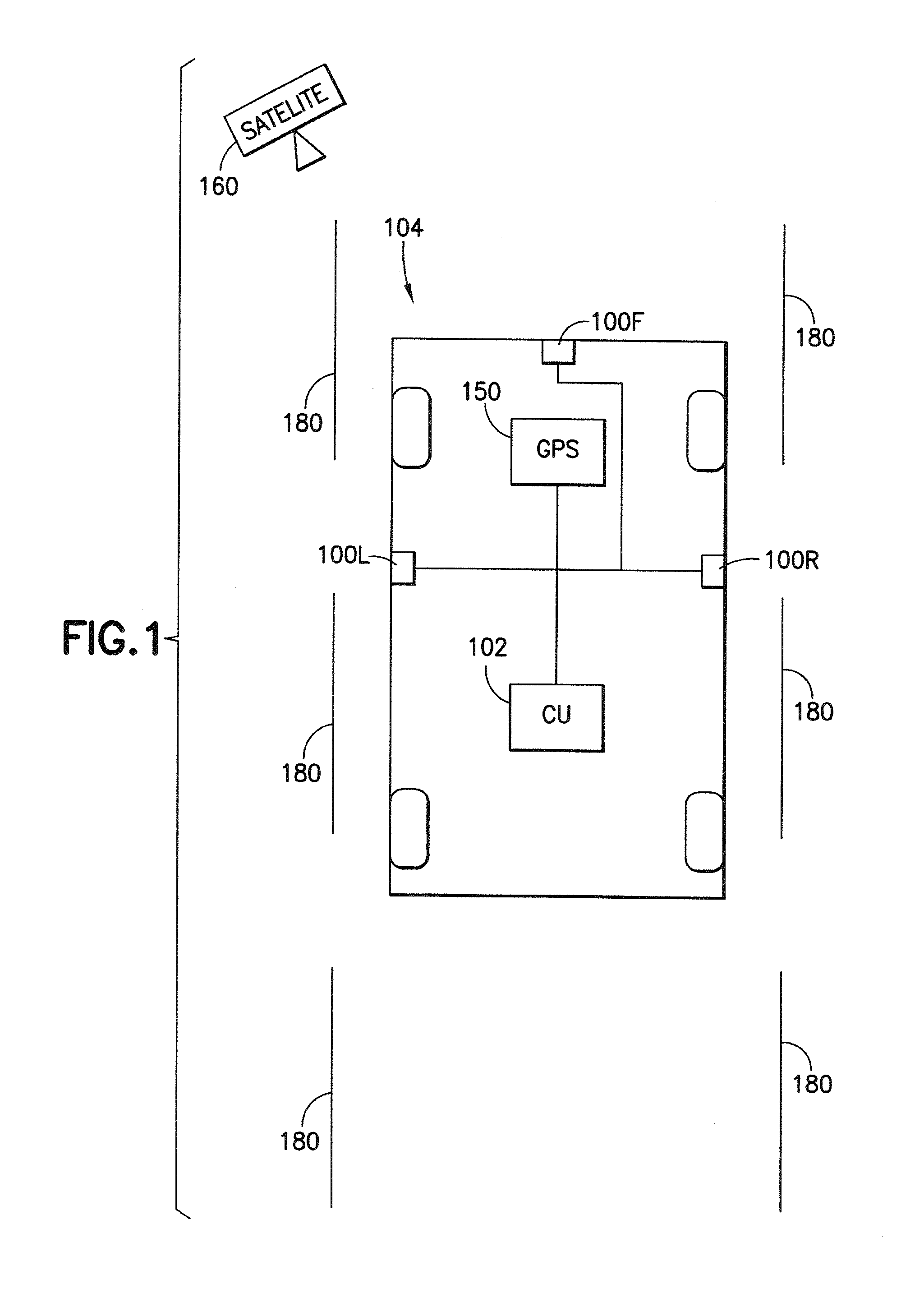
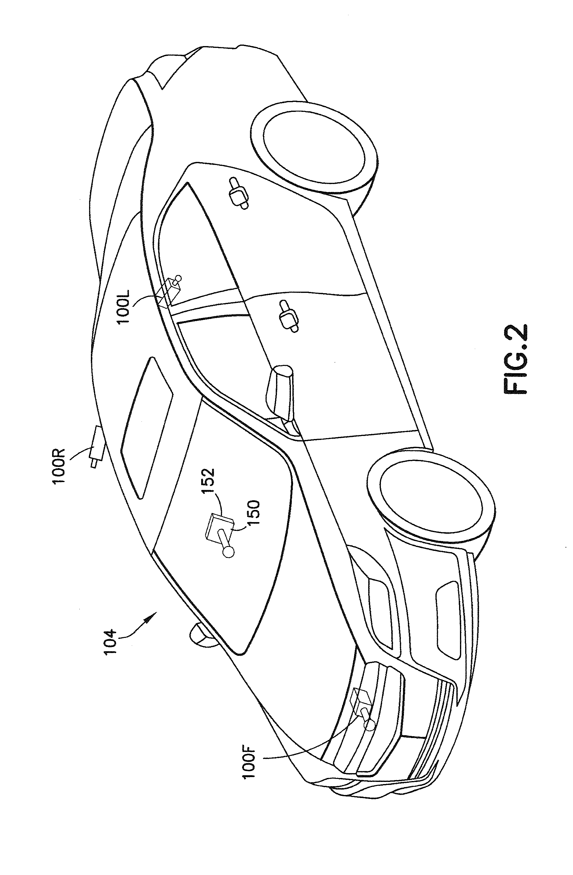
[0023]The system also includes a lane position monitor having at least one lane position sensor to determine a vehicle's relative position on a roadway. In the preferred embodiment, the at least one lane positioning sensor comprises several cameras mounted on a front position and on sides of the vehicle. The cameras t

Problems solved by technology

Commercial GPS devices (e.g., TomTom GO 950) provide lane guidance to indicate the appropriate lane to be in for an upcoming exit or turn but cannot detect the lane the vehicle occupies and recommend the required lane changes at appropriate distances from the impending exit or turn.
However, the system adds another layer of sophistication through the use of four radar units mounted in the front fascia and side of the vehicle.
However, both systems have some limitations.

Method used


Image

  • System and method of integrating lane position monitoring with locational information systems
  • System and method of integrating lane position monitoring with locational information systems
  • System and method of integrating lane position monitoring with locational information systems

Examples


Embodiment Construction

[0032]Preferred embodiments of the disclosure will be described herein with reference to the accompanying drawings. In the following description, well-known functions or constructions are not described in detail to avoid obscuring the disclosure.

[0033]Embodiments of the present disclosure overcome the shortcomings of existing practices and provides a system and method for integrating lane position monitoring and locational information systems.

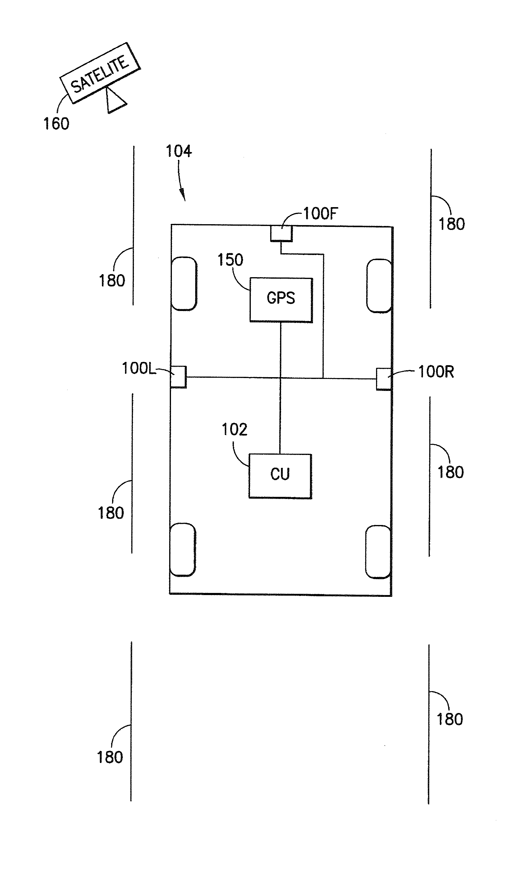
[0034]Referring to FIG. 1, a system for integrating lane position monitoring devices with locational information includes a lane positioning monitoring sensors 100 connected to a computer processor 102, e.g., a microprocessor, central processing unit, etc., both of which are connected via a mounted on a vehicle 104 and configured to identify and record lane marking information. The computer processor 102 is configured to analyze the lane marking information from the sensors 100 to determine the relative position of the vehicle 104 on a roadway....


PUM


Abstract

A system and method for an integrated lane positioning monitor with locational information systems is provided. The system and method gather and process information and data to assist an automobile operator in selecting and changing driving lanes. Further, the system and method is integrated with a locational information system to inform the operator of upcoming congestion and traffic issues as well as an appropriate distance to change lanes before a highway exit or entrance.

Description

[0001]This application claims priority on U.S. Provisional Application No. 61 / 407,183 filed on Oct. 27, 2010.BACKGROUND[0002]1. Field[0003]A system and method are provided to enhance current lane departure warning systems with lane-level position information that can be integrated with GPS navigation functionality to enable enhanced lane guidance.[0004]2. Description of the Related Art[0005]Current GPS systems give directions and traffic alerts but do not indicate a vehicle's lane position on a roadway or utilize that information to further assist a vehicle operator with directional information.[0006]Commercial GPS devices (e.g., TomTom GO 950) provide lane guidance to indicate the appropriate lane to be in for an upcoming exit or turn but cannot detect the lane the vehicle occupies and recommend the required lane changes at appropriate distances from the impending exit or turn. Lane-level positioning capability integrated with the GPS device can create a lane-level navigation syste...

Claims


Application Information

Patent Timeline
IPC IPC(8): G01C21/34G01C21/36G08G1/0967
CPCG01C21/3658G08G1/167
Inventor ROTHSCHILD, LEIGH M.
Owner REAGAN INVENTIONS
Learn More