Dangerous lane strands

a dangerous lane and lane strand technology, applied in traffic control systems, navigation instruments, instruments, etc., can solve problems such as indirect affecting the change of speed, events affecting specific vehicles on the roadway, and affecting vehicles and vehicle operators

Active Publication Date: 2020-09-17
HERE GLOBAL BV
View PDF0 Cites 10 Cited by
  • Summary
  • Abstract
  • Description
  • Claims
  • Application Information

AI Technical Summary

Problems solved by technology

These transient changes may impact the time for traveling a particular route, which impacts the determination of the optimum route from the origin to the destination location.
For example, dangerous driving conditions in roadways which may affect vehicles and vehicle operators as the roadways are traveled.
These dangerous driving conditions may cause or result in events impacting specific vehicles on the roadway.
In some instances, the external factors may impact the change in speed data due to physical limitations, and in other instances, the external factors may impact the perceptions of drivers, which indirectly affects the change in speed.
The cost from the dangerous road strand may be combined with other costs such as that derived from speed limits, traffic, curvature, or other costs.
Turn restrictions may also restrict that travel from a particular lane through a node.
Additionally, the illustrations are merely representational and may not be drawn to scale.

Method used


Image

  • Dangerous lane strands
  • Dangerous lane strands
  • Dangerous lane strands

Examples


Embodiment Construction

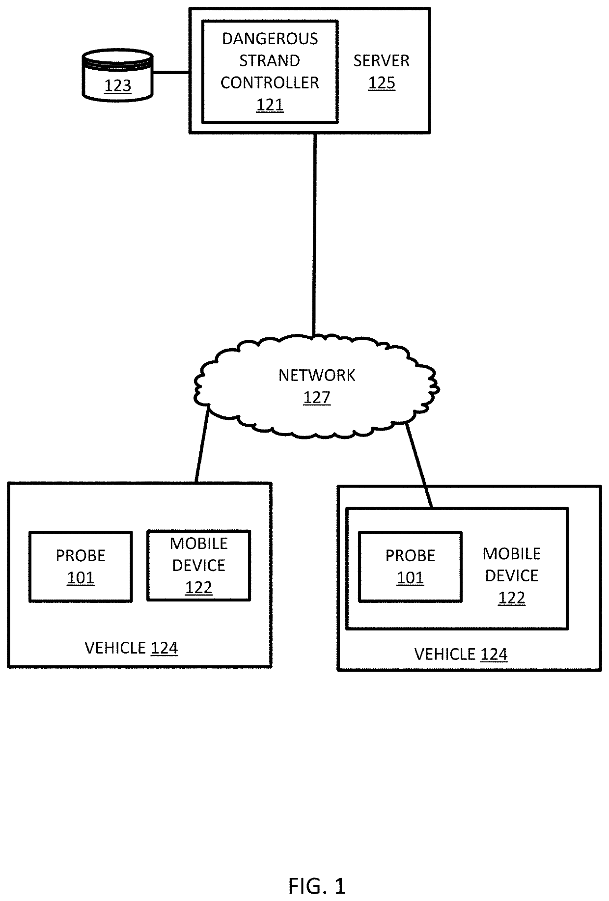
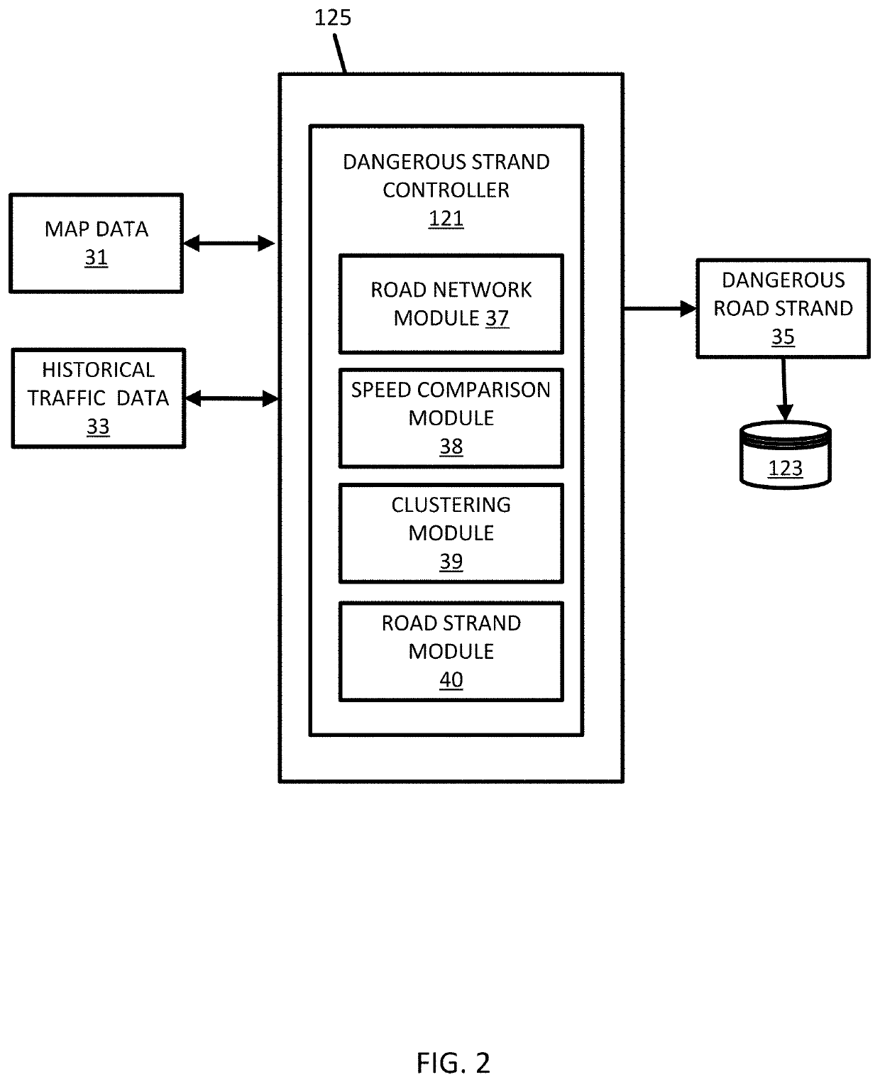
[0021]The following embodiments include navigation systems and other location based services that process probe data including a calculation related to how safely vehicles are able to navigate individual road lanes, as well as, a calculation to quantify which lanes are more dangerous compared to others or a baseline safety level. When one lane is determined to be more dangerous than adjacent lanes of the roadway, navigation systems may issue instructions (e.g., stay left, change lanes) to avoid the dangerous lane. Similarly, anonymous or assisted driving vehicles may avoid dangerous lanes or select the safest lanes based on attributes of the roadway such as through a sharp curve.

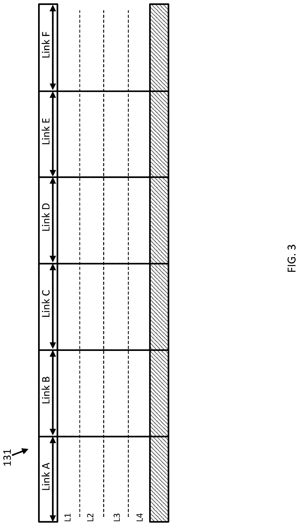
[0022]For these embodiments, high granularity between lanes and along lanes that defines where the dangerous conditions begin and end. High precision navigation is provided to vehicles by high definition maps for navigation, and it is important to provide information in the map that has high granularity and ...


PUM


Abstract

An apparatus and method are disclosed for calculation of a dangerous road strand of a roadway. Probe data for a roadway having multiple lanes is identified. A subset of the probe data for a predetermined lane is selected and values for a change in velocity for multiple sequences in the subset of probe data are calculated. Based on clustering for the change in velocity and a danger value, the dangerous road strand is identified. The dangerous road strand is stored in a geographic database in association with the lane for the roadway.

Description

FIELD[0001]The following disclosure relates to the identification of dangerous roadway conditions, and more specifically, to the calculation of dangerous conditions on individual lanes of a roadway.BACKGROUND[0002]Map databases or geographic databases are used in computer based systems that provide useful features to users. For example, the identification of routes to destinations or points of interests. A navigation system determines the optimum route to be taken by the end user to travel from the origin to the destination location from map data stored in a map database. Similarly, the navigation system may query the map database for nearby points of interest.[0003]The map database may be changed as permanent changes are made to the roadways. As new roads are built, other roads are closed, or locations of business are changed, the corresponding changes are made to the map database. Other road conditions may be transient. These transient changes may impact the time for traveling a p...

Claims


Application Information

Patent Timeline
Patent Type & Authority Applications(United States)
IPC IPC(8): G01C21/34G08G1/01G06F16/29
CPCG01C21/3461G08G1/0133G06F16/29G01C21/3804G08G1/0141G08G1/096775
Inventor FOWE, JAMES
Owner HERE GLOBAL BV
Why Eureka
Try Eureka