

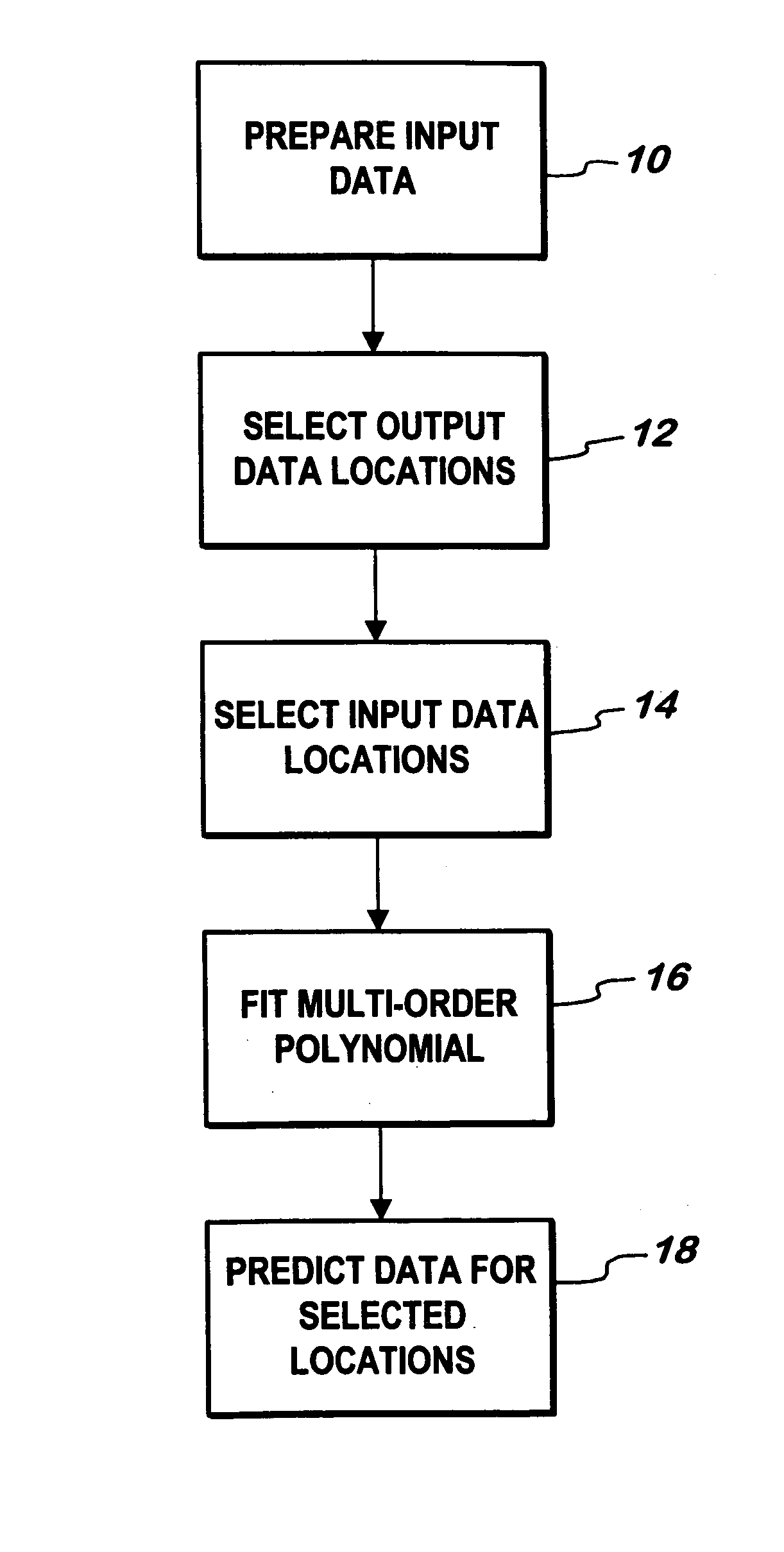
Seismic data interpolation system
a data interpolation and seismic data technology, applied in the field of seismic data interpolation system, can solve the problems of insufficient offset (source to receiver distance), and insufficient distribution of offsets, etc., to achieve the effect of assisting in predicting the formation structur
- Summary
- Abstract
- Description
- Claims
- Application Information
AI Technical Summary
Benefits of technology
Problems solved by technology
Method used
Image

Examples
examples
[0100]A number of tests were performed on both real and synthetic data.
[0101]Synthetic Data
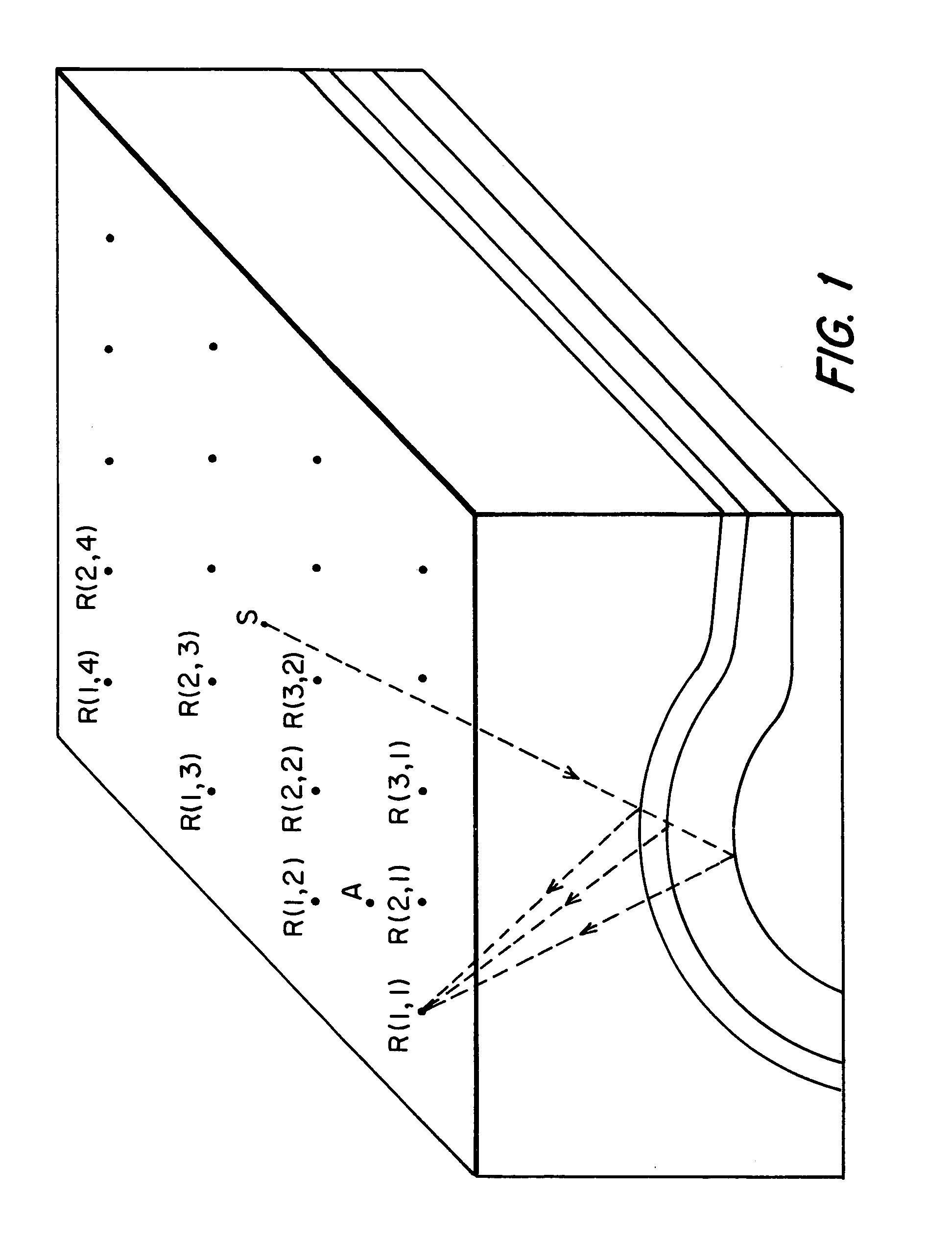
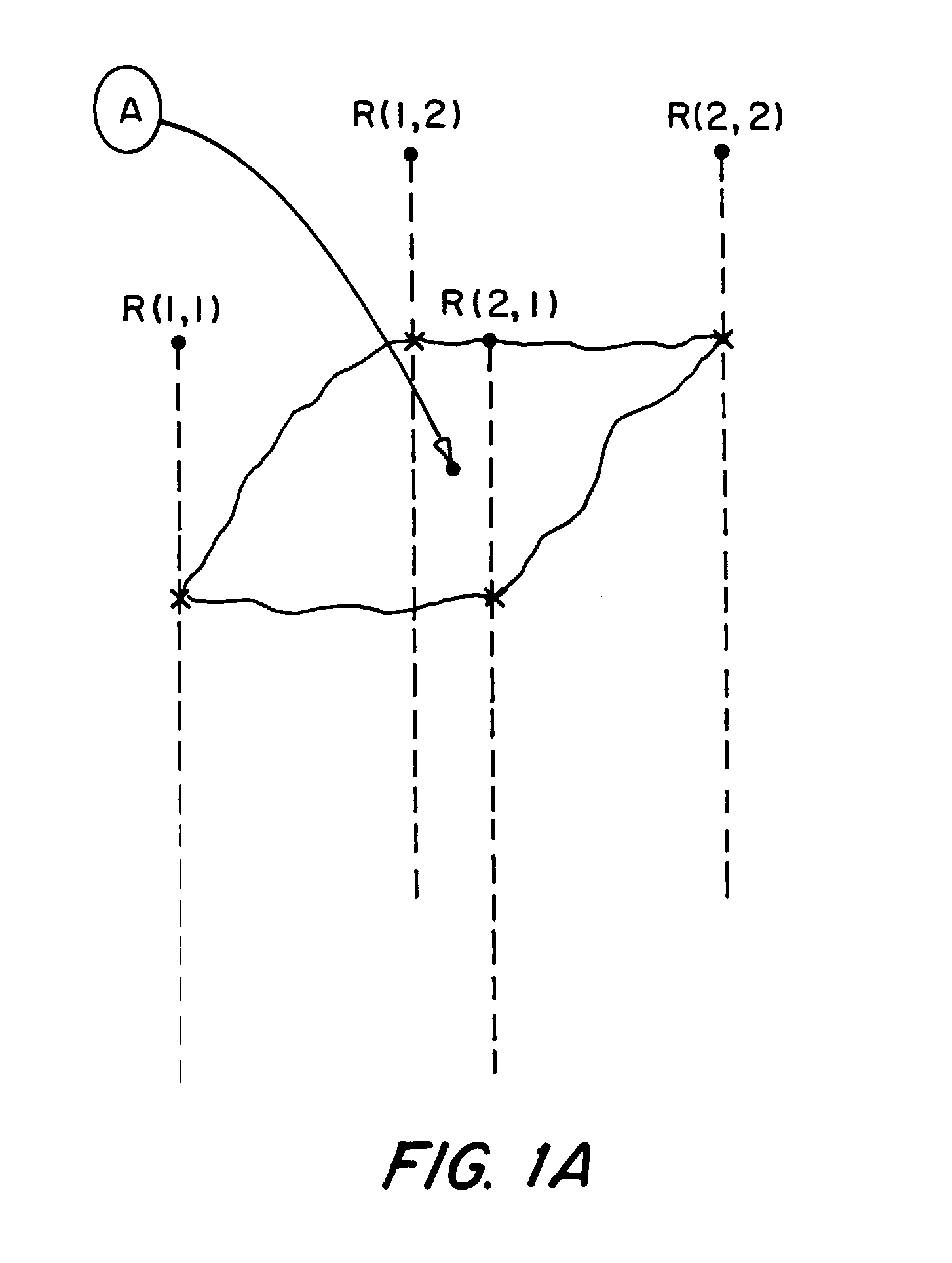
[0102]Testing using synthetic data utilized a delta function approach. A zero phase wavelet is reflected from a tilted boundary with random source and receiver locations about a common mid-point (CMP). The gathered traces contain the same wavelet placed at calculated arrival times. With such an input data set, interpolation to the same locations has resulted in near perfect results.
[0103]Field Data
[0104]A few field-data sets have been utilized that provide satisfactory interpolation results as detailed below.
[0105]Sources form a grid with x and y intervals of dx=513 & dy=96 meters, with 6 shot lines oriented in the y direction, and 56 shots per line. Note that geographical features and dead shots either prevented a shot from being made or resulted in a no shot. The total number of live shots is 317 as shown in FIG. 3.
[0106]The shot data was received with receivers forming a grid with x and y i...
PUM
 Abstract
Description
Claims
Application Information