
Spatial point to cable distance calculator for high bandwidth metropolitan area networks

a technology of high-bandwidth metropolitan area and calculator, which is applied in the field of high-bandwidth telecommunication, can solve the problems of increasing the difficulty of maintaining the records of such a large number of vendors, changing the ownership status of various cables, and affecting the planning and implementation of high-bandwidth connections and high-bandwidth cabling. , to achieve the effect of convenient planning and implementation of high-bandwidth cabling

Inactive Publication Date: 2009-03-24
SPRINT CORPORATION
View PDF4 Cites 9 Cited by
  • Summary
  • Abstract
  • Description
  • Claims
  • Application Information

AI Technical Summary

Benefits of technology

"The present invention is a system that helps plan and install high-speed internet connections in metropolitan areas. It keeps track of the location of high-speed cables and the people who own them. It also displays the cables in order of priority based on the company that owns them. The system calculates the distance between points and cables, making it easier to plan the best way to connect them. Overall, the invention makes it easier to install and use high-speed internet in urban areas."

Problems solved by technology

Maintaining records of such a large number of vendors can be extremely difficult.
Making matters even more difficult, the ownership status of various cables can change frequently.
Because of the installation of additional cable and the transfer of existing cable, maintaining records as to the location and ownership of high bandwidth telecommunication cables in a metropolitan area network can be a challenging task.
Simply maintaining the location and ownership of high bandwidth cable is not enough to plan a connection to the cable system.
Not all locations along a high bandwidth telecommunication cable are appropriate for forming a connection.
Maintaining and accessing records of the location of high bandwidth cables, the vendors who own the cables, and the location and type of node for each cable can be an extraordinarily challenging task.
However, placing all of the information regarding the high bandwidth telecommunication cable network for a metropolitan area upon one or more hard copy maps presents problems for users.
First, the dynamic nature of a metropolitan area network will render a static hard copy map obsolete quickly.
Moreover, the high quantity of information to be displayed on the map can be overwhelming.
However, the common practice of maintaining metropolitan area network maps on a particular workstation, while superior in many regards to maintenance of hard copy maps, does not adequately address the needs of companies installing high bandwidth telecommunication cable providing connectivity to telecommunication customers.
Information maintained on a single workstation can be difficult to access.
Further, simply converting maps of metropolitan area high bandwidth telecommunication cable from a hard copy format to a digital format does not necessarily facilitate the maintenance and display of information.
Hard copy maps and hard copy format maps converted to digital format do not facilitate the fast and convenient calculation of this distance.
Both processes are prone to error and labor intensive, especially when several nodes and cable from different vendors are involved.

Method used


Image

  • Spatial point to cable distance calculator for high bandwidth metropolitan area networks
  • Spatial point to cable distance calculator for high bandwidth metropolitan area networks
  • Spatial point to cable distance calculator for high bandwidth metropolitan area networks

Examples


Embodiment Construction

[0028]The present invention utilizes computer software to maintain, calculate, and display information pertaining to metropolitan area high bandwidth telecommunication networks. Software applying one or more methods in accordance with this invention may be placed in any computer readable media, including, but not limited to, disk drives, hard drives, and magnetic tape. The present invention is particularly well suited for use in a networked computing environment, thus permitting multiple users to access its capability. Alternatively, the present invention may be maintained on a single workstation.

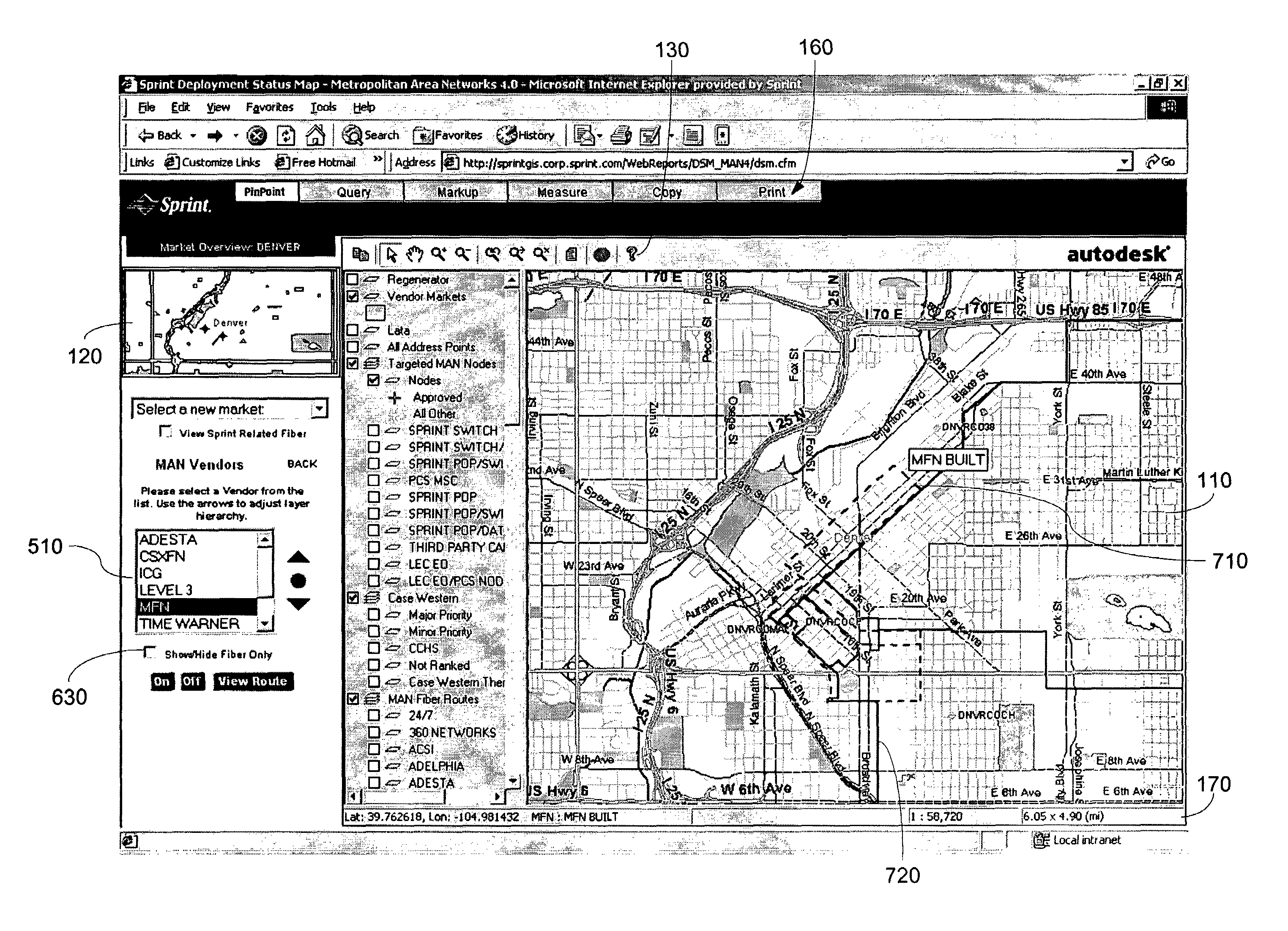
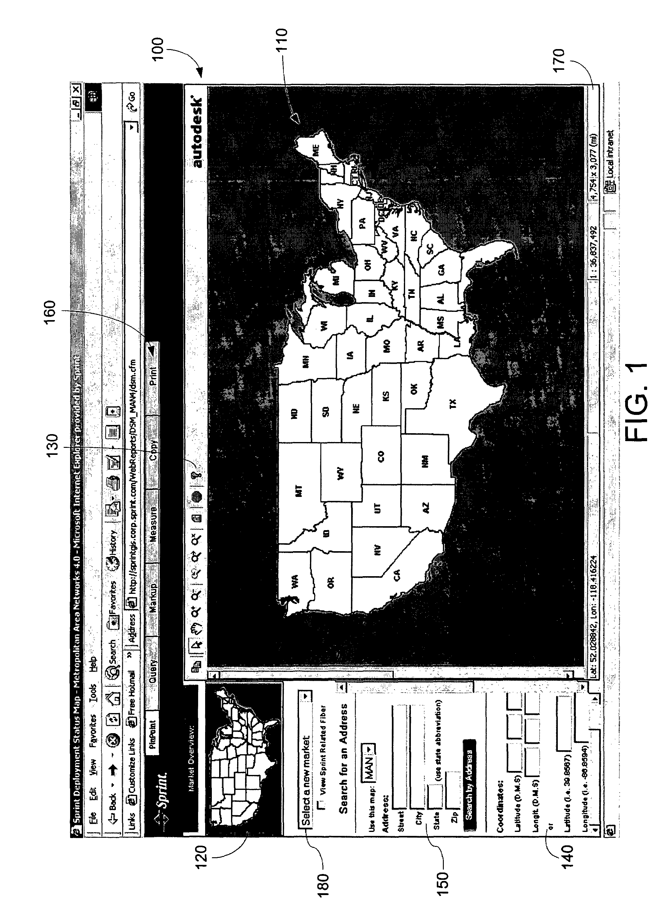
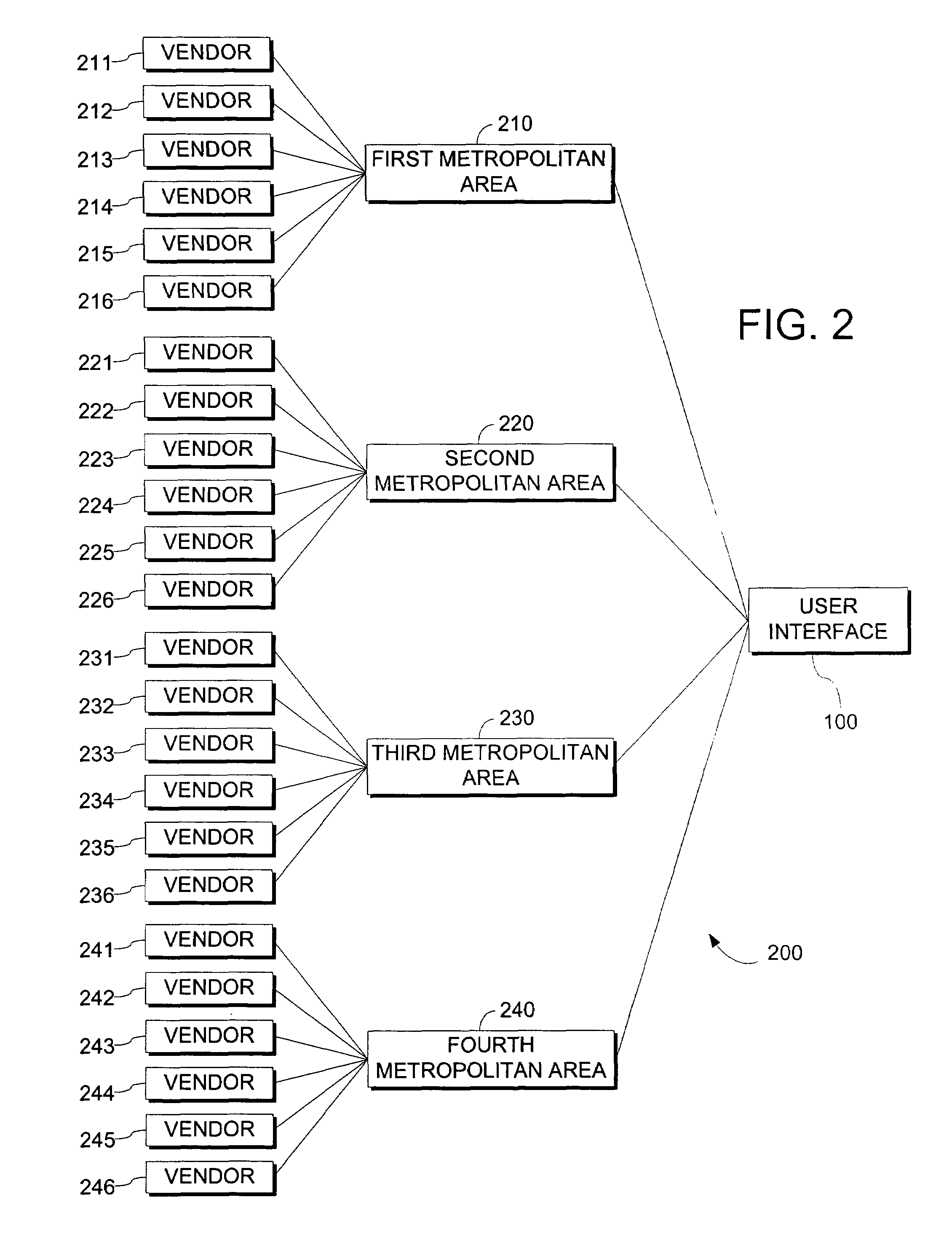
[0029]FIG. 1 illustrates a user interface 100 in accordance with the present invention. Within the user interface 100, a map view 110 displays geographical information regarding a metropolitan area. As shall be further illustrated, map view 110 may further display information relating to the location of high bandwidth cable, as well as other information as requested by a user. The market di...


PUM


Abstract

The present invention provides a system and method for calculating, maintaining, and displaying information regarding the relative distance from nodes associated with telecommunication cable to high bandwidth telecommunication cables in metropolitan areas. The present invention allows a user to select the cable from at least one of the vendors who own telecommunication cable in the area and a specific node or series of nodes for calculation. The present invention provides a fast and convenient means by which to determine this relative distance and may be useful in the planning, budgeting, and vendor selection of connecting to customers.

Description

CROSS-REFERENCE TO RELATED APPLICATIONS[0001]This is a continuation-in-part of U.S. patent application Ser. No. 10 / 354,346 filed on Jan. 30, 2003 now U.S. Pat. No. 7,207,012 and entitled System and Method for Mapping Deployment Status of High Bandwidth Metropolitan Area Networks.STATEMENT REGARDING FEDERALLY SPONSORED RESEARCH OR DEVELOPMENT[0002]None.TECHNICAL FIELD[0003]This invention is related generally to the field of high bandwidth telecommunication. More particularly, the present invention relates to the maintaining of an electronic geographical map displaying of the deployment status of high bandwidth metropolitan areas and the calculation and display of relative distances between a high bandwidth telecommunication cable and user-selected telecommunication nodes.BACKGROUND OF THE INVENTION[0004]The present invention relates to the design and implementation of high speed metropolitan area networks. More particularly, the present invention relates to the computerized mapping o...

Claims


Application Information

Patent Timeline
Patent Type & Authority Patents(United States)
IPC IPC(8): G06F3/00
CPCG06F3/0481G06Q30/00G09B29/007
Inventor HOUSE, RON L.HAYWARD, RICH E.
Owner SPRINT CORPORATION
Learn More