Method providing positioning and navigation inside large buildings

a technology for large buildings and navigation, applied in the field of positioning and navigation systems, can solve the problems of not being able to position itself and navigate within large buildings, and achieve the effect of facilitating navigation and positioning

Active Publication Date: 2012-09-04
NOKIA TECH OY
View PDF8 Cites 180 Cited by
  • Summary
  • Abstract
  • Description
  • Claims
  • Application Information

AI Technical Summary

Problems solved by technology

It is currently not possible for an electronic device, such as a mobile device, to position itself and to navigate within large buildings, e.g., malls, large office buildings, public buildings (museums, city halls, conference centers, etc.), covered parking lots, etc.
However, such technology operates by mapping a WLAN AP beacon (that is found by driving around and scanning) to geolocation coordinates, where the signal was detected, thus still necessitating GPS signal availability.

Method used


Image

  • Method providing positioning and navigation inside large buildings
  • Method providing positioning and navigation inside large buildings
  • Method providing positioning and navigation inside large buildings

Examples


Embodiment Construction

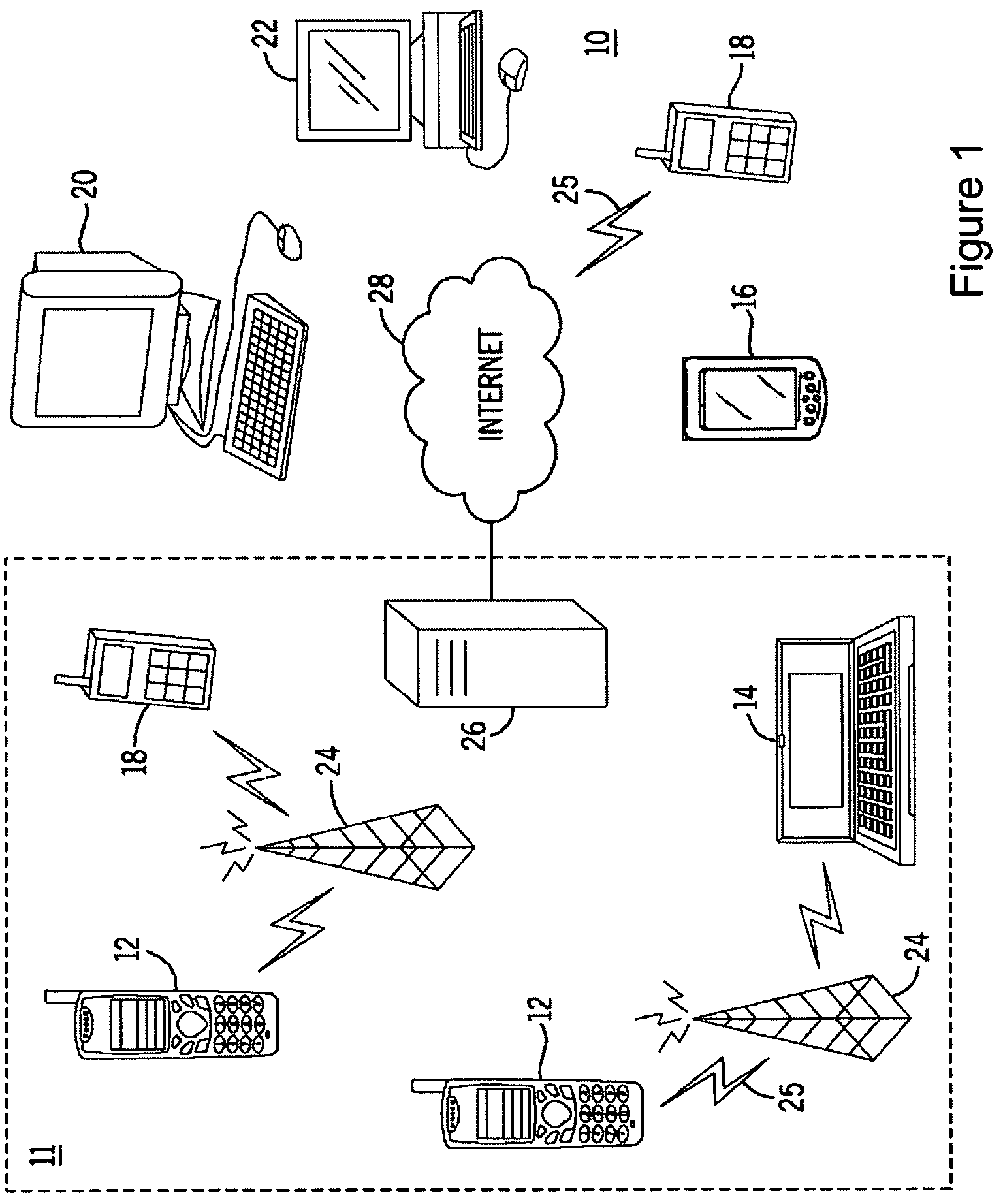
[0015]FIG. 1 shows a system 10 in which various embodiments of the present invention can be utilized, comprising multiple communication devices that can communicate through one or more networks. The system 10 may comprise any combination of wired or wireless networks including, but not limited to, a mobile telephone network, a wireless Local Area Network (LAN), a Bluetooth personal area network, an Ethernet LAN, a token ring LAN, a wide area network, the Internet, etc. The system 10 may include both wired and wireless communication devices.

[0016]For exemplification, the system 10 shown in FIG. 1 includes a mobile telephone network 11 and the Internet 28. Connectivity to the Internet 28 may include, but is not limited to, long range wireless connections, short range wireless connections, and various wired connections including, but not limited to, telephone lines, cable lines, power lines, and the like.

[0017]The exemplary communication devices of the system 10 may include, but are no...


PUM


Abstract

Positioning and / or navigation of an electronic device within a building when GPS signals are unavailable is provided. The electronic device scans for available Wireless Local Area Network (WLAN) Access Points (APs) upon, e.g., entering a building. The electronic device detects a signal (e.g., beacon) from at least one available WLAN AP, whereupon the electronic device retrieves the indoor location of the available WLAN AP. The location information can be directly downloaded from the WLAN AP while in state-1 via, e.g., a Native Query Protocol which includes an extension to currently defined Native Query info elements that returns location information. Alternatively, the Media Access Control (MAC) address of the WLAN AP can be read from the beacon signal, which is then used to retrieve the location of the WLAN AP from an associated database. Additionally, various embodiments may be implemented with or via a mapping application or service, where the mapping application is able to display any floor's floor plan of a building and determine / obtain the position of the electronic device inside the building relative to the floor plan.

Description

FIELD OF THE INVENTION[0001]The present invention relates generally to positioning and navigation systems. More particularly, the present invention relates to the use of Wireless Local Area Network Access Point (WLAN AP) locations in conjunction with maps, building floor plans, and specification standards for positioning and navigation purposes inside structures such as large buildings where Global Positioning System (GPS) signals are generally unavailable.BACKGROUND OF THE INVENTION[0002]This section is intended to provide a background or context to the invention that is recited in the claims. The description herein may include concepts that could be pursued, but are not necessarily ones that have been previously conceived or pursued. Therefore, unless otherwise indicated herein, what is described in this section is not prior art to the description and claims in this application and is not admitted to be prior art by inclusion in this section.[0003]Various methods have been develop...

Claims


Application Information

Patent Timeline
Patent Type & Authority Patents(United States)
IPC IPC(8): H04W4/04H04W4/029H04W4/33
CPCH04W4/043H04W64/00G01S1/68G01S5/02H04W84/12H04W4/029H04W4/33
Inventor BAJKO, GABOR
Owner NOKIA TECH OY
Why Eureka
Try Eureka