Satellite signal multipath mitigation in GNSS devices

a multipath mitigation and satellite signal technology, applied in satellite radio beaconing, measurement devices, instruments, etc., can solve problems such as multipath errors, source of measurement errors, and distortion of raw measurements

Active Publication Date: 2014-05-06
JAVAD GNSS
View PDF5 Cites 29 Cited by
  • Summary
  • Abstract
  • Description
  • Claims
  • Application Information

AI Technical Summary

Problems solved by technology

A well known source of measurement error is due to multipath error.
Multipath errors are caused by reflection of the radio signal from surfaces located near the receiving antenna.
The combination of two (or more) signals at the antenna leads to the distortion of raw measurements.
Multipath errors affect both pseudo-range and carrier phase measurements.

Method used


Image

  • Satellite signal multipath mitigation in GNSS devices
  • Satellite signal multipath mitigation in GNSS devices
  • Satellite signal multipath mitigation in GNSS devices

Examples


Embodiment Construction

[0025]The following description is presented to enable a person of ordinary skill in the art to make and use the various embodiments. Descriptions of specific devices, techniques, and applications are provided only as examples. Various modifications to the examples described herein will be readily apparent to those of ordinary skill in the art, and the general principles defined herein may be applied to other examples and applications without departing from the spirit and scope of the invention as claimed. Thus, the various embodiments are not intended to be limited to the examples described herein and shown, but are to be accorded the scope consistent with the claims.

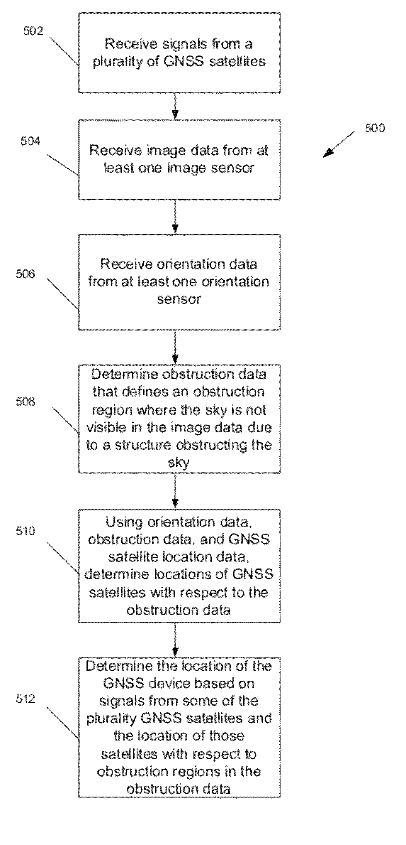
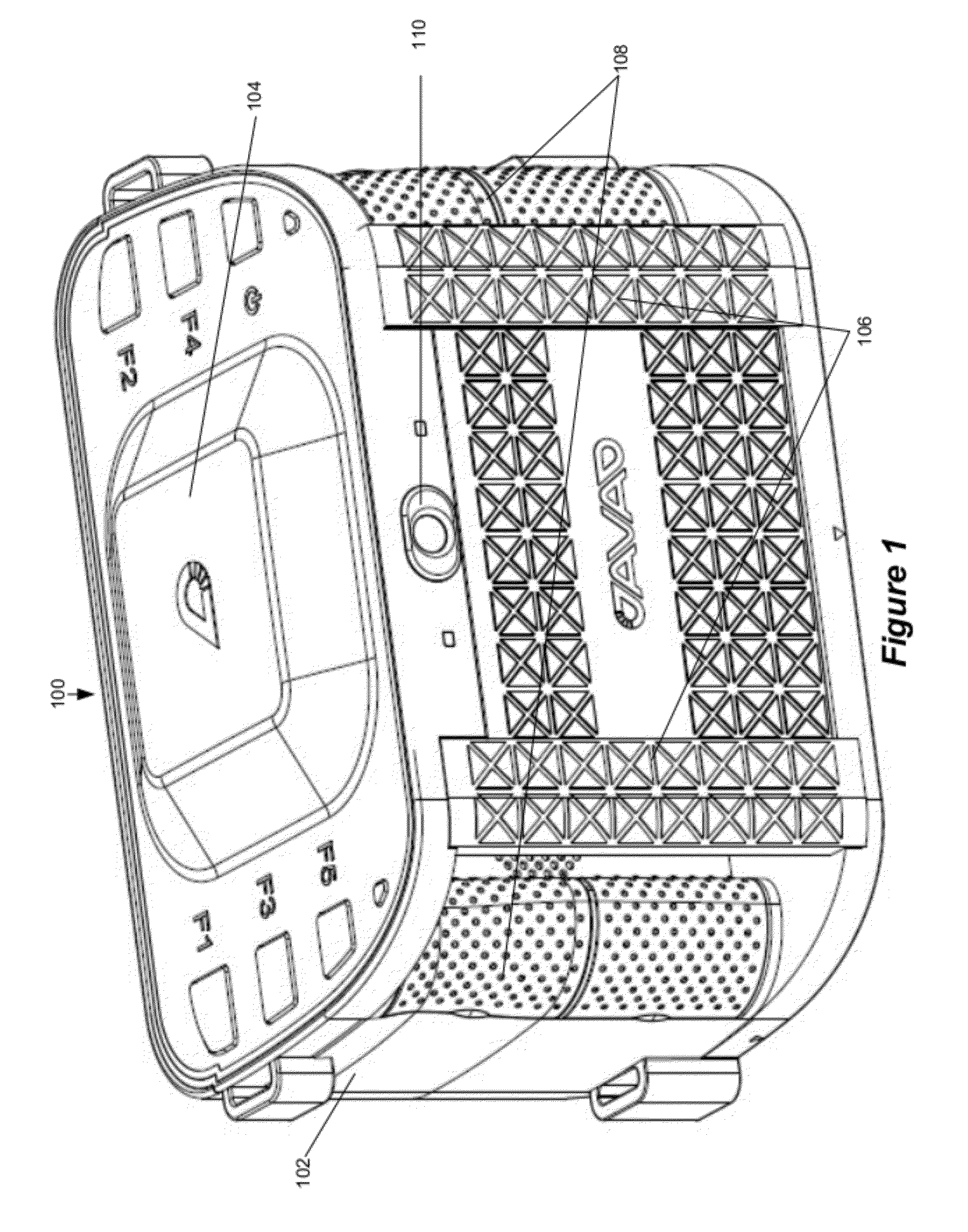
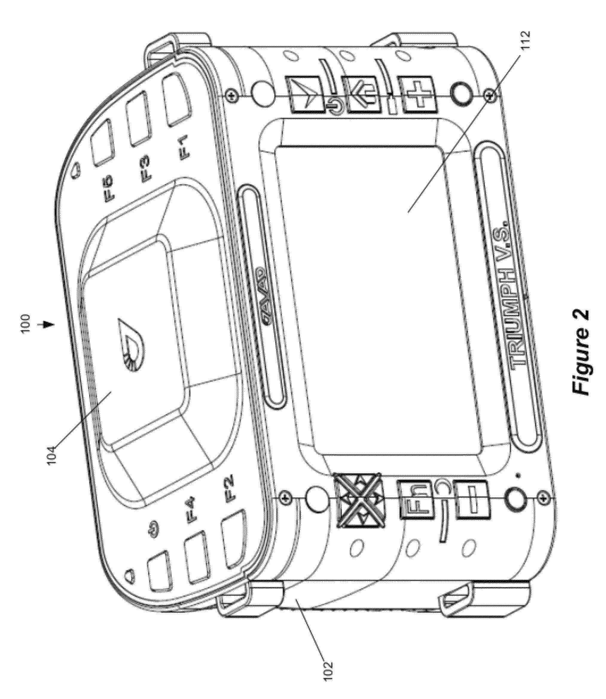
[0026]FIG. 1 illustrates an exemplary handheld GNSS device 100. Handheld GNSS device 100 utilizes a single housing 102. Several GNSS elements are integral to the housing 102 in that they are within the housing or securely mounted thereto. A securely mounted element may be removable. Housing 102 allows the user to hold ...


PUM


Abstract

A method for mitigating the effects of multipath errors in GNSS devices is provided. Signals from GNSS satellites are received. Image data from an image sensor is received. Orientation data from an orientation sensor is received. The orientation data describes the orientation of the image sensor. Obstruction data is determined based on the image data. The obstruction data includes an obstruction region that indicates the sky in that region is obstructed by a structure. Based on the orientation data, obstruction data, and GNSS satellite location data, the position of GNSS satellites with respect to the obstruction region is determined. The location of the GNSS device is determined based on signals from some of the GNSS satellites and the position of GNSS satellites with respect to the obstruction region.

Description

CROSS-REFERENCE TO RELATED APPLICATIONS[0001]This application claims the benefit of U.S. Provisional Application No. 61 / 417,209, filed Nov. 24, 2010, which is incorporated by reference herein.BACKGROUND[0002]1. Field[0003]The present invention relates to mitigating the effects of multipath error from indirect satellite signals in Global Navigation Satellite System (GNSS) devices.[0004]2. Related Art[0005]Navigation receivers that use global navigation satellite systems, such as GPS or GLONASS (hereinafter collectively referred to as “GNSS”), enable a highly accurate determination of the position of the receiver. The satellite signals may comprise carrier harmonic signals that are modulated by pseudo-random binary codes and which, on the receive side, may be used to measure the delay relative to a local reference clock. These delay measurements are used to determine the pseudo-ranges between the receiver and the satellites. The pseudo-ranges are not true geometric ranges because the ...

Claims


Application Information

Patent Timeline
Patent Type & Authority Patents(United States)
IPC IPC(8): G01S19/42G01S19/22
CPCG01S19/22G01S19/28G01S19/35G01S19/485
Inventor ASHJAEE, JAVADGRIBKOV, MIKHAIL
Owner JAVAD GNSS
Why Eureka
Try Eureka