Click on the blue label to locate the original text in one second.
Reading with bidirectional positioning of images and text.
Examples
Embodiment Construction
[0046] In order to clearly illustrate the method and device of the present invention, preferred embodiments of the present invention are given below in detail with reference to the accompanying drawings.
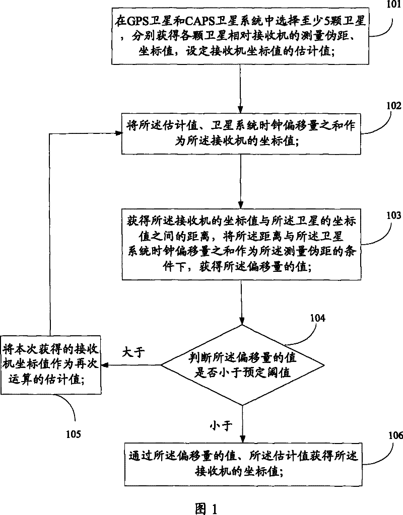
[0047] First provide embodiment one of the present invention, embodiment one is the method embodiment of the present invention, see figure 1 ,include:
[0048] Step 101: Select at least 5 satellites in the GPS satellite and CAPS satellite system, respectively obtain the measured pseudorange and coordinate value of each satellite relative to the receiver, and set the estimated value of the receiver coordinate value;
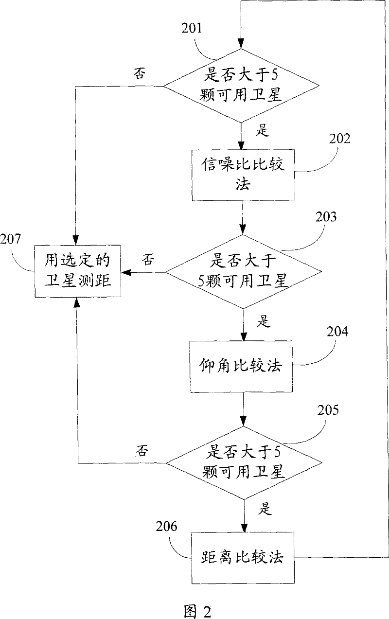
[0049] Positioning is performed through GPS satellites and satellites in the CAPS satellite system. Therefore, it is necessary to select at least 2 CAPS satellites and at least 3 GPS satellites; or select at least 3 CAPS satellites and at least 2 GPS satellites so that the total number is at least 5, and then the receiver can be positioned.
[0050] In order t...
PUM
Abstract
This invention discloses a method and a device for obtaining position of a receiver under a mixed satellite mode, in which, the method includes: A, selecting at least five satellites in GPS and CAPS satellites and obtaining measure false distance and coordinate values of the satellites and setting estimation value of the coordinate value of the receiver, B, taking sum of the estimation value and position offset as the coordinate of the receiver, C, obtaining a distance between coordinate values of the receiver and said satellite, D, judging if the offset of the position is less than a preset threshold value, if so, it gets the coordinate of the receiver by the offset and the estimation value, if so, it takes the coordinate value of the receiver got this time as an estimation value next time to execute step B, which can avoid limit of locating.
Description
technical field [0001] The present invention relates to the field of communication technology, in particular to a method and device for acquiring the position of a receiver in a hybrid satellite mode. Background technique [0002] Satellite navigation and positioning systems are widely used in national defense, vehicle and weapon navigation, geographic detection and many other aspects. [0003] There are many sets of satellite positioning systems being used internationally, and the independent satellite positioning system used by China - China Area Positioning System (CAPS) and GPS satellite positioning system. The GPS satellite constellation consists of a constellation of nominally 24 satellites and 8 spare satellites. GPS satellites are located in 6 geocentric orbit planes, with 4 satellites in each orbit; CAPS system has 3 in-orbit synchronous satellites. [0004] The CAPS system is a satellite-based navigation and positioning system based on geosynchronous orbit commun...
Claims