Building height measurement method based on single digital photo
A technology of building height and measurement method, applied in height/level measurement, measurement device, photo interpretation, etc., can solve the problems of long cycle, lack of three-dimensional urban model, and high cost
Inactive Publication Date: 2009-07-08
SOUTHEAST UNIV
View PDF0 Cites 12 Cited by
- Summary
- Abstract
- Description
- Claims
- Application Information
AI Technical Summary
Problems solved by technology
However, many buildings cannot provide complete parallel lines in three directions, and at the same time, only measurement cameras can be used, which makes this method have great limitations
[0005] There are many ways to acquire building height data, such as: 3D laser scanner acquisition, digital stereo photogrammetry acquisition, total station or hand-held range finder on-site acquisition, etc. These methods have the defects of low efficiency, high cost, and long cycle
At present, commercial digital city 3D modeling software is calculated based on the number of floors of buildings, and its defects are obvious. Since the height data is approximate, it does not achieve a real 3D model of the city
Method used
View moreImage
Smart ImageViewing Examples
Examples
Embodiment
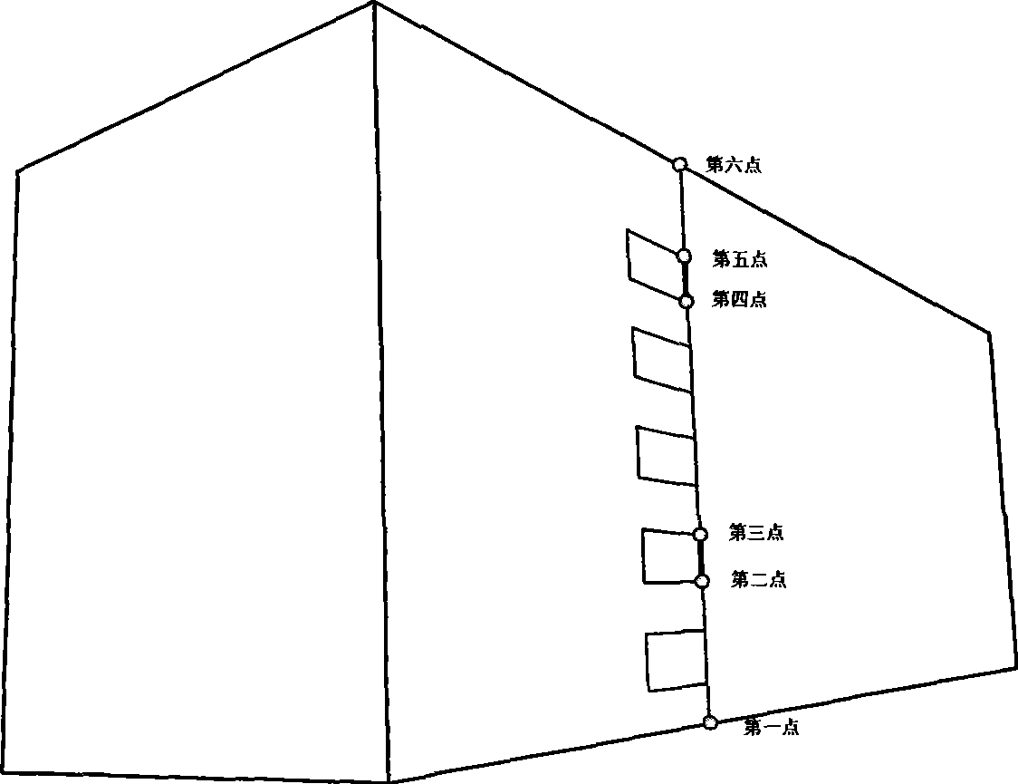
[0063] Example: such as figure 1 as shown,
[0064] (1) Known data: yes figure 1 On-site measurements of buildings in , and building window heights were measured. The measurement results are:
[0065] ΔX 21 =ΔX 34 =1.64(m)
[0066] (2) Image measurement data
Login to View More PUM
 Abstract
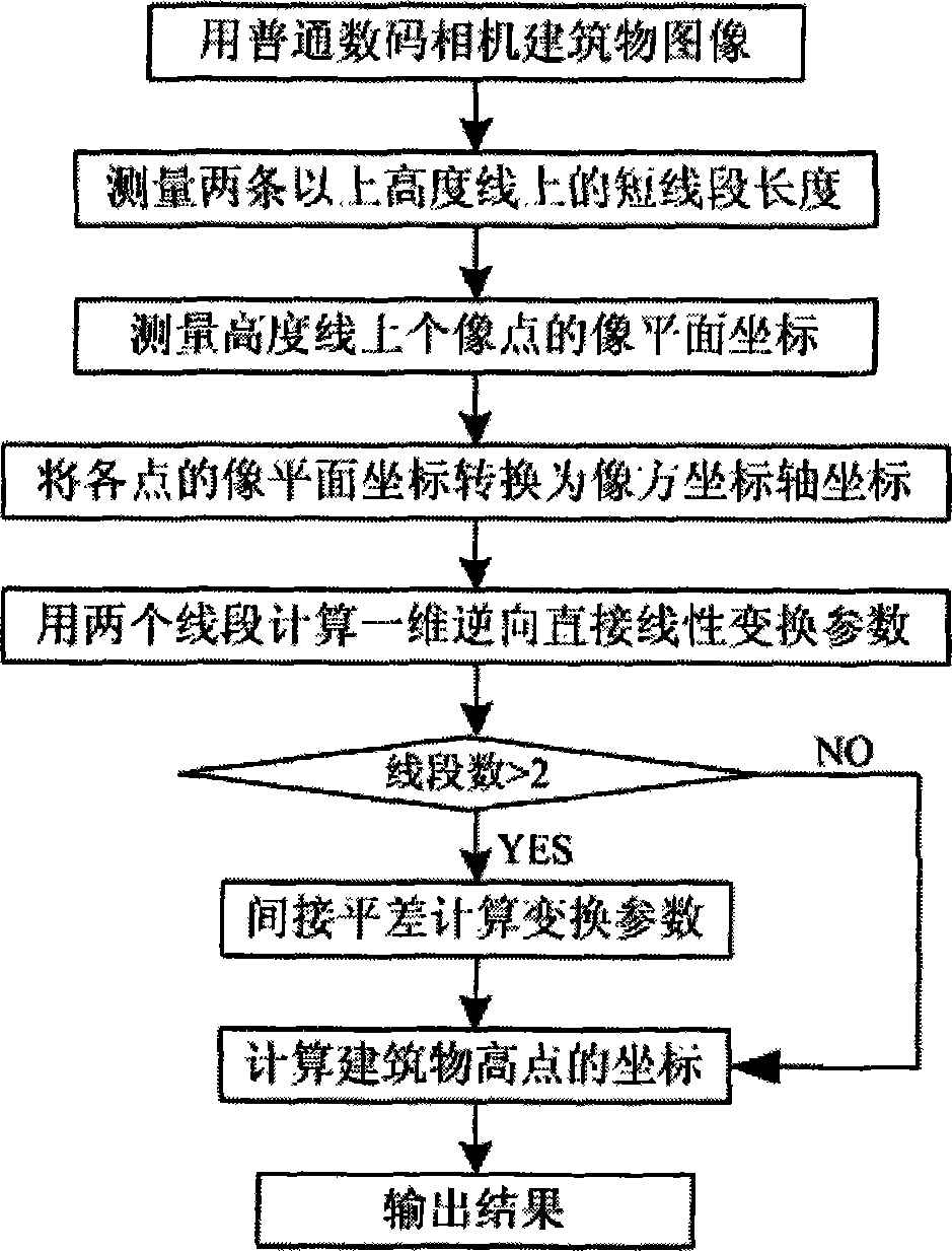
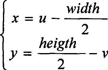
The invention relates to a method for measuring the height of a building on the basis of a single digital photo, and provides a principle and the method for measuring the height of the building by utilization of the single digital photo. The method is widely applied to digital urban construction, and belongs to the field of photogrametry and computer vision. The method is a method for measuring the height of the building by adopting an inverse direct linear transformation computing method on the basis of a direct linear transformation formula, and comprises the following steps: firstly, shooting the digital photo of the building; secondly, measuring image coordinates (u, v) of various points on a height line of the building on the digital photo; thirdly, transforming the image coordinates (u, v) of the various points into a right-handed system image plane coordinate system C1-xy taking the center of the digital photo as an origin; fourthly, using the height line of the building to establish an object space height coordinate axis, and taking an origin of the object space height coordinate axis as a low point of the building and the height direction as the forward direction of the coordinate axis; and fifthly, substituting a coordinate of an image space coordinate axis of a high point of the building into a one-dimensional inverse direct linear transformation formula, and calculating a coordinate of an object space coordinate axis of the high point of the building, wherein the coordinate value is the height of the building.
Description
technical field [0001] The invention proposes the principle and method of measuring building height by using a single digital photo, which is widely used in digital city construction and belongs to the fields of photogrammetry and computer vision. Background technique [0002] From the 1990s to the present, many scholars have done research on the three-dimensional measurement of buildings using a single digital photo, and have made considerable progress. But this technology has not been really practical in the establishment of digital cities (Liu Yawen, Zhang Zuxun, Zhang Jianqing, Wu Jun. A new way to use maps and single images for 3D reconstruction of buildings [J]. Journal of Wuhan University Information Science Edition, February 2005, 146-149). [0003] The primary content of urban 3D modeling technology lies in the collection of a large number of urban basic 3D data. The collected data includes the plane position, ground elevation, height and texture of ground objects....
Claims
Login to View More Application Information
Patent Timeline
 IPC IPC(8): G01C5/00G01C11/04
Inventor 沙月进胡伍生王慧青胡旋
Owner SOUTHEAST UNIV
Features
- R&D
- Intellectual Property
- Life Sciences
- Materials
- Tech Scout
- Unparalleled Data Quality
- Higher Quality Content
- 60% Fewer Hallucinations
Learn More Browse by: Latest US Patents, China's latest patents, Technical Efficacy Thesaurus, Application Domain, Technology Topic, Popular Technical Reports.
© 2025 PatSnap. All rights reserved.Legal|Privacy policy|Modern Slavery Act Transparency Statement|Sitemap|About US| Contact US: help@patsnap.com


