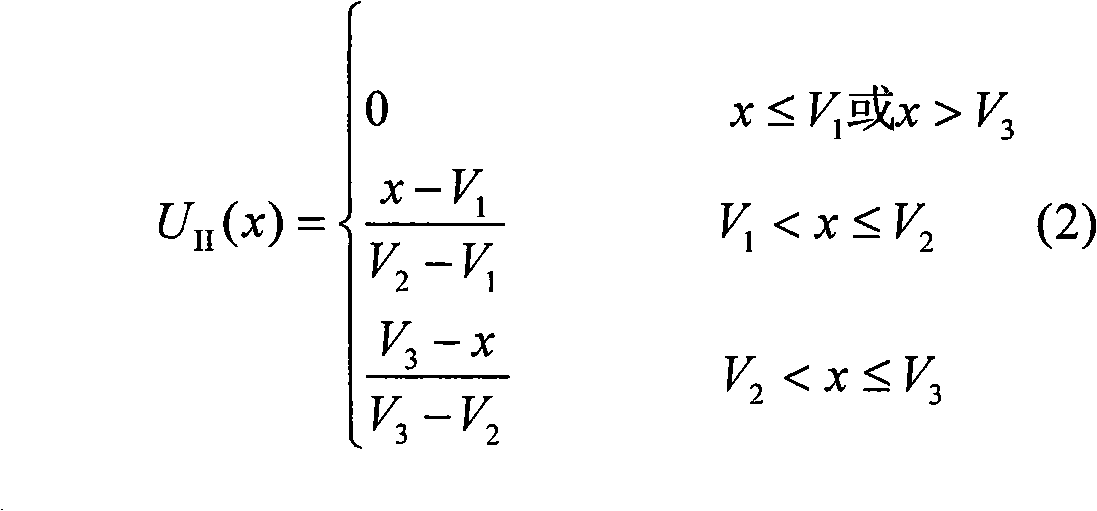
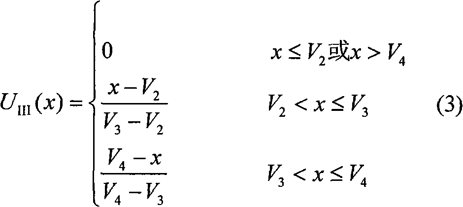
Mountainous area highway landslide risk evaluation model
A landslide risk, highway technology, applied in special data processing applications, instruments, electrical digital data processing, etc., can solve problems such as the project can not be realized in time, the indirect loss is large, etc.
- Summary
- Abstract
- Description
- Claims
- Application Information
AI Technical Summary
Problems solved by technology
Method used
Image
Examples
Embodiment Construction
[0041] The present invention is further illustrated below by way of examples.
[0042] Section k68+890~+990 of the 14th standard of a highway in Yunnan under construction is located in the transition zone between the Yunnan-Guizhou Plateau and Sichuan. Risk assessment is carried out according to the aforementioned theoretical framework.
[0043] 1. Risk fuzzy comprehensive evaluation
[0044] (1) Geological factors
[0045] There are no faults in the landslide body, and two sets of joints are developed in the oblique bedding. There is a relatively steep facing surface in the lower part of the landslide, and the slope of the front facing surface is above 60°. , the lithology is purple-red, purple-gray medium-thick layered mudstone, the mudstone is fully-severely weathered, the fully-weathered mudstone is clay-like, the strong-weathered mudstone is gravel-like, the gravel is massive, and the local fully-weathered mudstone is Bulk structure.
[0046] (2) Structural factors
...
PUM
 Abstract
Description
Claims
Application Information
 - R&D
- Intellectual Property
- Life Sciences
- Materials
- Tech Scout
- Unparalleled Data Quality
- Higher Quality Content
- 60% Fewer Hallucinations
Browse by: Latest US Patents, China's latest patents, Technical Efficacy Thesaurus, Application Domain, Technology Topic, Popular Technical Reports.
© 2025 PatSnap. All rights reserved.Legal|Privacy policy|Modern Slavery Act Transparency Statement|Sitemap|About US| Contact US: help@patsnap.com


