
Event location determination

A technology for event and signal determination, which is applied in the field of determining the location of events of interest, and can solve the problem of power consumption of the tracking system

Active Publication Date: 2011-11-30
U-BLOX
View PDF7 Cites 2 Cited by
  • Summary
  • Abstract
  • Description
  • Claims
  • Application Information

AI Technical Summary

Problems solved by technology

However, the tracking system consumes power continuously, even if the result is not actually used - the track must be maintained in case it is needed later

Method used

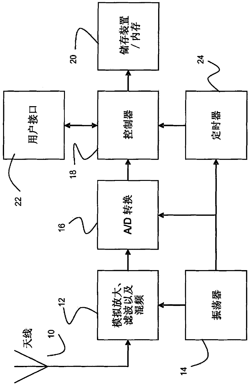
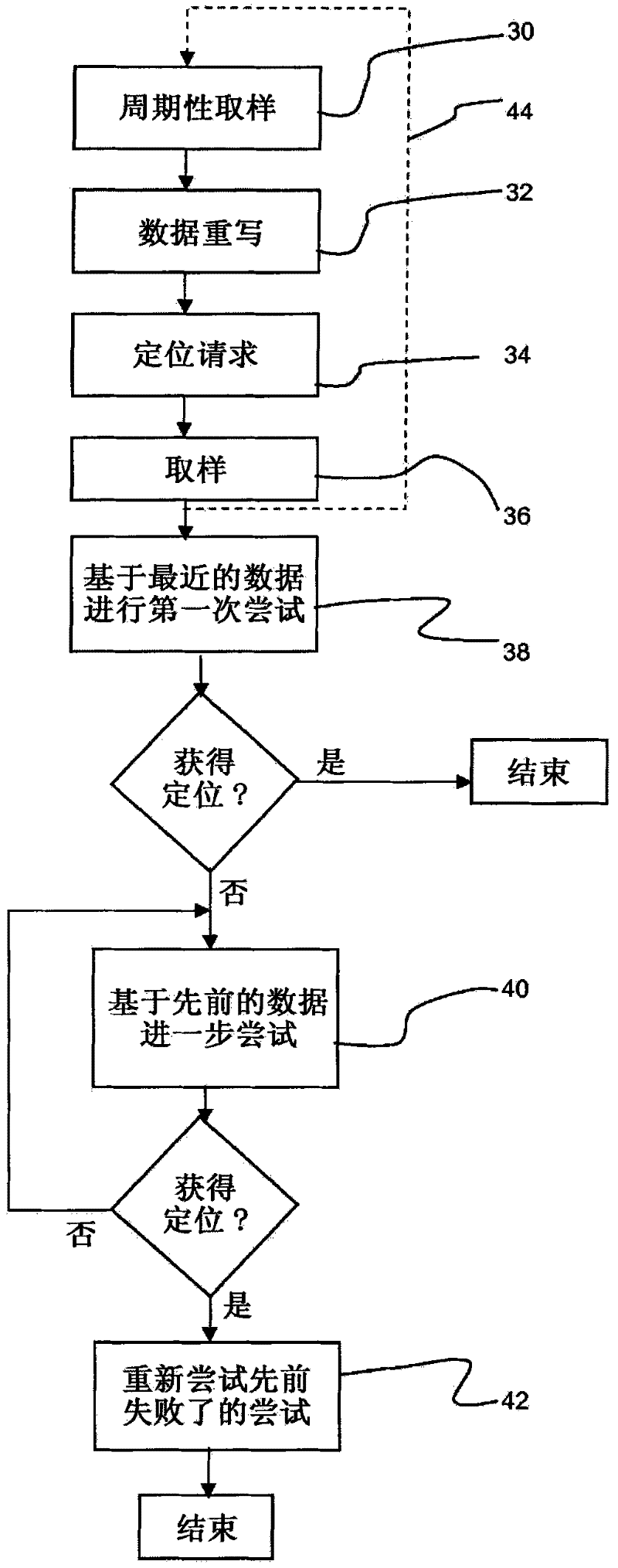
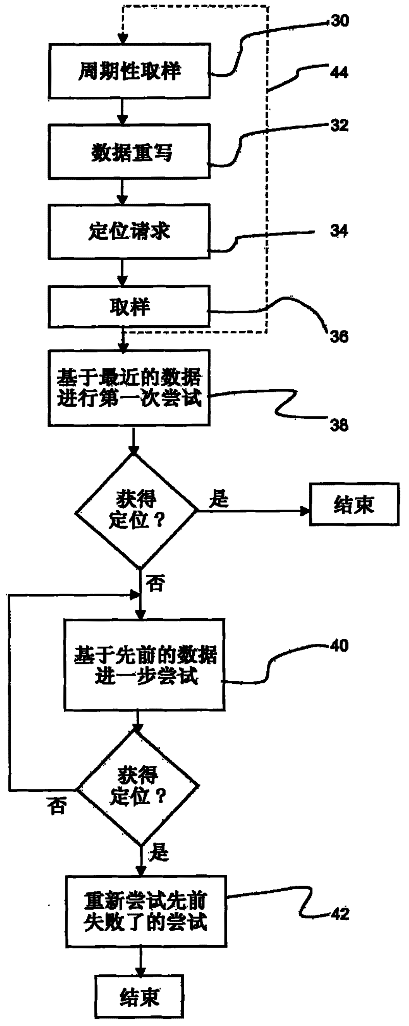

Image

  • Event location determination
  • Event location determination
  • Event location determination

Examples


Embodiment Construction

[0053] The present invention provides a method of processing the most recent chunk of data samples in an attempt to obtain a definite position of the fix. If this attempt is unsuccessful, blocks of data samples recorded at earlier times in the sequence are processed to try again to obtain a fix until a fix is ​​obtained. The used historical data chunks are irregularly spaced in time such that the used data samples are more densely distributed in relatively recent times than in relatively earlier times.

[0054] The invention can be used in a full-featured GPS receiver or in capture and later process applications. In each case, however, the device implements a form of capture-and-later-processing functionality in which data captures are stored for future use in obtaining a position fix.

[0055] In a typical capture-and-later-process application, a small capture device that stores short "captures" of IF data samples into memory can essentially upload its IF data captures to a ...


PUM


Abstract

A method of determining a location of an event of interest by processing signals from a satellite positioning system comprises periodically recording blocks of data samples of a satellite broadcast. In response to a request for a position determination at a particular time, a most recent block of data samples is processed in an attempt to obtain a position fix. If unsuccessful, the method furthercomprises processing blocks of data samples which were recorded further back in time in a sequence to make further attempts to obtain a position fix, until a position fix is obtained. The blocks of data samples used for the further attempts are irregularly spaced in time, for example more densely populated in relatively recent time than in relatively ancient time with respect to the particular time. This enables the processing resource in attempting to obtain a position fix to be allocated efficiently, thereby reducing power consumption.

Description

technical field [0001] The present invention relates to a method of determining the location of an event of interest in conjunction with a satellite positioning system such as GPS. Background technique [0002] The Global Positioning System is a satellite-based navigation system consisting of a network of up to 32 orbiting satellites (referred to as space vehicles ("SV")) in 6 different orbital planes. The system design requires 24 satellites, but more satellites would provide improved coverage. These satellites are constantly moving so that two full orbits circle the Earth in exactly 24 hours. [0003] The GPS signals transmitted by the satellites are in the form commonly referred to as Direct Sequence Spread Spectrum (DSSS), which uses a pseudo-random code that repeats continuously in a conventional manner. Satellite broadcasts several signals with different spreading codes, including Coarse / Acquisition or C / A codes, which are freely available to the public, and restrict...

Claims


Application Information

Patent Timeline
Patent Type & Authority Applications(China)
IPC IPC(8): G01S5/00
CPCG01S5/0036
Inventor 克里斯·马歇尔
Owner U-BLOX
Learn More