Map information storing and rapid displaying method

A technology of map information and display method, applied in the field of navigation, can solve the problems of difficulty in displaying all map information at the same time, limited information processing capability of navigator system information storage space, etc., and achieve the effect of improving the reading speed

Active Publication Date: 2013-06-19
GUANGZHOU HAIGE COMM GRP INC
View PDF8 Cites 0 Cited by
  • Summary
  • Abstract
  • Description
  • Claims
  • Application Information

AI Technical Summary

Problems solved by technology

However, the existing navigator system has limited information storage space and information processing capacity, so it is necessary to simplify the information processed by the navigator system on the basis of ensuring complete information.
Moreover, the existing display device is difficult to display all the information in the map at the same time due to size limitation, so it is necessary to selectively display the displayed map information

Method used


Image

  • Map information storing and rapid displaying method
  • Map information storing and rapid displaying method

Examples


Embodiment Construction

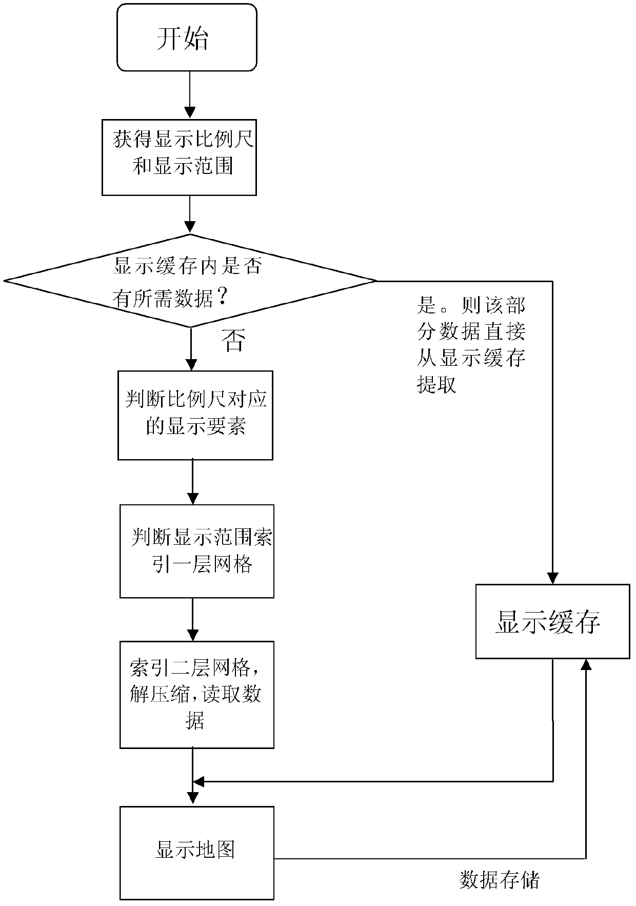
[0019] The invention is a method for storing and quickly displaying map information, wherein the storage method is the basis and preparation for the fast display method, and the two are closely related.

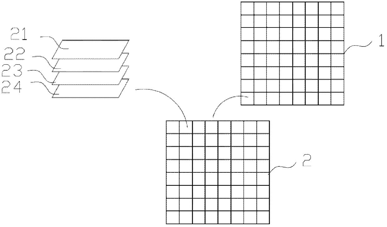
[0020] First, the display elements of the map are layered according to their importance. The most basic elements are the bottom layer, such as terrain, water system, etc.; the higher the layer, the more detailed the display elements are, such as POIs, roads, etc. Display elements at higher levels are associated with larger scales.

[0021] Then, divide the map into 8*8 or 25*25 (selected according to actual needs) square grids on average, called a layer of grids, and then divide each layer of grids into 8*8 or 25* 25 square grids are called second-level grids; the information index of each second-level grid is stored in the corresponding first-level grid.

[0022] The map information data belonging to the same second-level grid will be packaged together, compressed and store...


PUM


Abstract

The invention relates to a map information quick display method which comprises: storing layering and vacuate classification gauge according to the map information, determining a lamination where a display proportional scale is, reading and displaying corresponding map display elements; storing a bilayer net index information based on the map information according to a range to be displayed by the map, and reading corresponding map information from one layer of net index to the corresponding next layer net. When the information is quickly read according to the corresponding method, required map information is rapidly read according to a corresponding method; meanwhile, displaying cache is adopted, such that the map can be displayed with a high efficiency by the system. The method is especially suitable for a navigating system of a navigator.

Description

technical field [0001] The invention relates to the field of navigation, more specifically, a method for quickly displaying map information. Background technique [0002] With the development of information technology, navigators are widely used in people's driving life. Navigators provide users with intuitive and easy-to-read map information through geographic positioning, route planning and map display. [0003] The navigator system needs to display a variety of map elements, such as roads, POIs, water systems, green ground, building surfaces, etc., with a lot of information. However, the existing navigator system has limited information storage space and information processing capability, so it is necessary to simplify the information processed by the navigator system on the basis of ensuring the integrity of the information. Moreover, it is difficult for existing display devices to display all the information in the map at the same time due to size limitation, so it is ...

Claims


Application Information

Patent Timeline
Patent Type & Authority Patents(China)
IPC IPC(8): G01C21/32G01C21/36
Inventor 饶日锋
Owner GUANGZHOU HAIGE COMM GRP INC
Why Eureka
Try Eureka