Hyperspectral identification method for land parcel-based crop variety

A recognition method and hyperspectral technology, applied in character and pattern recognition, image data processing, instruments, etc., can solve problems such as difficulty in achieving crop variety-level classification, and achieve the effect of crop classification and precise crop variety recognition.

Inactive Publication Date: 2012-03-21
INST OF REMOTE SENSING & DIGITAL EARTH CHINESE ACADEMY OF SCI
View PDF4 Cites 22 Cited by
  • Summary
  • Abstract
  • Description
  • Claims
  • Application Information

AI Technical Summary

Problems solved by technology

[0011] The present invention provides a hyperspectral crop variety identification method based on plots, which is used to realize the identification of crop varieties using hyperspectral remote sensing data, and solve the problem that it is difficult to realize the classification of crop variety levels in common remote sensing classification problems

Method used


Image

  • Hyperspectral identification method for land parcel-based crop variety
  • Hyperspectral identification method for land parcel-based crop variety
  • Hyperspectral identification method for land parcel-based crop variety

Examples


Embodiment Construction

[0024] In order to better understand the technical solution of the present invention, the present invention will be described in detail below in conjunction with the accompanying drawings and specific embodiments.

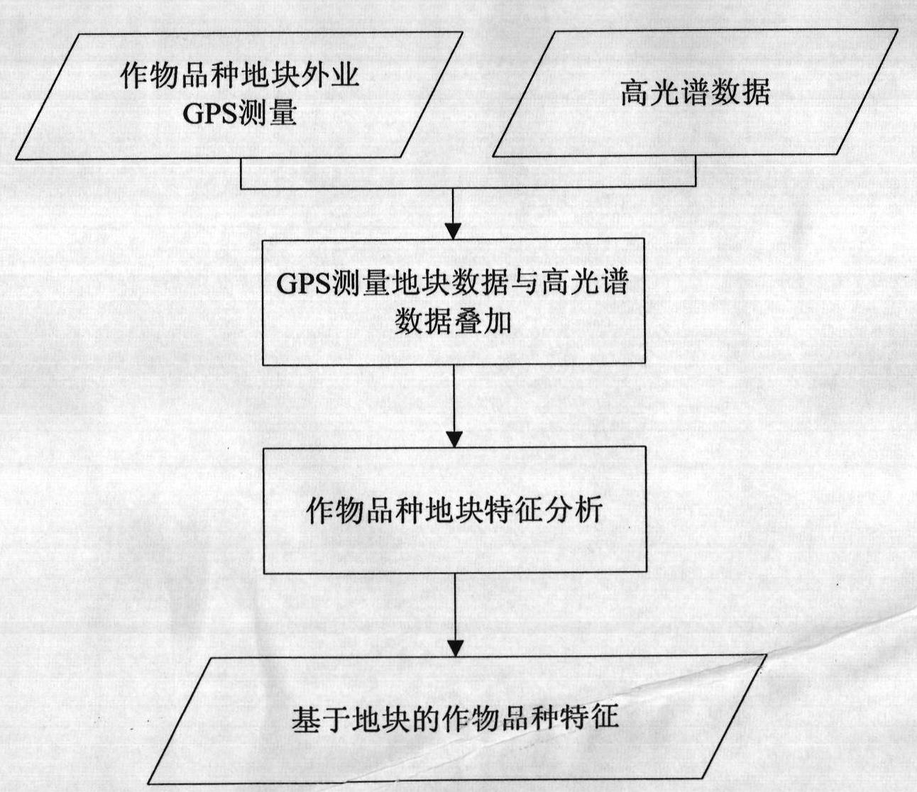
[0025] The present invention is a kind of hyperspectral identification method of crop varieties based on plots, and the method mainly includes the following steps:

[0026] 1. Hyperspectral data preprocessing;

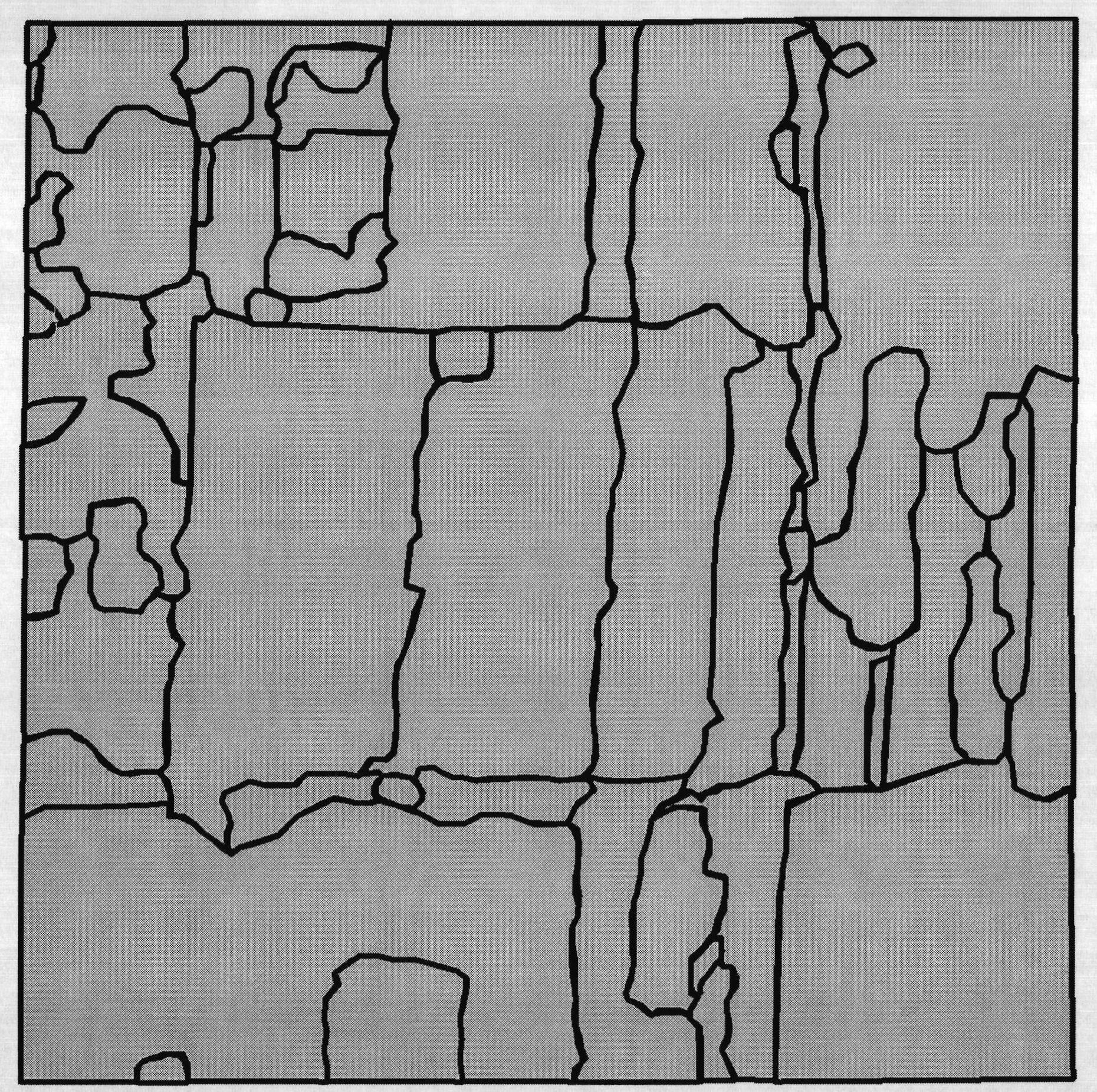
[0027] 2. Image segmentation to generate hyperspectral plot data;

[0028] 3. Field measurement and feature extraction of crop varieties;

[0029] 4. Classification of crop varieties based on plots;

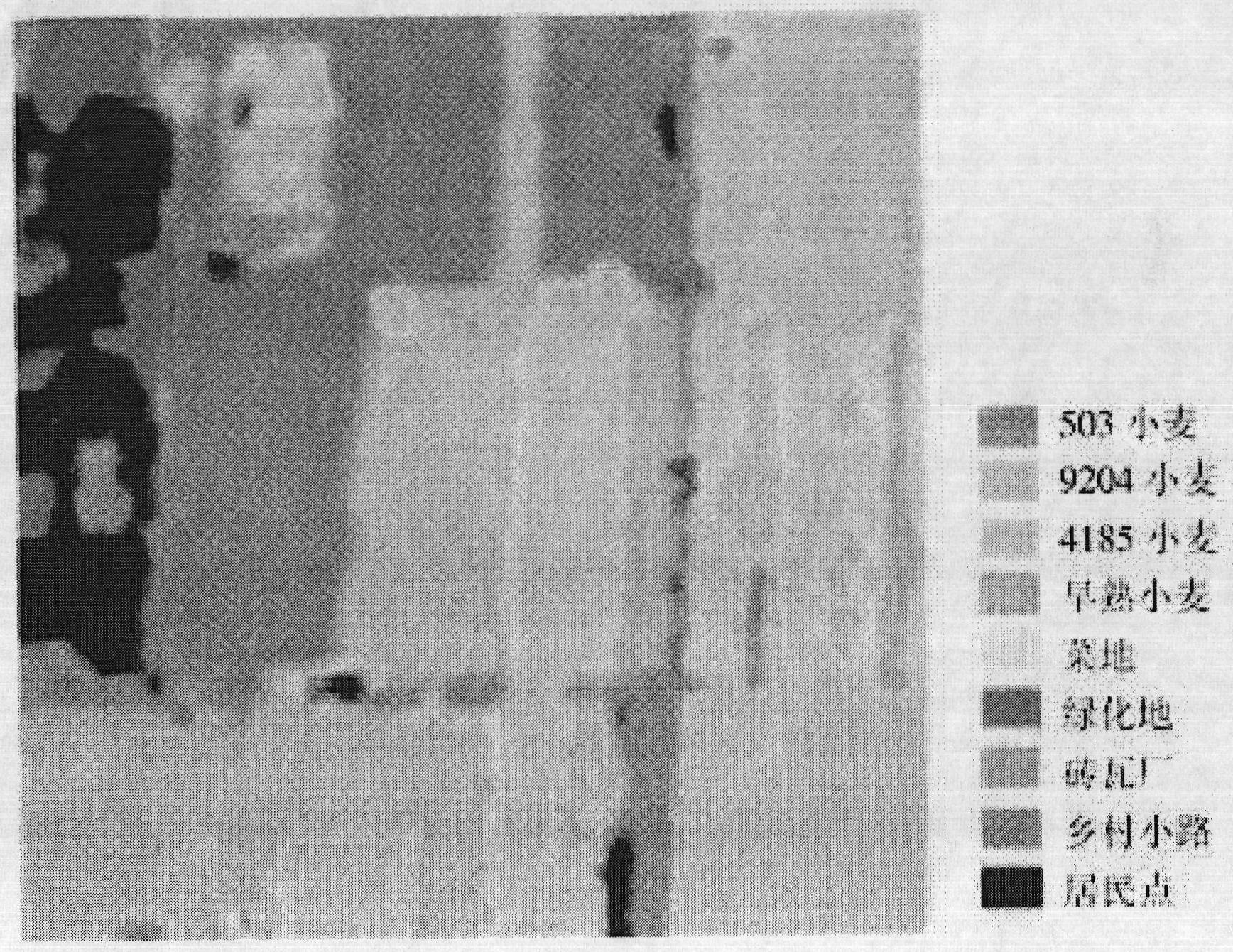
[0030] The concrete realization process of the present invention is as figure 1 As shown, the specific implementation details of each part are as follows:

[0031] 1. Hyperspectral data preprocessing

[0032] Since the hyperspectral data used is affected by images such as sensors and the atmosphere, some bands are not calibrated and are easily affected by...


PUM


Abstract

The invention relates to a hyperspectral identification method for a land parcel-based crop variety, which comprises the following steps: firstly, performing pretreatment on Hyperion data so as to remove unscaled bands which are easily influenced by water vapor in the Hyperion data; performing atmospheric correction on the data by utilizing a Flaash atmospheric correction module of ENVI; then, performing geometry correction on the Hyperion data by utilizing a topographic map or satellite data, such as corrected SPOT5, TM and the like to obtain a corrected Hyperion reflectivity image; performing outfield global positioning system (GPS) measurement on a crop variety land parcel to obtain the land parcel distribution map of the crop variety; overlying land parcel base onto the Hyperion reflectivity image to compute the characteristics of the crop variety, such as reflectivity mean value, variance and the like; by taking the reflectivity mean value, the variance and the like as the characteristics, performing image segmentation on the Hyperion reflectivity image to obtain the land parcel data based on the Hyperion reflectivity image; and according to the characteristics of the crop variety, such as the reflectivity mean value, the variance and the like, performing variety classification on the land parcel data to obtain a land parcel-based crop variety distribution map. In the hyperspectral identification method for the land parcel-based crop variety, the Hyperion hyperspectral data and outfield crop variety land parcel data are adopted to realize the drafting of the crop variety based on the image segmentation technology. The hyperspectral identification method for the land parcel-based crop variety can be used for monitoring nationwide crop varieties in the department of agriculture, and has wide market prospects and application value.

Description

technical field [0001] A field-based hyperspectral identification method for crop varieties belongs to the technical field of digital image processing, and in particular relates to digital image segmentation technology and digital image classification technology. Background technique [0002] The remote sensing identification of crop varieties uses hyperspectral remote sensing technology to realize the identification of crop varieties on the basis of crop classification. It provides basic information support for the fine management of crops and is one of the information sources for many scientific research institutions to conduct agricultural research. Its research is of great significance. [0003] Hyperspectral crop variety identification is one of the frontier research contents in the field of agricultural remote sensing and an important content of fine agricultural remote sensing. At present, hyperspectral crop variety identification mainly adopts traditional remote sen...

Claims


Application Information

Patent Timeline
Patent Type & Authority Applications(China)
IPC IPC(8): G06K9/00G06T5/00
Inventor 邬明权王力
Owner INST OF REMOTE SENSING & DIGITAL EARTH CHINESE ACADEMY OF SCI
Why Eureka
Try Eureka