Measuring data simulation method for autonomous navigation system based on sun-earth-moon azimuth information

An autonomous navigation system and azimuth information technology, which is applied in the field of numerical simulation based on the measurement information of the sun-earth-moon integrated sensor, and the field of autonomous navigation simulation test, which can solve the problems of inability to achieve high-precision simulation of moon shape changes, inability to simulate and so on.

Active Publication Date: 2015-02-11
BEIJING INST OF CONTROL ENG
View PDF4 Cites 0 Cited by
  • Summary
  • Abstract
  • Description
  • Claims
  • Application Information

AI Technical Summary

Problems solved by technology

However, the current semi-physical simulation test verification system is still unable to simulate the impact of the flattening of the earth on the measurement of the integrated sun-earth-moon sensor; it is also unable to achieve high-precision simulation of the moon's shape change. Therefore, it is necessary to study the measurement principle of the navigation system , simulate the pulse of the sensor, and simulate and verify the navigation method, and establish an autonomous navigation simulation verification system based on measurement information

Method used


Image

  • Measuring data simulation method for autonomous navigation system based on sun-earth-moon azimuth information
  • Measuring data simulation method for autonomous navigation system based on sun-earth-moon azimuth information
  • Measuring data simulation method for autonomous navigation system based on sun-earth-moon azimuth information

Examples


Embodiment Construction

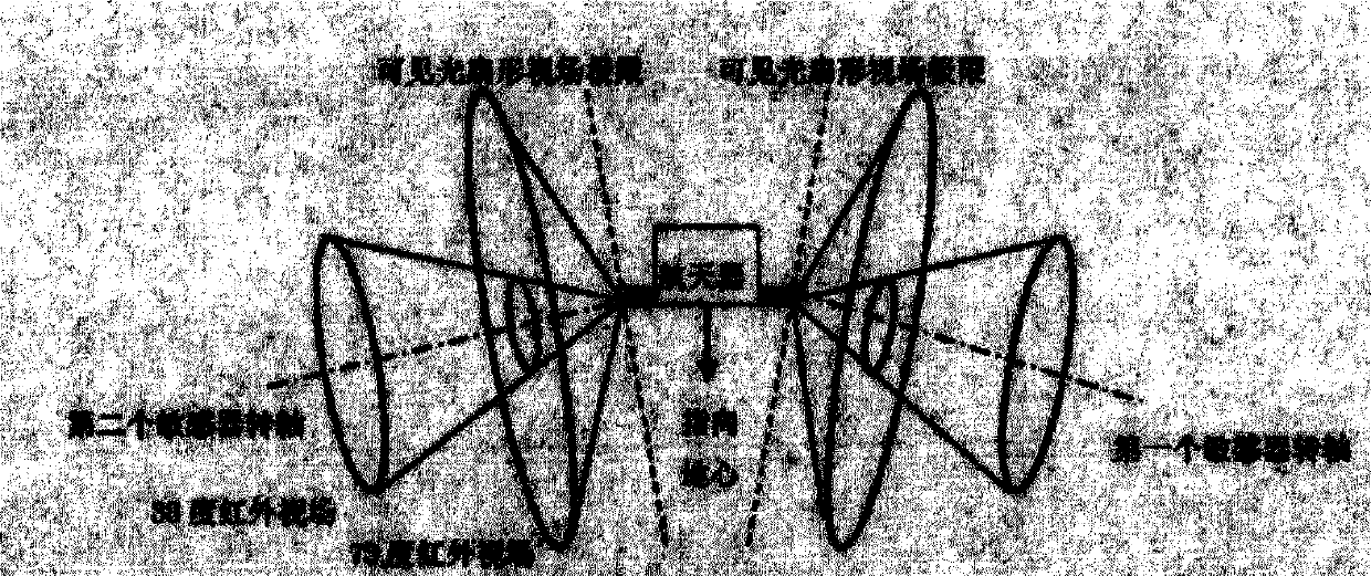
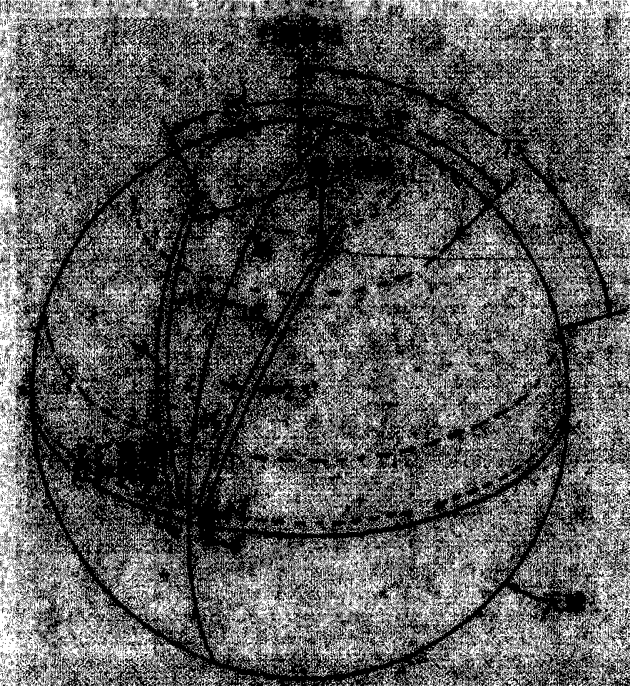
[0070] First, analyze the measurement geometric relationship of the integrated sensor of the sun, the earth and the moon, and analyze the number of pulses obtained by scanning the sensor in one circle; the analysis results of the measurement geometry can be used to directly obtain the simulation method of the reference pulse; according to the integrated sensor Measure the geometric relationship, use the earth's ellipsoid equation to establish a simulation of the earth's pulse, and give the pulse time when the sensor sweeps into and out of the earth; then establish a moon phase model, and use the sensor to measure The geometric relationship determines that the slit field of view of the sensor sweeps to the moon pulse; finally, according to the direction of the sun, the sensor measures the geometric relationship to determine that the slit field of view of the sensor sweeps to the sun pulse.

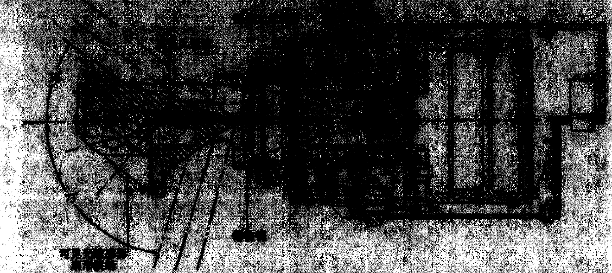
[0071] 1. Sensor measurement geometry analysis

[0072] The navigation sensor consists ...


PUM


Abstract

A measuring data simulation method for an autonomous navigation system based on sun-earth-moon azimuth information respectively comprises simulation for reference pulse, earth pulse, moon pulse and sun pulse. The simulation and measurement data accurately and comprehensively reflects the influence on sun-earth-moon integrated sensor measurement caused by various complex factors, including the influence on the compression of the earth and the shape change of the earth. According to the measuring data simulation method disclosed by the invention, the simulation of pulse information of the sun-earth-moon integrated sensor and the quantitative assessment for system errors of the sensor and the verification for the performances of the navigation system can be effectively carried out in a number value artificial form.

Description

technical field [0001] The invention relates to an autonomous navigation simulation test method, in particular to a numerical simulation method based on measurement information of an integrated sun-earth-moon sensor, belonging to the technical field of autonomous navigation. Background technique [0002] Autonomous navigation technology means that the satellite can determine the position and velocity of the satellite in real time only by on-orbit measurement equipment without relying on the support of the ground system, also known as autonomous orbit determination. For satellite systems, autonomous navigation is beneficial to reduce the dependence of satellites on the ground and improve the survivability of the system. For example, in wartime, when the ground measurement and control station is destroyed and interfered by the enemy, the orbit can still be determined and maintained. This is of great significance for military satellites. In addition, autonomous navigation can ...

Claims


Application Information

Patent Timeline
Patent Type & Authority Patents(China)
IPC IPC(8): G01C25/00
Inventor 黄翔宇王大轶李茂登魏春岭何英姿李果
Owner BEIJING INST OF CONTROL ENG
Why Eureka
Try Eureka