Web service integration method of geographic information

A geographic information service and web service technology, which is applied in the field of conversion and aggregation of geographic information data services, can solve the problems of inconvenient sharing and interoperability of geographic information resources, users cannot use them at the same time, and geographic information resources cannot be directly called each other.

Active Publication Date: 2013-01-30
NAT GEOMATICS CENT OF CHINA
View PDF2 Cites 17 Cited by
  • Summary
  • Abstract
  • Description
  • Claims
  • Application Information

AI Technical Summary

Problems solved by technology

Therefore, it makes it impossible for users to use services in different geographic information service platforms on the same browser at the same time.
The geographical information resources of these different platforms cannot direc

Method used


Image

  • Web service integration method of geographic information
  • Web service integration method of geographic information
  • Web service integration method of geographic information

Examples


Embodiment Construction

[0019] In order to have a clearer understanding of the technical features, purposes and effects of the present invention, the implementation steps and principles of a geographic information web service integration method according to the present invention will be described in detail below.

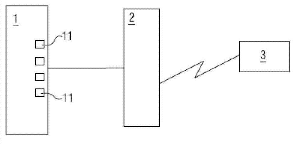
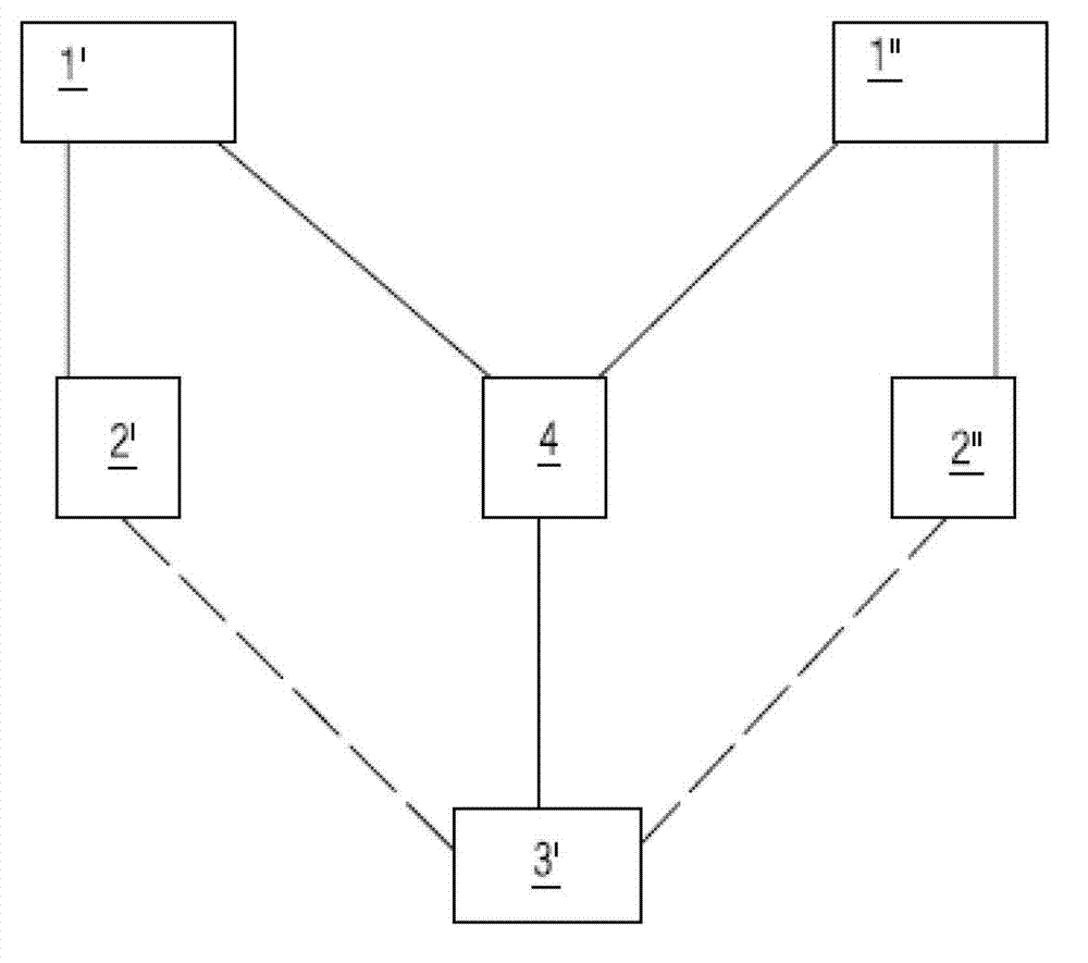
[0020] A geographic information web service integration method according to a specific embodiment of the present invention, the method is used to integrate data services of different geographic information service platforms in a network environment, and the network environment includes at least two geographic information service platforms, At least one client browser and at least one integrated web publishing server; the geographic information service platform includes at least one server-side server for storing original data, and a web publishing server connected to the server-side server; the web The integrated publishing server is respectively connected with the server end server of the ...


PUM


Abstract

The invention relates to a web service integration method of geographic information, wherein the method is used for integrating the data services of different geographic information service platforms in a network environment; a web integration publishing server is directly connected with server end servers of different geographic information service platforms; the background services of different geographic information service platforms are switched; the calling interface of the web integration publishing server is used for calling the data of geographic information data service according to the platform type information of different platform products and link information; simultaneously, geographic information service data switched into a unified format is provided for a user through web service according to data service standard predefined by a client browser of the user; and the user can call the data services of different geographic information service platforms just through the same browser. The invention provides a web service integration method of geographic information, and the sharing and interoperability of geographic information service resources are greatly strengthened.

Description

technical field [0001] The invention relates to a geographic information data service processing method, in particular to a method for converting and aggregating geographic information data services of different geographic information service service platforms. Background technique [0002] Geographical data refers to the general term of data forms such as numbers, texts, images and graphics that represent the quantity, quality, distribution characteristics, connections and laws of the inherent elements or substances of a geographical circle or geographical environment. Geographical information refers to the representation and all useful knowledge of the nature, characteristics and movement state of geographical entities. It is the interpretation of geographical data. Geographical information services refer to the services provided by geographic information systems to users. Users can obtain and use geographic data and computing services on demand, such as map services, spat...

Claims


Application Information

Patent Timeline
IPC IPC(8): G06F17/30H04L29/08
Inventor 陈军武昊廖安平
Owner NAT GEOMATICS CENT OF CHINA
Why Eureka
Try Eureka