Route planning method for traveling saleman based on remote sensing electronic map
An electronic map and route planning technology, applied in the field of navigation
- Summary
- Abstract
- Description
- Claims
- Application Information
AI Technical Summary
Problems solved by technology
Method used
Image

Examples
Embodiment Construction
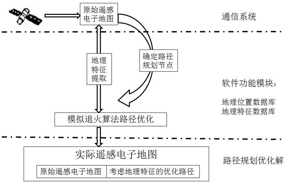
[0031] Such as figure 1 As shown, the solution of the traveling salesman route planning problem in the remote sensing electronic map needs to consider two aspects, the first is to seek a heuristic algorithm applied to solve the problem, and the simulated annealing algorithm is used in the present invention; the second is to seek a characteristic The method of extraction and image processing abstracts the key geographical features related to the actual effect and rationality of the path planning algorithm in the remote sensing electronic map into a mathematical model, stores them in the geographical feature database, and then applies them to improve the heuristic algorithm based on the above , is that the result of the algorithm conforms to the actual geographical situation.
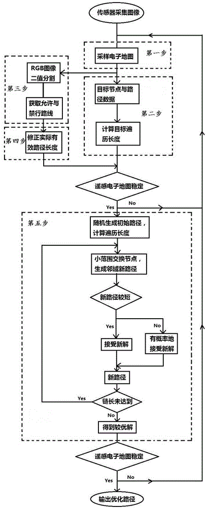
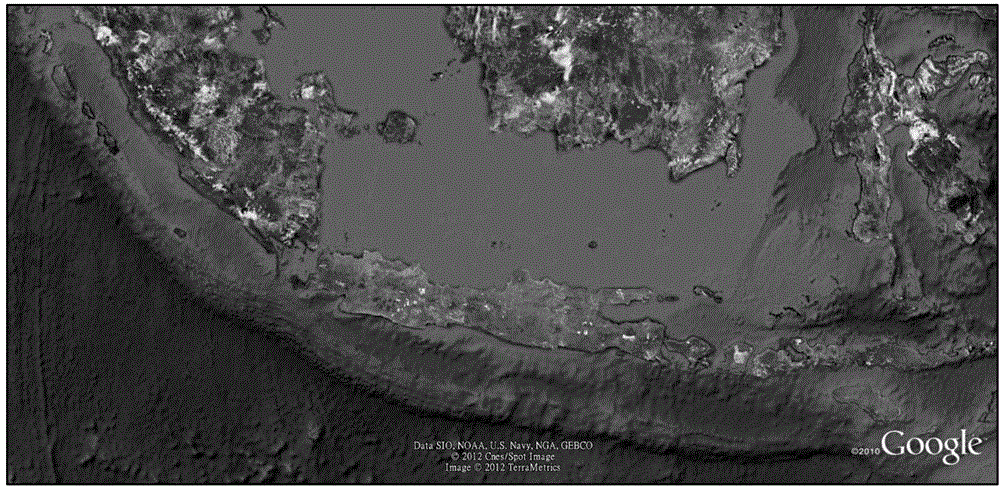
[0032] Such as figure 2 is a schematic flow chart of the method, Figure 3-Figure 6 The figure shows an example of a traveling salesman’s route planning problem based on a remote sensing electronic map...
PUM
 Abstract
Description
Claims
Application Information
 - R&D Engineer
- R&D Manager
- IP Professional
- Industry Leading Data Capabilities
- Powerful AI technology
- Patent DNA Extraction
Browse by: Latest US Patents, China's latest patents, Technical Efficacy Thesaurus, Application Domain, Technology Topic.
© 2024 PatSnap. All rights reserved.Legal|Privacy policy|Modern Slavery Act Transparency Statement|Sitemap