
Navigational constellation slow varying inter-satellite link planning method based on earth station layout constraints

A technology for inter-satellite links and link planning, which is applied in the field of satellite-to-satellite link management and can solve problems such as unseen link planning methods

Inactive Publication Date: 2015-08-12
CHINA XIAN SATELLITE CONTROL CENT
View PDF2 Cites 52 Cited by
  • Summary
  • Abstract
  • Description
  • Claims
  • Application Information

AI Technical Summary

Problems solved by technology

Searching public literature shows that there is no link planning method for spacecraft measurement and control and navigation constellation inter-satellite link management

Method used


Image

  • Navigational constellation slow varying inter-satellite link planning method based on earth station layout constraints
  • Navigational constellation slow varying inter-satellite link planning method based on earth station layout constraints
  • Navigational constellation slow varying inter-satellite link planning method based on earth station layout constraints

Examples


Embodiment Construction

[0062] The present invention will be further described below in conjunction with the accompanying drawings and embodiments, and the present invention includes but not limited to the following embodiments.

[0063] The present invention adopts following technical scheme:

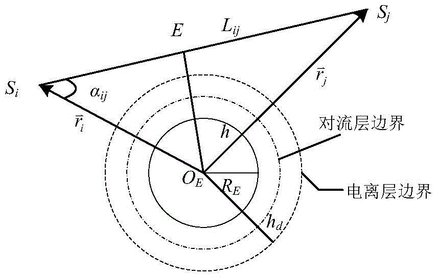
[0064] ① Construct the visible model of the satellite-ground link: According to the configuration and orbit elements of the mid-orbit constellation, the geometric layout and site coordinates of the ground measurement and control station, the J2000 earth inertial coordinate system is used to construct the visible model of the satellite-ground link.

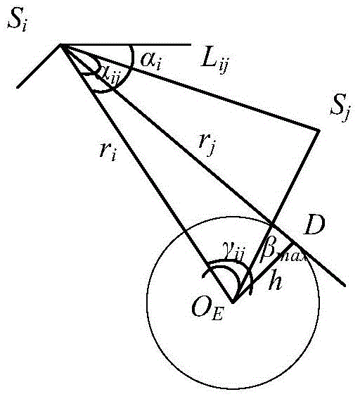
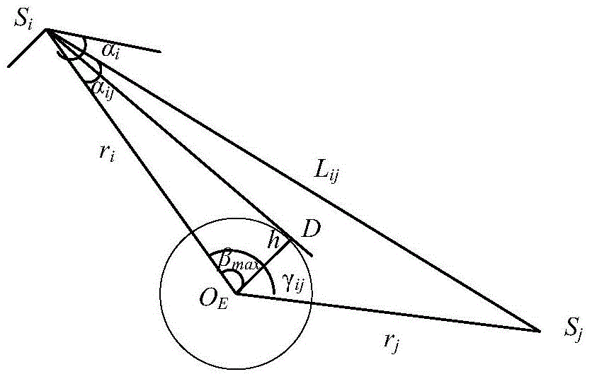
[0065] ② Construct the visible model of the inter-satellite link: it includes three parts in total. First, construct the geometric visible model of the inter-satellite link according to the configuration of the mid-orbit constellation, the number of orbit elements, and the installation position of the inter-satellite antenna; second, According to the beam range of...


PUM


Abstract

The invention provides a navigational constellation slow varying inter-satellite link planning method based on earth station layout constraints. First of all, a satellite-earth link visible model and an inter-satellite visible model are constructed, then inter-satellite / satellite-earth visible time slot preprocessing is carried out, after the topology structure of a constellation is established, a router optimized constraint model and an optimization object function are determined, and a router table of a navigational constellation slow varying inter-satellite link is obtained through solving the model. According to the invention, the problem of managing a global navigational constellation through the slow varying inter-satellite link under the condition of a scarcity of ground measurement and control resources is solved, the model better meets engineering needs, the application value is quite good, and a new router can be rapidly established at a minimum cost in case that nodes are changed.

Description

technical field [0001] The invention relates to the field of satellite-earth-inter-satellite link management of navigation constellations, in particular to a navigation constellation route optimization and maintenance method with slowly changing inter-satellite links. Background technique [0002] Satellite constellation (referred to as "constellation") refers to a satellite system that is composed of multiple satellites, the satellite orbit forms a stable spatial geometric configuration, and the satellites maintain a fixed space-time relationship, and is used to complete specific space missions. The function of the navigation constellation is to make full use of the space constraints formed by the constellation itself, and use appropriate measurement methods to realize the navigation and positioning of ground and space users. The navigation constellation is usually composed of medium earth orbit satellites operating at a height of about 20000km. [0003] With the expansion...

Claims


Application Information

Patent Timeline
IPC IPC(8): G06Q10/06
Inventor 李晶耶刚强张天骄董卫华崔卫华张江赵国强安静斌余培军
Owner CHINA XIAN SATELLITE CONTROL CENT
Learn More