A 3D Spatial Indexing Method Based on Multi-level Hybrid
A three-dimensional, multi-level technology, applied in special data processing applications, instruments, electrical and digital data processing, etc., can solve the problems of different sizes, difficult to meet the efficient indexing of 3D model data, and different target shapes, and achieve fast filtering and The effect of indexing
- Summary
- Abstract
- Description
- Claims
- Application Information
AI Technical Summary
Problems solved by technology
Method used
Image
Examples
Embodiment Construction
[0024] The present invention will be further described in detail below in conjunction with the accompanying drawings and specific embodiments.
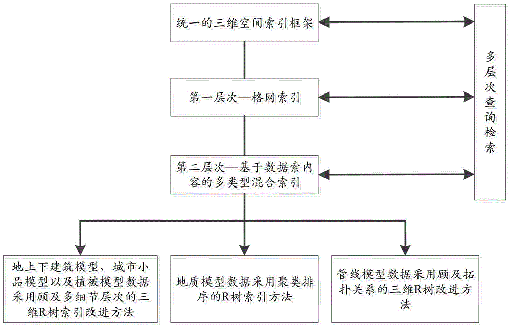
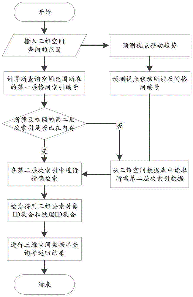
[0025] like figure 1 As shown, it is a flowchart of an embodiment of the multi-level mixed three-dimensional space indexing method of the present invention. The multi-level mixed three-dimensional space indexing method of the present invention includes the following steps,
[0026] Step 1, establishing a unified three-dimensional spatial index framework;
[0027] Step 2, divide the large-scale urban space into several small areas, and establish the first-level grid index;
[0028] Step 3, in the first-level grid area, establish a second-level multi-type mixed index for different types of three-dimensional spatial data;
[0029] In step 3, the three-dimensional element data includes discretely distributed above-ground and underground building models, urban sketch models, and vegetation model data, and the above-ground and underground...
PUM
 Abstract
Description
Claims
Application Information
 - R&D
- Intellectual Property
- Life Sciences
- Materials
- Tech Scout
- Unparalleled Data Quality
- Higher Quality Content
- 60% Fewer Hallucinations
Browse by: Latest US Patents, China's latest patents, Technical Efficacy Thesaurus, Application Domain, Technology Topic, Popular Technical Reports.
© 2025 PatSnap. All rights reserved.Legal|Privacy policy|Modern Slavery Act Transparency Statement|Sitemap|About US| Contact US: help@patsnap.com


