Regional spatial quality analysis method
A technology of space quality and analysis method, applied in the direction of analysis materials, measuring devices, special data processing applications, etc., can solve the problems of low interpolation accuracy and unreliable concentration interpolation results, etc., and achieve the effect of high interpolation accuracy
- Summary
- Abstract
- Description
- Claims
- Application Information
AI Technical Summary
Problems solved by technology
Method used
Image
Examples
Embodiment Construction
[0051] The present invention will be described in further detail below in conjunction with the accompanying drawings and specific embodiments.
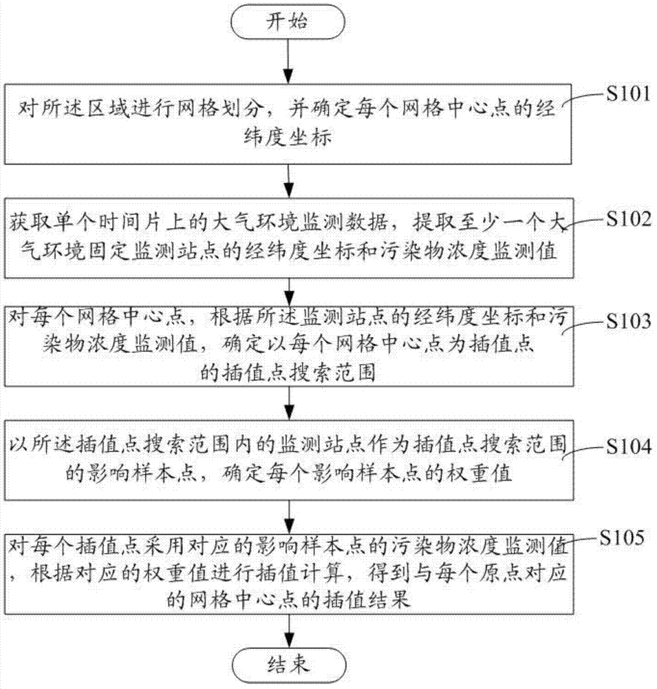
[0052] Such as figure 1 Described is a working flow chart of a method for analyzing regional space quality of the present invention, including:
[0053] Step S101, performing grid division on the area, and determining the latitude and longitude coordinates of each grid center point;
[0054] Step S102, obtaining atmospheric environment monitoring data on a single time slice, and extracting the latitude and longitude coordinates and pollutant concentration monitoring values of at least one fixed atmospheric environment monitoring station;
[0055] Step S103, for each grid center point, determine the spatial distribution characteristics according to the latitude and longitude coordinates of the monitoring site and the pollutant concentration monitoring value, and determine the influence point with each grid center point as the interp...
PUM
 Abstract
Description
Claims
Application Information
 - R&D
- Intellectual Property
- Life Sciences
- Materials
- Tech Scout
- Unparalleled Data Quality
- Higher Quality Content
- 60% Fewer Hallucinations
Browse by: Latest US Patents, China's latest patents, Technical Efficacy Thesaurus, Application Domain, Technology Topic, Popular Technical Reports.
© 2025 PatSnap. All rights reserved.Legal|Privacy policy|Modern Slavery Act Transparency Statement|Sitemap|About US| Contact US: help@patsnap.com


