
Method and system for obtaining navigation message from public electronic map

An electronic map and navigation information technology, applied in the field of communication, can solve problems such as easy to forget navigation routes, complicated walking routes, and difficult to reach destinations, and achieve the effect of autonomous and efficient navigation

Inactive Publication Date: 2013-10-09
LEADING INFORMATION TECH
View PDF10 Cites 14 Cited by
  • Summary
  • Abstract
  • Description
  • Claims
  • Application Information

AI Technical Summary

Problems solved by technology

[0004] However, large public places have large activity areas and relatively complicated walking routes. Even if the place provides an electronic map, users generally can only obtain information by memorizing routes. It is easy to forget the navigation route, making it difficult to reach the destination conveniently and quickly, and the electronic map also loses the effect of navigation

Method used


Image

  • Method and system for obtaining navigation message from public electronic map
  • Method and system for obtaining navigation message from public electronic map
  • Method and system for obtaining navigation message from public electronic map

Examples


no. 1 example

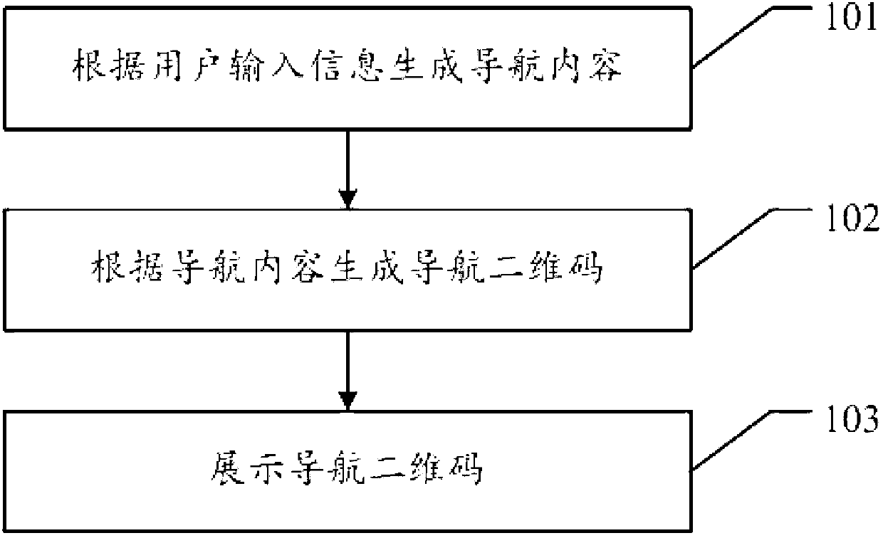
[0055] see figure 1 , the first embodiment of the method for obtaining navigation information from a public electronic map in the embodiment of the present invention includes:

[0056] 101. Generate navigation content according to user input information;

[0057] Before obtaining navigation information from the public electronic map, it is first necessary to generate navigation content according to user input information. The aforementioned generation of navigation content based on user input information may be: a navigation center, which may be an electronic map installed in a public place, generates corresponding navigation content after receiving the user's click or input of a destination.

[0058] 102. Generate a navigation QR code according to the navigation content;

[0059] After the navigation content is generated according to the user input information, a navigation QR code can be generated according to the navigation content. The above-mentioned generation of the...


PUM


Abstract

The embodiment of the invention discloses a method and a system for obtaining a navigation message from a public electronic map, so that a user can rapidly achieve at the destination through navigation content obtained on a handheld device after departing from the public electronic map. The method disclosed by the embodiment of the invention comprises the following steps of: generating navigation content according to input information of the user; generating a navigation two-dimension code according to the navigation content; and displaying the navigation two-dimension code. The user can use the handheld device with two-dimension code scanning and decoding functions to scan the finally displayed navigation two-dimension code and decode the navigation two-dimension code, so as to obtain the navigation content, so that independent and efficient navigation of the user in a public place can be achieved; and the user can rapidly achieve at the destination through the navigation content obtained on the handheld device after departing from the public electronic map.

Description

technical field [0001] The embodiments of the present invention relate to the communication field, and in particular to a method and system for obtaining navigation information from a public electronic map. Background technique [0002] General large-scale public places, such as shopping malls, hospitals, shopping plazas, etc., have a relatively large activity area and relatively complicated walking routes, so these places are generally equipped with guidance maps to guide users to their destinations. [0003] Existing guide maps can be roughly divided into traditional physical maps and electronic maps, wherein physical maps include stone maps and paper maps, etc., while electronic maps Figure 1 Generally, it exists independently or is set in other shopping navigation systems. At present, the development of electronic maps is particularly rapid, and has replaced traditional physical maps in many places. The existing electronic map can not only show the regional distribution...

Claims


Application Information

Patent Timeline
Patent Type & Authority Applications(China)
IPC IPC(8): G01C21/00
Inventor 李俊奇
Owner LEADING INFORMATION TECH
Learn More