Navigation equipment, method for displaying journey introduction and path thereof and navigation method thereof

A technology of itinerary and path, applied in the field of navigation, can solve problems such as time-consuming and labor-intensive

Inactive Publication Date: 2010-07-14
SHENZHEN CARELAND TECH
View PDF0 Cites 14 Cited by
  • Summary
  • Abstract
  • Description
  • Claims
  • Application Information

AI Technical Summary

Problems solved by technology

For users who do not drive by themselves, if they need to get to a certain place, they can only rely on paper map information, road sign information or manual consultation, and these methods are time-consuming and laborious

Method used


Image

  • Navigation equipment, method for displaying journey introduction and path thereof and navigation method thereof
  • Navigation equipment, method for displaying journey introduction and path thereof and navigation method thereof
  • Navigation equipment, method for displaying journey introduction and path thereof and navigation method thereof

Examples


Embodiment Construction

[0053] In order to make the purpose, technical solution and advantages of the present invention more clear, the present invention will be further described in detail below in conjunction with the accompanying drawings and embodiments. It should be understood that the specific embodiments described here are only used to explain the present invention, not to limit the present invention.

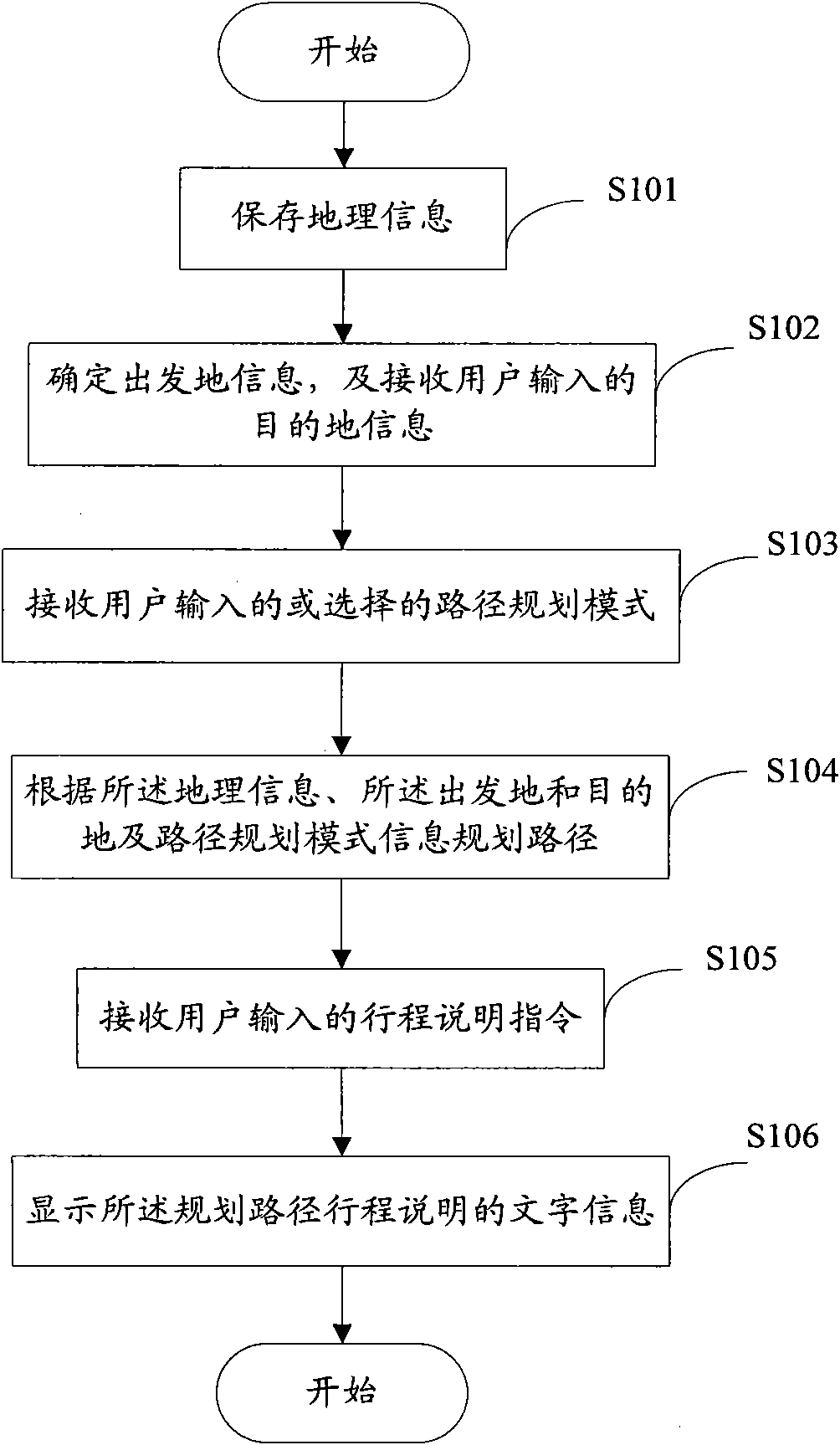
[0054] Such as figure 1 As shown, in the flow chart of Embodiment 1 of the method for displaying itinerary description of the present invention, the method includes the following steps:

[0055] Step S101. Store geographic information, the geographic information includes: map data, bus information, subway information or walking information, wherein the walking information includes: pedestrian bridge information, zebra crossing information, tunnel information. Map data includes road network information and point of interest information; bus information includes bus platform name information, bu...


PUM


Abstract

The invention relates to navigation equipment, a method for displaying journey introduction and path thereof and a navigation method thereof. The method for displaying the journey introduction comprises: storing geographic information which comprises map data, public transportation information, subway information or walking information; determining departure point information and receiving destination information input by a user; according to the geographic information and the departure point information and the destination information, planning a path which comprises at least one of road section: public transportation road section, subway road section and walking road section; receiving a journey introduction order input by the user; and displaying the written information of journey introduction of the planned path. The technical scheme of the invention can navigate for no-driving users, thus ensuring that the no-driving users can quickly reach the destination.

Description

technical field [0001] The present invention relates to navigation technology, more specifically, to a navigation device and a method for displaying itinerary description, route and navigation method. Background technique [0002] The working principle of the navigation technology GPS (Global Positioning System) is: the navigation terminal receives the position coordinates transmitted by at least 3 satellites among the 24 GPS satellites around the earth, and compares them with the position coordinates recorded in the electronic map stored in the terminal itself. The location coordinates are matched to determine the exact location of the navigation object equipped with the terminal in the electronic map. After the user sets the starting point and destination, the navigator will calculate the best route, and navigate for the user based on the calculated best route. [0003] At present, the navigation system is mostly used in vehicles, that is, the navigation system is loaded ...

Claims


Application Information

Patent Timeline
Patent Type & Authority Applications(China)
IPC IPC(8): G01C21/26G01C21/34G01S19/39
Inventor 张文星
Owner SHENZHEN CARELAND TECH
Why Eureka
Try Eureka