Geofence generating method

A geo-fencing and range technology, applied in the field of mobile Internet, can solve problems such as automatic mining of internal associations, achieve reasonable and accurate division, and overcome the effect of simple division

Active Publication Date: 2014-01-22
XIAMEN YAXON NETWORKS CO LTD
View PDF7 Cites 46 Cited by
  • Summary
  • Abstract
  • Description
  • Claims
  • Application Information

AI Technical Summary

Problems solved by technology

These simple geographic boundary generation methods have great limitations, which rely on individual geographic center points and human subjective judgments and operations. When faced with a huge amount of geographic information or mobile terminal user location

Method used


Image

  • Geofence generating method
  • Geofence generating method
  • Geofence generating method

Examples


Embodiment Construction

[0058] The present invention will be further described in conjunction with the accompanying drawings and specific embodiments.

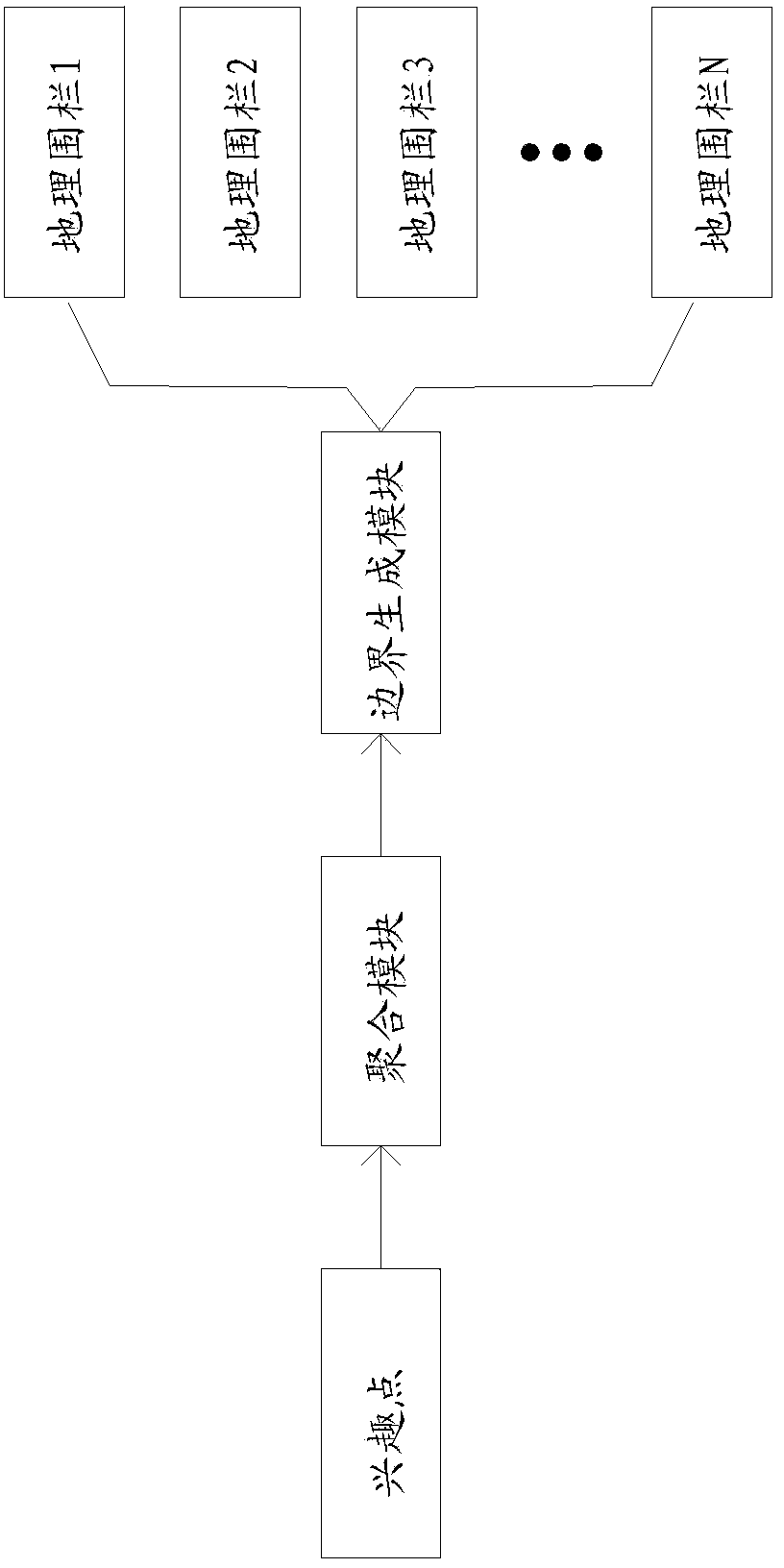
[0059] As a specific embodiment, the geo-fence generation method described in the present invention, refer to figure 1 , including the aggregation module and the boundary generation module. The functions and functions of each module are as follows:

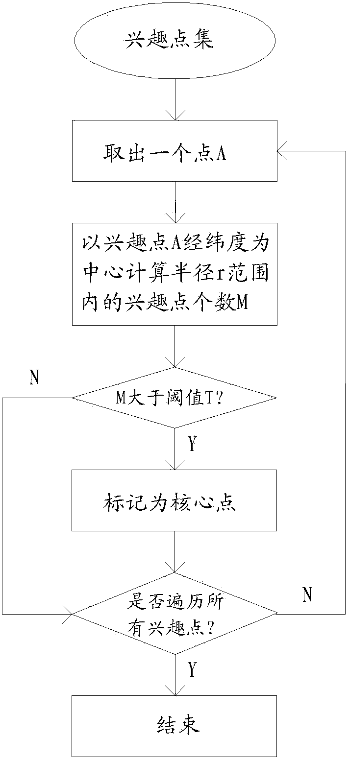
[0060] Aggregation module: It is characterized by the longitude and latitude information of interest points, and calculates the density of points within a certain range around the interest point one by one, and points with a density greater than a certain threshold are marked as core points; calculate the connectivity between each core point, and combine all The connected core points and other non-core points in the local area are classified into a point set for processing by the boundary generation module.

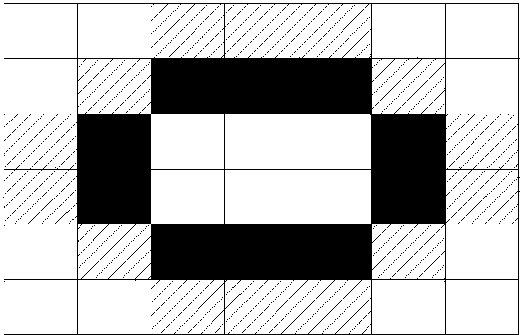
[0061] Boundary generation module: rasterize and expand the point set, perform serial search o...


PUM


Abstract

The invention relates to a geofence generating method which comprises the following steps of: a step a of calculating densities of points in a certain range around one by one by using longitude and latitude information of an interest point as the characteristic and using the interest point as the center and marking points of which the densities are greater than a certain threshold value into core points; a step b of calculating connectivity among the core points, processing each core point and integrating all the communicated core points and other non-core points in a local region into one point set; and a step c of carrying out rasterization and expansion processing on the point set, carrying out serializable searching on an expansion boundary point and automatically generating a smooth closed geographic boundary for the point set, wherein the geographic boundary comprises all the points in the point set and accords with the overall shape characteristic of the point set. According to the invention, relevance of geographic information can be automatically mined; the irregular geofence boundary which has obvious significance and accords with subjective geographic cognition of people is generated; and the aim of automatically and intelligently generating the geofence is fulfilled.

Description

technical field [0001] The invention relates to mobile Internet technology, in particular to a method for generating a geographic fence. Background technique [0002] Generating geo-fences means constructing virtual geographic boundaries, which is a key technology in mobile Internet services. When a mobile terminal with positioning function enters, leaves or stays in a specific geographical area, it can automatically receive and push relevant messages and reminders in the fence, forming a dynamic information push and sharing service based on geographic fences. Geofencing is widely used in many fields, such as advertising (refer to invention patent 201110315680.2), automated data collection (refer to invention patent 201180004573.6), mobile device power control (refer to invention patent 201210388895.1), remote monitoring and other fields have important value . [0003] However, the generation of geofences in existing applications is basically based on the geographic center...

Claims


Application Information

Patent Timeline
IPC IPC(8): H04W4/02H04W16/18G06F17/50
Inventor 涂岩恺季刚时宜黄家乾曹辉标
Owner XIAMEN YAXON NETWORKS CO LTD
Why Eureka
Try Eureka