Method and system for obtaining information by clicking map on touch display screen
A touch screen, map technology, applied in the input/output process of data processing, special data processing applications, instruments, etc., can solve the problems of complicated filling in banking application forms
- Summary
- Abstract
- Description
- Claims
- Application Information
AI Technical Summary
Problems solved by technology
Method used
Image
Examples
Embodiment l
[0026] Embodiment 1 A method and system for obtaining information by clicking a map on a touch screen The method and system.
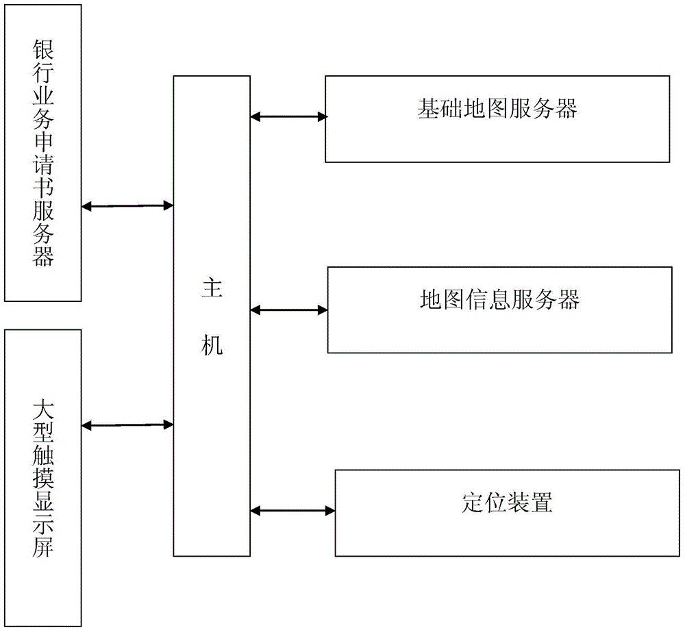
[0027] As shown in Figure 1, the embodiment of the present invention is a method and system for obtaining information by clicking on a map on a touch screen, including: a host, a banking application server, a basic map server, a map information server, a large touch screen, a positioning device.
[0028] The host obtains the location of the host through the positioning device, and displays a map centered on the location of the host with a scale of N kilometers. When the customer clicks on the nearest target location on the map, a map centered on the location of the target location is displayed with a scale of 20 meters. The customer Then click on the building on the map, then the level and address of the building will be displayed on the screen. After the customer clicks on the address, one or more information of the name, address, contact person, and ...
Embodiment 2
[0040] Embodiment 2 A method and system for obtaining information by clicking a map on a touch screen The method and system.
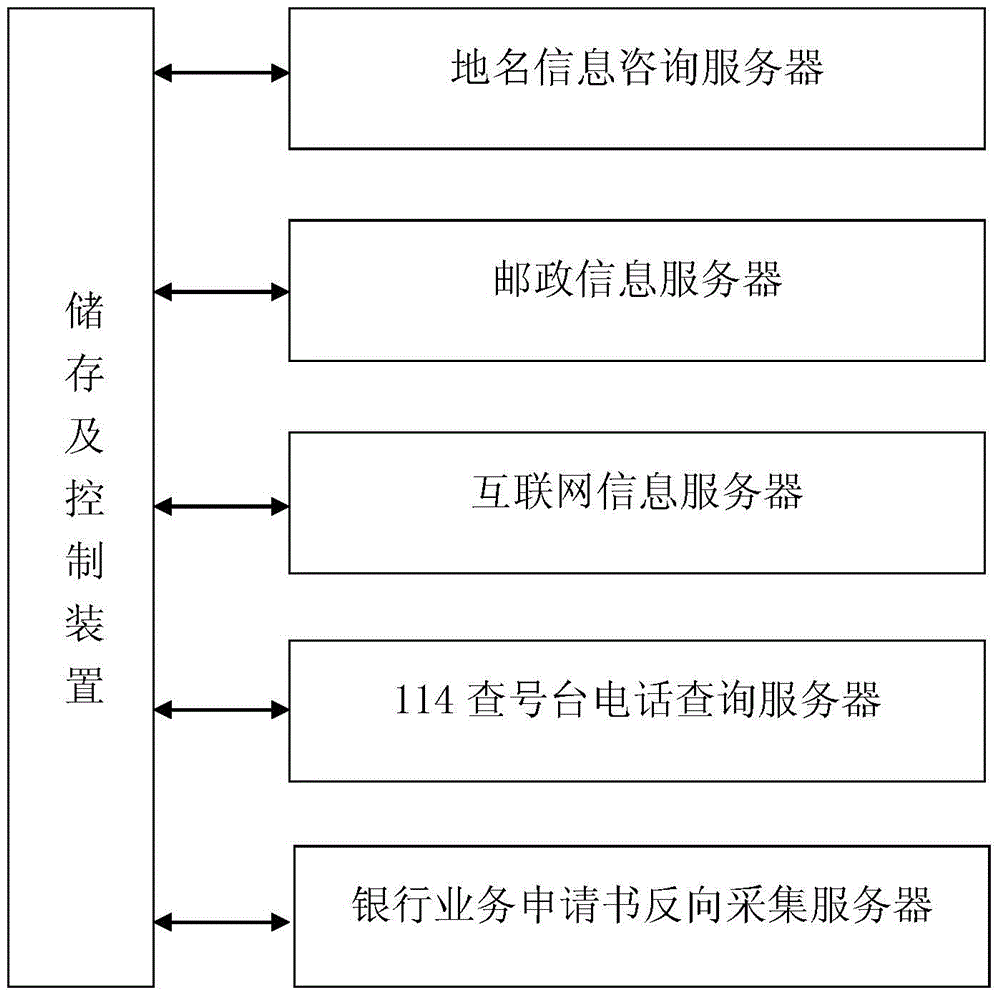
[0041] Such as figure 2 As shown, the implementation flow chart of the map information server in the embodiment of the present invention.
[0042] 1. The map information server first performs preprocessing, and is composed of a geographical name information consulting server, a postal information server, an Internet information server, a 114 directory telephone inquiry server, a reverse collection server for banking business applications, and a storage and control device. Each server starts the query one after another; it is used to fill in and store the geographical elements that are not on the map provided by the map supplier, especially the data of each building on the map.
[0043] 2. Do preprocessing again every month to mark new geographic information.
[0044] 3. When the customer clicks four times and cannot find the house number information...
PUM
 Abstract
Description
Claims
Application Information
 - R&D
- Intellectual Property
- Life Sciences
- Materials
- Tech Scout
- Unparalleled Data Quality
- Higher Quality Content
- 60% Fewer Hallucinations
Browse by: Latest US Patents, China's latest patents, Technical Efficacy Thesaurus, Application Domain, Technology Topic, Popular Technical Reports.
© 2025 PatSnap. All rights reserved.Legal|Privacy policy|Modern Slavery Act Transparency Statement|Sitemap|About US| Contact US: help@patsnap.com


