
Method for calculating hybrid line of navigated vehicle and walk

A route and walking navigation technology, applied in the field of car navigation, can solve the problems of unsatisfactory economy, time and convenience, and achieve the effect of optimizing parking

Inactive Publication Date: 2015-01-07
SHENYANG MXNAVI CO LTD
View PDF13 Cites 2 Cited by
  • Summary
  • Abstract
  • Description
  • Claims
  • Application Information

AI Technical Summary

Problems solved by technology

[0003] Although the original route calculation of car navigation and bus navigation can provide people with several optimal routes calculated based on raw data, due to the different actual environments, the original solution is slightly unsatisfactory in terms of economy, time and convenience.

Method used


Image

  • Method for calculating hybrid line of navigated vehicle and walk
  • Method for calculating hybrid line of navigated vehicle and walk

Examples


Embodiment 1

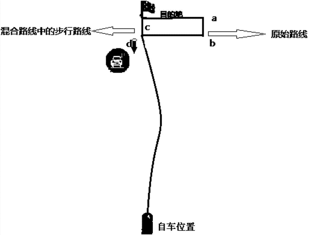
[0017] This embodiment provides a method for calculating a vehicle-walking mixed route for navigation, which is characterized in that: in the method for calculating a vehicle-walking mixed route for navigation, the mixed route is calculated by realizing the mutual cooperation between driving and walking. Road, collect overpasses, underground passages or sidewalks to build a database, according to the destination location and related data;

[0018] To collect and establish a mixed route database, first collect available roads including important parking lots, overpasses, and underground passages, check and process the information, and generate data for application;

[0019] Based on the generated data, determine whether to switch to walking navigation, and finally make a mixed route.

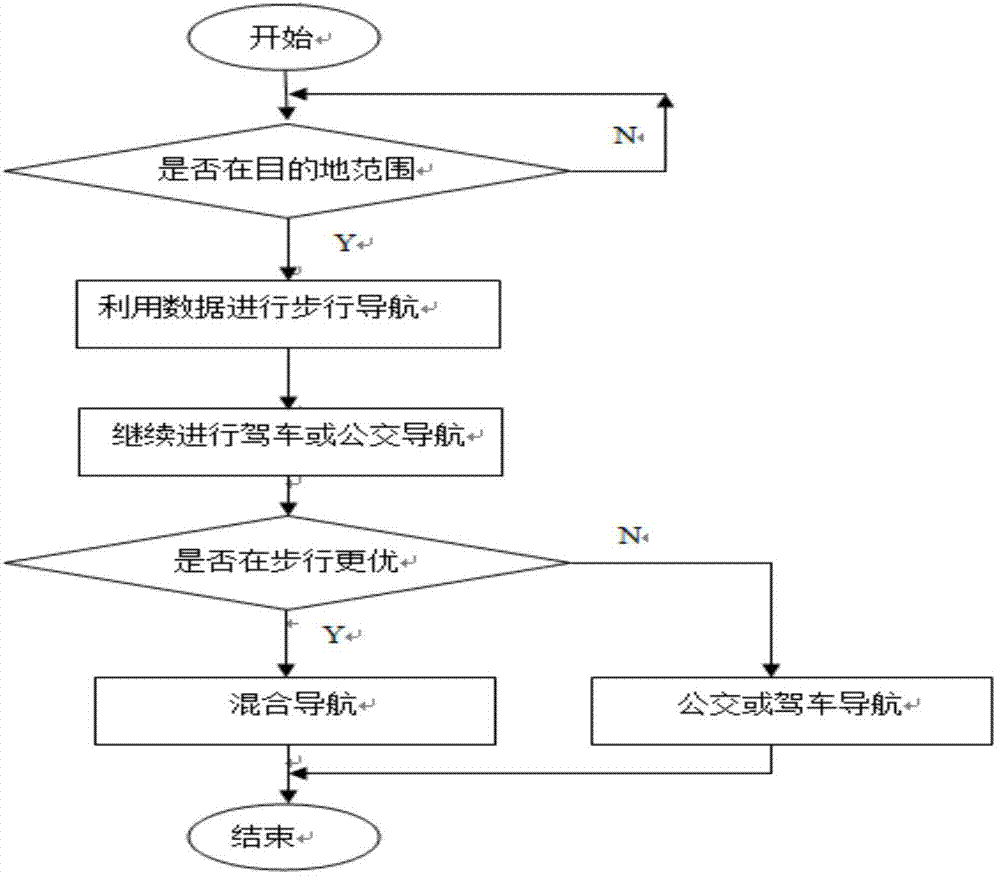
[0020] The method for calculating the mixed route of car and walk for navigation, the specific process is: initially determine whether it is within the destination range, then use the data to car...


PUM


Abstract

The invention provides a method for calculating a hybrid line of a navigated vehicle and walk. The method for calculating the hybrid line of the navigated vehicle and walk is characterized in that a hybrid line database is collected and created; the usable ways, including an important parking lot, an overpass and an underground passage, are collected and then checked and processed to generate data to be applied; the walking navigation is determined to be switched according to the generated data, and then the hybrid line is generated. The method specifically comprises the following processes: initially determining whether the destination range covers; navigating to walk through the data, and continuously driving or navigating to the bus; determining whether walking is better; if so, performing hybrid navigating; if not so, navigating to the bus or driving until reaching the destination. The method for calculating the hybrid line of the navigated vehicle and walk has the advantages that the hybrid line combines the advantages of walking distance calculation, and therefore, the parking can be optimized, and the destination can be conveniently and quickly reached.

Description

technical field [0001] The invention relates to the field of car navigation, in particular to a method for calculating a mixed route of car and walking for navigation. Background technique [0002] With the improvement of living standards, people have stricter requirements on time concept and work efficiency. When traveling by car, it is impossible to park reasonably, and the situation of arriving at the destination conveniently and quickly occurs from time to time. This is especially true when you come to a city that you are not very familiar with. [0003] Although the original route calculation of car navigation and bus navigation can provide people with several optimal routes calculated based on raw data, due to the different actual environments, the original solution is slightly unsatisfactory in terms of economy, time and convenience. . [0004] The so-called mixed route is the optimized route of the mixed route of car and walking. Contents of the invention [00...

Claims


Application Information

Patent Timeline
Patent Type & Authority Applications(China)
IPC IPC(8): G06F19/00
Inventor 李根明韩文敬
Owner SHENYANG MXNAVI CO LTD
Learn More