Calibration method of inter-satellite systematic difference based on ka ranging mode

A calibration method and inter-satellite technology, applied in the field of satellite navigation, can solve the problem that the Ka ranging mode is not considered

Active Publication Date: 2016-09-21
NAT TIME SERVICE CENT CHINESE ACAD OF SCI
View PDF4 Cites 0 Cited by
  • Summary
  • Abstract
  • Description
  • Claims
  • Application Information

AI Technical Summary

Problems solved by technology

Domestic research on inter-satellite links is in its infancy. In the past, the consideration of inter-satellite equipment system deviation was mainly based on the GPS inter-satellite ranging mode based on the UHF ranging system in the literature, and the Ka ranging mode has not been considered.

Method used


Image

  • Calibration method of inter-satellite systematic difference based on ka ranging mode
  • Calibration method of inter-satellite systematic difference based on ka ranging mode
  • Calibration method of inter-satellite systematic difference based on ka ranging mode

Examples


Embodiment Construction

[0037] The present invention will be further described below in conjunction with the accompanying drawings and embodiments, and the present invention includes but not limited to the following embodiments.

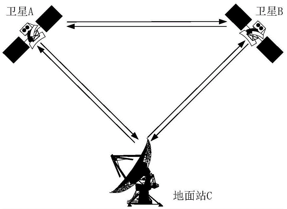
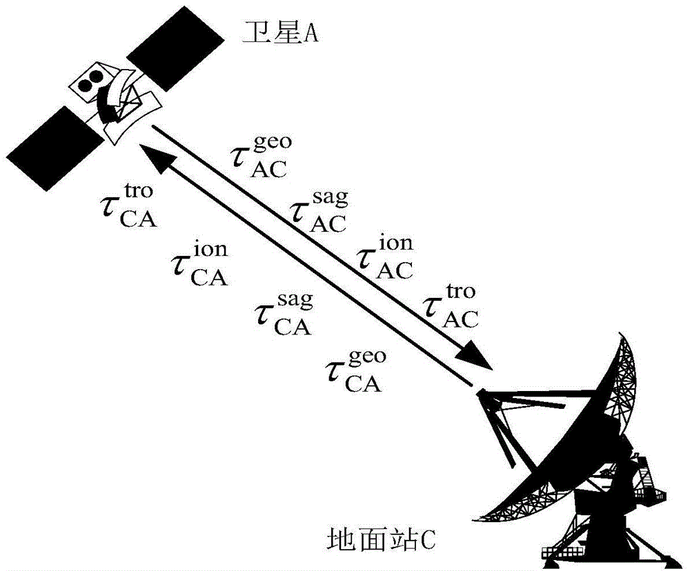
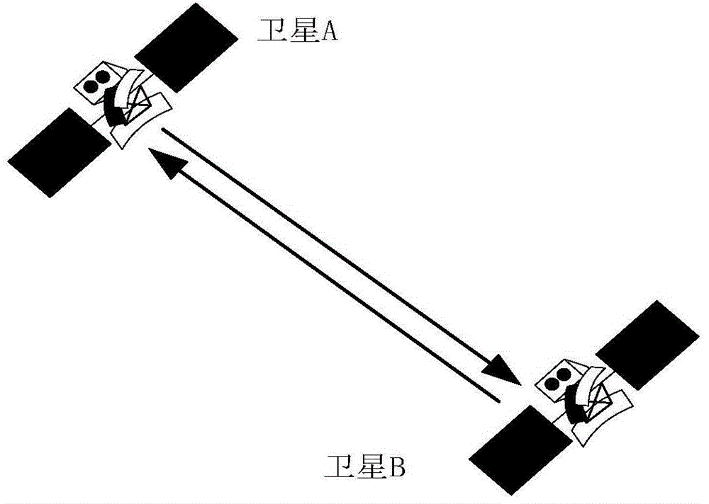
[0038] Calibration principle of inter-satellite equipment system deviation: such as figure 1 As shown, the known satellites A, B and the ground station C with an external atomic frequency standard can establish an inter-satellite bidirectional link between AB (the present invention considers that two satellites can establish an inter-satellite link under visible conditions), and AC , BC can establish star-to-earth two-way link. Through the two satellite-ground two-way links AC and BC, the satellite-ground clock difference t between the ground station C and satellites A and B at a certain moment can be obtained respectively CA , t CB , if the clock error of ground station C is considered to be zero, it is easy to obtain the clock error t of satellites A and B relative to g...


PUM


Abstract

The invention provides an inter-satellite system difference calibration method based on a Ka range finding mode. The method comprises: first of all, solving a satellite-ground clock error, and correcting a satellite-ground radio pseudo range error; then solving an inter-satellite clock error, and correcting an inter-satellite radio pseudo range error; and finally obtaining an inter-satellite equipment system difference through the difference between the inter-satellite clock error obtained through a satellite-ground two-way link and an inter-satellite clock error obtained through an inter-satellite two-way link. According to the invention, the inter-satellite equipment system deviation can be calibrated, the RMS is better than 1 ns, the inter-satellite time synchronization precision can be improved, and the autonomous navigation precision can be accordingly enhanced.

Description

technical field [0001] The invention relates to a method for calibrating inter-satellite system differences, which belongs to the field of satellite navigation. Background technique [0002] As the construction of major satellite navigation systems matures, people not only pay attention to the compatibility and interoperability between systems, but also pay more attention to the autonomous navigation capabilities of satellite navigation systems. The construction of inter-satellite links is a prerequisite for autonomous navigation, and it is a milestone in the development of satellite navigation systems. At present, the inter-satellite link works in the UHF and Ka bands. The UHF antenna has a wide half-cone angle, low communication rate, and susceptibility to interference. The inherent defects have obviously constrained the vigorous development of GPS technology, and the Ka mode can effectively reduce the Interference, enhance link security, GPS Ⅲ has planned to replace UHF ...

Claims


Application Information

Patent Timeline
Patent Type & Authority Patents(China)
IPC IPC(8): G01S19/20G04R20/02
CPCG01S19/20G01S19/256G04R20/02
Inventor 钦伟瑾杨旭海韦沛任晓乾
Owner NAT TIME SERVICE CENT CHINESE ACAD OF SCI
Why Eureka
Try Eureka