
A fast detection method for multi-source navigation electronic map vector road network changes

An electronic map and detection method technology, applied in structured data retrieval, electronic digital data processing, geographic information database, etc., can solve the problems of incompetence for large data volume and time-consuming, etc., to reduce field expenses and speed up production Efficiency, high accuracy effect

Inactive Publication Date: 2017-08-25
NORTH CHINA UNIV OF WATER RESOURCES & ELECTRIC POWER
View PDF4 Cites 2 Cited by
  • Summary
  • Abstract
  • Description
  • Claims
  • Application Information

AI Technical Summary

Problems solved by technology

These representative road network matching methods pursue the data fusion of the road network and are not designed for change detection. Therefore, such methods pay too much attention to the matching accuracy and spend a lot of time and adopt various complicated methods to achieve accurate identification. For the purpose of road elements with the same name, it is obvious that such methods are not suitable for the large amount of data. On the other hand, even if a complex calculation process is adopted, due to the complexity of the actual situation, the matching and recognition accuracy of the elements with the same name will be low. affected by various factors

Method used


Image

  • A fast detection method for multi-source navigation electronic map vector road network changes
  • A fast detection method for multi-source navigation electronic map vector road network changes
  • A fast detection method for multi-source navigation electronic map vector road network changes

Examples


Embodiment 1

[0030] Step 1. Data acquisition:

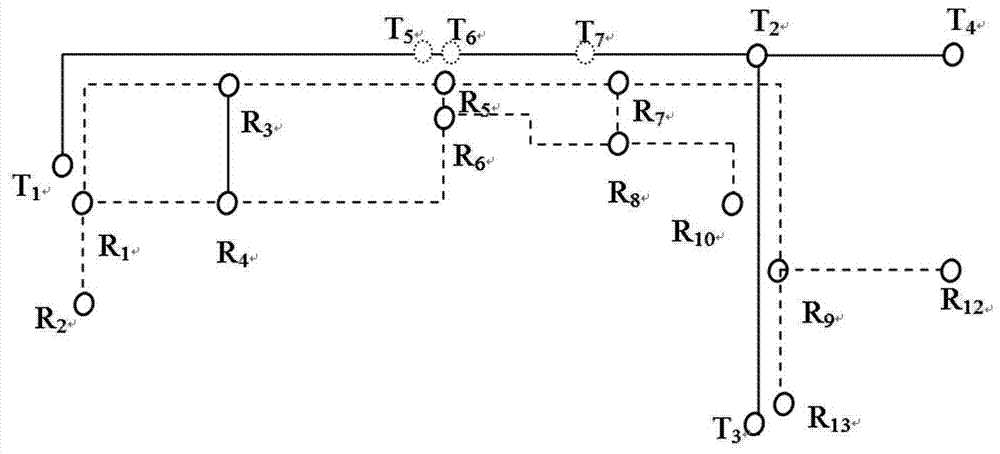
[0031] Read two sets of road networks to be matched and change detection, set the node set in the reference road network as A={a 1 ,a 2 ,...,a m}, and the set of nodes in the target road network is B={b 1 ,b 2 ,...,b n}, obtain the topological relationship between road network nodes and road arcs during the reading process, and use the grid index method to construct the spatial index of road node elements;

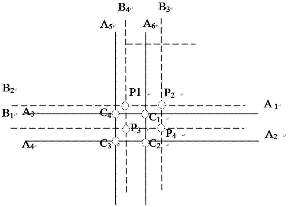
[0032] Step 2. Determination of road node matching relationship:

[0033] Let any point a in A i The topology is associated with m nodes At the same time, the topology is associated with m arc segments According to the prior knowledge of the reference road network and the target road network, such as scale and accuracy, the maximum distance deviation D between the two points with the same name can be calculated, and a is found in the target road network. i All nodes whose distance is less than D, these nodes are a i Candidate ...


PUM


Abstract

The invention discloses a detection method for rapid change in a multi-source navigation electronic map vector road network. The detection method comprises the following steps: I. reading two groups of road networks to be matched, wherein one group is marked as a reference road network and the other group is marked as a target road network, acquiring topological relation between road network node and arc, and constructing a spatial index of node elements; II. for each road node in the reference road network, searching candidate matching node from the target road network, determining matching relation of the road node, and determining corresponding relation of road arcs by calculating an included angle cosine matrix; III. depending on the obtained node matching relation and arc corresponding relation, finally obtaining possible m-to-n matching relation between the road arcs, wherein if the matching relation can exist, both m and n are not changed; and IV. on the basis of result of the determined road arc matching relation, further deducing and judging possible matching relation. Through the detection method disclosed by the invention, a matching result with relatively high accuracy rate is obtained, and efficiency is comparatively high as well.

Description

technical field [0001] The invention relates to the field of navigation electronic map vector road network, in particular to a method for quickly detecting changes in multi-source navigation electronic map vector road network. Background technique [0002] As an extremely important basic geographic information, vector road network data is closely related to people's daily travel; in recent years, with the rapid development of data collection technology and the popularization of GIS applications, different departments and enterprises have collected A large amount of vector road network data with different characteristics. This makes the industry have a strong demand for the integration and fusion of multi-source road network data. For example, manufacturers of navigation electronic maps can often obtain road network data from other sources through data purchase, exchange, etc., and they often hope to be able to compare other sources The difference between the source road net...

Claims


Application Information

Patent Timeline
Patent Type & Authority Patents(China)
IPC IPC(8): G06F17/30
CPCG06F16/2272G06F16/2365G06F16/2474G06F16/29
Inventor 赵东保
Owner NORTH CHINA UNIV OF WATER RESOURCES & ELECTRIC POWER
Learn More