

A method of power line detection in urban areas based on airborne lidar data
A detection method and technology of urban areas, applied in image data processing, radio wave measurement systems, instruments, etc., can solve problems such as similarity loss of power line information
Active Publication Date: 2017-09-29
HARBIN INST OF TECH
View PDF5 Cites 2 Cited by
- Summary
- Abstract
- Description
- Claims
- Application Information
AI Technical Summary
Problems solved by technology
The purpose of the present invention is to solve the problem that in the process of extracting power line information in a complex urban environment, there is a high similarity between the power line points in the urban area and the point cloud at the edge of the building, and a large number of power lines will be lost when the power line point cloud is directly rasterized. In view of the problem of information, a power line detection method in urban areas based on airborne LiDAR data is proposed
Method used
View moreImage
Smart ImageViewing Examples

Examples
specific Embodiment approach 1
specific Embodiment approach 2
specific Embodiment approach 3
Login to View More PUM
 Abstract
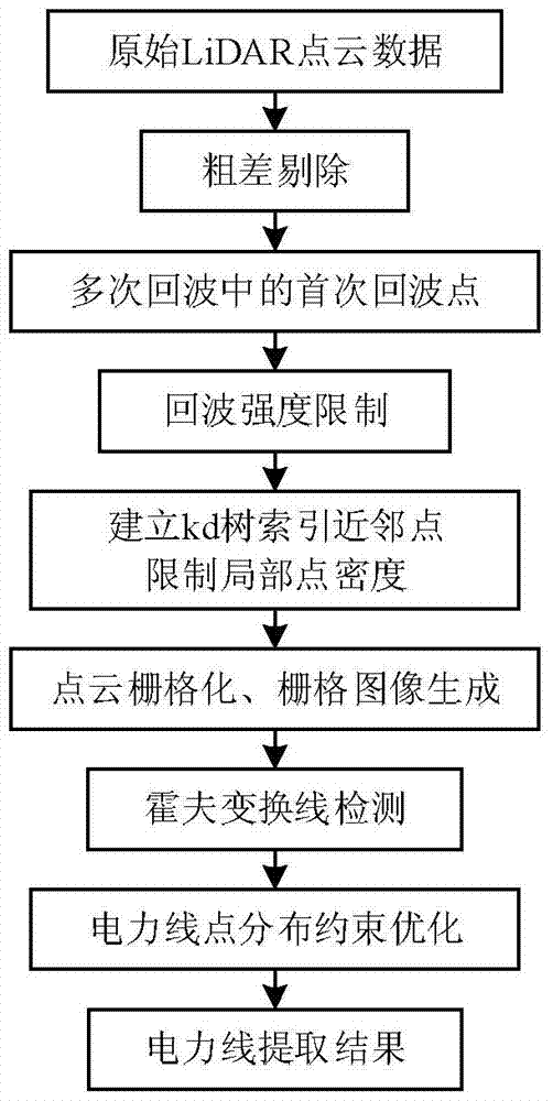
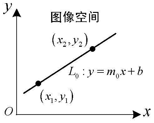
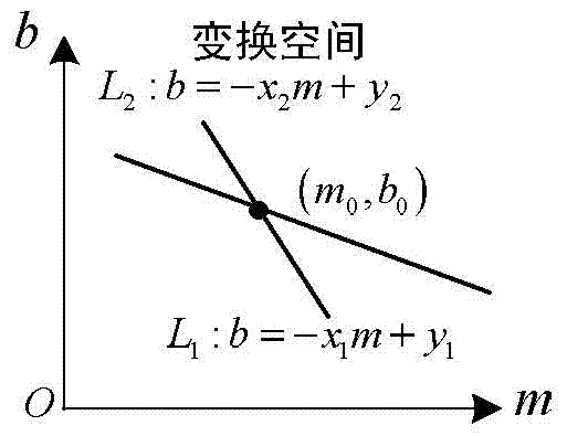
The invention provides a city region power line detection method based on airborne LiDAR (light detection and ranging) data, relates to the field of city region power line detection and aims to solve problems that power line point cloud is very similar to building edge point cloud and a large quantity of power line information can be lost due to the fact that rasterization treatment is performed on the power line point cloud directly during power line information extraction in a city region environment. The method comprises steps as follows: 1, acquiring LiDAR data after gross error rejection; 2, finding out point cloud in a first echo position; 3, finding out echo point cloud with the echo intensity quantized to be zero; 4, acquiring point cloud after the filter result; 5, acquiring a grid image after point cloud rasterization; 6, determining the linear structure of the grid image after point cloud rasterization; 7, obtaining the final power line detection result and the like. The method is applied to the field of city region power line detection.
Description
A Power Line Detection Method in Urban Area Based on Airborne LiDAR Data technical field The invention relates to the field of power line detection in urban areas; in particular, it relates to the field of a power line detection method in urban areas based on airborne LiDAR data. Background technique The power system provides hundreds of millions of households and various industrial factories and mines with continuous power through the power line network. However, the security of the vast power line network is always threatened by surrounding trees, buildings and abnormal human activities. In order to realize accurate monitoring and management of power line network status, traditional methods often require a lot of manpower, material resources and financial resources for manual line inspection or helicopter line inspection, which has low efficiency and poor accuracy. For this reason, research on high-efficiency, high-precision, and large-scale power line inspection techno...
Claims
Login to View More Application Information
Patent Timeline
 Patent Type & AuthorityPatents(China)
IPC IPC(8): G06T7/00G06T7/13
CPCG01S7/4802G06T7/0002G06T2207/10028G06T2207/10044G06T2207/20061
Inventor谷延锋解冰谦曹志民
OwnerHARBIN INST OF TECH