Pedestrian navigation system and navigation positioning method based on kinesiology model

A kinematic model, pedestrian navigation technology, applied in mapping and navigation, navigation through speed/acceleration measurement, navigation and other directions, can solve the problem of not taking into account measurement accuracy and range, etc.

Inactive Publication Date: 2015-05-13
NANJING NORMAL UNIVERSITY
View PDF9 Cites 27 Cited by
  • Summary
  • Abstract
  • Description
  • Claims
  • Application Information

AI Technical Summary

Problems solved by technology

The current low- and medium-precision inertial sensor devices cannot take into account the contradiction between measurement accuracy an

Method used


Image

  • Pedestrian navigation system and navigation positioning method based on kinesiology model
  • Pedestrian navigation system and navigation positioning method based on kinesiology model
  • Pedestrian navigation system and navigation positioning method based on kinesiology model

Examples


Embodiment Construction

[0039] The present invention will be further described below in conjunction with the accompanying drawings.

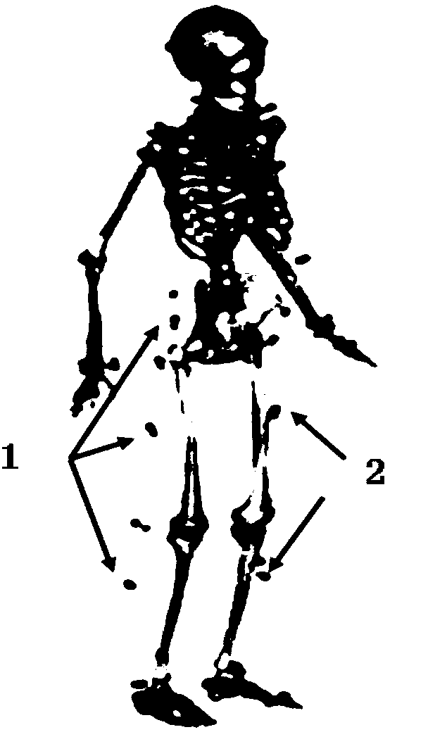
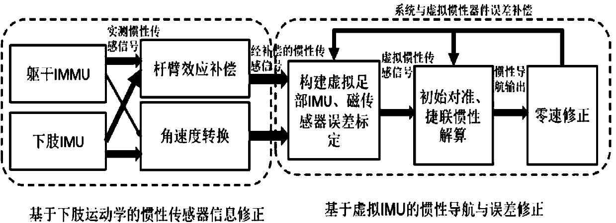
[0040] Such as figure 1 As shown, the pedestrian navigation system based on the distributed installation of inertial sensing components: the distributed installation of inertial sensing components (including inertial and geomagnetic The measurement unit is installed at the hip of the human trunk. In practical applications, low-to-medium precision inertial and geomagnetic measurement units can be used, such as MPU-6050 sensing components, etc.; four sets of inertial measurement units are installed on the thigh and calf of both legs. Near the position of the center of mass, a set of inertial sensing components can be further installed on the feet of the human body; the micro-navigation computer can be installed on the torso of the human body, connected with the above-mentioned sensor components through cables, or complete data transmission through wireless communication....


PUM


Abstract

The invention discloses a pedestrian navigation system and a navigation positioning method based on a kinesiology model, and belongs to the field of combination of biodynamics and inertial navigation. The navigation positioning method comprises the following steps: constructing a virtual inertial sensor component by using a kinematics law between lower limbs (including feet, calves, thighs and hips) in human movement and joints connecting the lower limbs, and correcting errors of the virtual inertial sensor component and the pedestrian navigation system in real time, so as to realize the accurate navigation positioning in human movement. In high-overload human movement, influences of measured information outrange, impact signals and the like on a navigation solution can be effectively overcome, and the real-time positioning performance is relatively high.

Description

technical field [0001] The invention relates to a pedestrian navigation system and a navigation positioning method based on a human kinematics model, and belongs to the technical field of biodynamics and inertial navigation. Background technique [0002] Pedestrian navigation is an important branch in the field of navigation and localization. The pedestrian navigation system can determine and monitor the position of the individual and the movement state of the human body in real time, thereby effectively improving the rapid response capabilities of military combatants and emergency search and rescue personnel, and providing real-time and accurate positioning information of pedestrians in the civilian context. And civilian application prospects. [0003] Pedestrian navigation technology based on inertial technology began in the 1990s and is mainly used in future soldier systems in developed countries such as the United States. Pedestrian navigation systems in this type of te...

Claims


Application Information

Patent Timeline
IPC IPC(8): G01C21/16G01C21/08
CPCG01C21/08G01C21/165G01C21/20
Inventor 钱伟行熊智曾庆化赵宾谢非彭晨马刚杨建飞
Owner NANJING NORMAL UNIVERSITY
Why Eureka
Try Eureka