

Hybrid method of combining multipoint statistic and object-based methods for creating reservoir property models
An object, model technology, applied in the field of computing
- Summary
- Abstract
- Description
- Claims
- Application Information
AI Technical Summary
Problems solved by technology
Method used
Image

Examples
Embodiment Construction
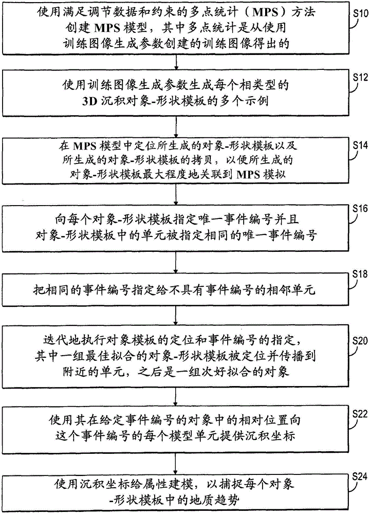
[0030] figure 1 is a flowchart of a hybrid method combining multi-point statistics and object-based methods for creating a reservoir property model suitable for reservoir flow simulation in accordance with an embodiment of the invention. The method includes creating a multipoint statistical (MPS) model at S10. MPS models can be created using any MPS method that satisfies the conditioning data and constraints, where multipoint statistics are derived from training images created using training image generation parameters. The training image generation parameters include object shape, orientation, position, size, etc. Examples of shapes include triangles, squares, rectangles, semicircles, ribbons, or more complex shapes.
[0031] In one embodiment, the MPS method may include building a grid in a desired geological region and interpreting the facies of specific cells in the grid (the MPS grid). The method also includes establishing or generating MPS training images (ie, 3D trai...
PUM
 Abstract
Description
Claims
Application Information