

Target control point-based satellite CCD array image geometric calibration method
Patent Information
- Authority / Receiving Office
- CN · China
- Patent Type
- Applications(China)
- Current Assignee / Owner
- SATELLITE SURVEYING & MAPPING APPL CENTSASMAC NAT ADMINISTATION OF SURVEYING MAPPING & GEOINFORMATION OF CHINANASG
- Publication Date
- 2015-07-29
Smart Images
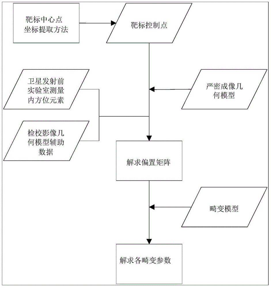
Figure 1 
Figure 2 
Figure 3
Abstract
Description
technical field
[0001] The invention belongs to the technical field of photographic imaging surveying and mapping, and in particular relates to a method for geometrically checking satellite CCD array images based on target control points. Background technique
[0002] The geometric accuracy of satellite imagery is an important basis for subsequent applications, and the geometric accuracy directly represents the location accuracy of image features. If the geometric accuracy of satellite images is low, a large number of control points will be required for correction during subsequent image processing, which requires a lot of manpower, material and financial resources, which will lead to a decrease in image sales.
[0003] At present, the domestically-developed domestic satellites have improved in terms of image visual effects and radiation quality, but there is still a large gap in geometric quality compared with similar foreign satellites. For example, the positioning accura...