Multi-scale remote-sensing image segmentation method based on local homogeneity index

A remote sensing image, homogeneity technology, applied in the field of remote sensing image analysis, can solve problems such as difficult to obtain satisfactory results

Active Publication Date: 2016-02-17
NANJING UNIV OF INFORMATION SCI & TECH
View PDF4 Cites 26 Cited by
  • Summary
  • Abstract
  • Description
  • Claims
  • Application Information

AI Technical Summary

Problems solved by technology

At present, although JSEG has achieved good results in the segmentation of medium and low-resolution remote sensing images, it is difficult to achieve satisfactory results by directly using the JSEG algorithm in the face of new challenges brought by the improvement of spatial resolution to remote sensing image segmentation.

Method used


Image

  • Multi-scale remote-sensing image segmentation method based on local homogeneity index
  • Multi-scale remote-sensing image segmentation method based on local homogeneity index
  • Multi-scale remote-sensing image segmentation method based on local homogeneity index

Examples


Embodiment Construction

[0068] The technical solutions of the present invention will be described in detail below in conjunction with the accompanying drawings.

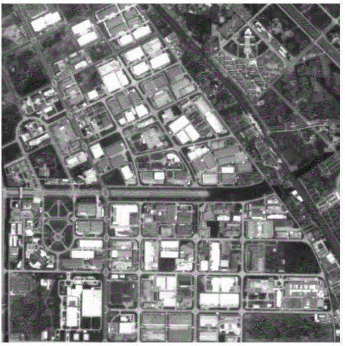
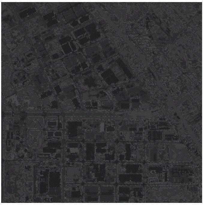
[0069] This embodiment first introduces the basic principle and implementation process of the JSEG algorithm, and analyzes the key problems and deficiencies of the JSEG algorithm in the segmentation of high-resolution remote sensing images, and then explains the improvement strategy and implementation process of the algorithm proposed by the present invention; And the experimental results were analyzed and compared.

[0070] Basic principle of JSEG algorithm

[0071] The segmentation process of the traditional JSEG algorithm mainly includes three steps: image quantization, spatial segmentation and region merging. In image quantization, firstly, the original image is converted to LUV color space, and then PGF (PeerGroupFiltering) is used to smooth the image, and then the classic hard threshold HCM (HardC-Means) method is used for color quan...


PUM


Abstract

The invention discloses a multi-scale remote-sensing image segmentation method based on the local homogeneity index. The segmentation method comprises image quantization based on the bisecting K-means clustering, multi-scale segmentation based on surface feature context information and region merging based on SSIM and D-S evidence theory. According to the invention, coarse image quantization in JSEG is improved; the multi-scale segmentation based on the surface feature context information and the SSIM and the region merging strategy based on the D-S evidence theory are provided; by carrying out segmentation experiments on multiple groups of different sensor types of high-definition remote sensing images, it can be proved that the boundary of objectives can be precisely positioned via the disclosed algorithm; and the segmentation method is provided with quite high segmentation precision.

Description

technical field [0001] The invention belongs to the technical field of remote sensing image analysis, and in particular relates to a remote sensing image segmentation method. Background technique [0002] Image segmentation technology realizes the extraction of contour information of geographically meaningful objects in the scene, and is the premise and basis for remote sensing image information extraction and target recognition using object-oriented image analysis (OBIA, Object-Based Image Analysis) technology. Different from ordinary images, remote sensing images have the characteristics of multi-spatial resolution, multi-spectral resolution, wide coverage, numerous types of ground objects, and rich texture features. First of all, the multi-band characteristics of remote sensing images make it difficult for traditional single-band image segmentation methods to be directly applied to multispectral or hyperspectral remote sensing image segmentation. In addition, remote sens...

Claims


Application Information

Patent Timeline
Patent Type & Authority Applications(China)
IPC IPC(8): G06T7/00
CPCG06T2207/10044
Inventor 王超徐梦溪
Owner NANJING UNIV OF INFORMATION SCI & TECH
Why Eureka
Try Eureka