Method and system for searching safety zone of elevation map based on Monte Carlo algorithm

A technology of Monte Carlo algorithm and safety area, which is applied in the field of search method and system of elevation map safety area, and can solve the problems of time-consuming search method and omissions, etc.

Active Publication Date: 2016-05-18
CHONGQING UNIVERSITY OF SCIENCE AND TECHNOLOGY
View PDF2 Cites 1 Cited by
  • Summary
  • Abstract
  • Description
  • Claims
  • Application Information

AI Technical Summary

Problems solved by technology

[0005] In view of the above problems, the object of the present invention is to provide a method and system for searching the safe area of ​​the elevati

Method used


Image

  • Method and system for searching safety zone of elevation map based on Monte Carlo algorithm
  • Method and system for searching safety zone of elevation map based on Monte Carlo algorithm
  • Method and system for searching safety zone of elevation map based on Monte Carlo algorithm

Examples


Embodiment Construction

[0026] In the following description, for purposes of explanation, numerous specific details are set forth in order to provide a thorough understanding of one or more embodiments. It may be evident, however, that these embodiments may be practiced without these specific details.

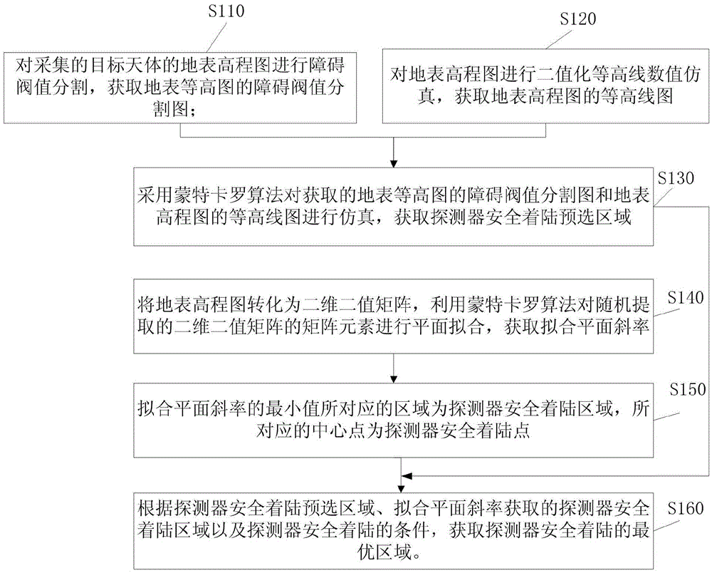
[0027] Aiming at problems such as the low accuracy of the safety area determined by the existing detection technology proposed above and the long time of the call charge, the present invention proposes a method and system for searching the safety area of ​​the elevation map based on the Monte Carlo algorithm. Algorithms determine the best landing areas for deep-space probes.

[0028] Specific embodiments of the present invention will be described in detail below in conjunction with the accompanying drawings.

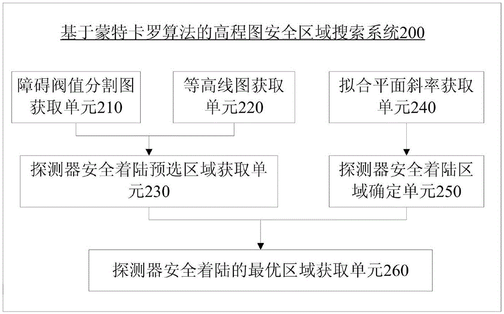
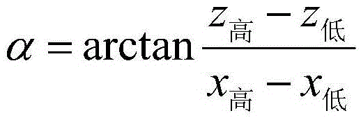
[0029] In order to illustrate the method for searching the safe area of ​​the height map based on the Monte Carlo algorithm provided by the present invention, figure 1 It shows the procedure o...


PUM


Abstract

The invention provides a method and system for searching a safety zone of an elevation map based on a Monte Carlo algorithm. The method comprises the following steps: using the Monte Carlo algorithm to simulate an acquired obstacle threshold segmentation map of a surface contour map and a contour map of a surface elevation map, and obtaining a safe landing preselected zone of a detector; transforming the surface elevation map into a two-dimensional binary matrix, using the Monte Carlo algorithm to perform plane fitting on random extracted matrix elements of the two-dimensional binary matrix, and obtaining a fitting plane slope; taking a zone corresponding to a minimum value of the fitting plane slope as a safe landing zone of the detector, and detecting a corresponding central point as a safe landing point of the detector; and acquiring an optimum zone for the safe landing of the detector according to the safe landing preselected zone, the safe landing zone of the detector acquired by the fitting plane slope and the condition of safe landing of the detector. By adopting the method and system for searching the safety zone of the elevation map based on the Monte Carlo algorithm provided by the invention, the problems of time-consuming, omission and so on in the traditional searching method of the detector can be solved.

Description

technical field [0001] The present invention relates to the field of aerospace technology, and more specifically, to a method and system for searching a safe area of ​​an elevation map based on a Monte Carlo algorithm. Background technique [0002] Safe area search is an important search method, which is widely used in aerospace, especially in the detection of extraterrestrial celestial bodies. A key technology in the return of the probe. However, it is difficult to achieve the global optimum in safe area search. To a large extent, the accuracy of the safe area determined is not high, and it takes a long time, which increases the risk of landing. [0003] In order to solve these problems, many scholars have proposed various security area search methods, the existing search methods, such as: spiral search and divergent search. The disadvantage of the spiral search method is that it only finds a safe landing area, but does not find the globally optimal safe area, and it take...

Claims


Application Information

Patent Timeline
IPC IPC(8): G06F17/50
CPCG06F30/20
Inventor 戚会清胡世莱王晓峰李继强
Owner CHONGQING UNIVERSITY OF SCIENCE AND TECHNOLOGY
Why Eureka
Try Eureka