Method for constructing virtual streetscape map

A map and street view technology, applied in the field of building virtual street view maps, can solve problems such as being unable to enter users and not being accepted by users, and achieve the effect of improving information dissemination and user arrival rate

Inactive Publication Date: 2016-06-29
SHANGHAI JIETU TIANXIA NETWORK SCI & TECH
View PDF6 Cites 39 Cited by
  • Summary
  • Abstract
  • Description
  • Claims
  • Application Information

AI Technical Summary

Problems solved by technology

For the non-existent target space, or the scene in the planning and implementation process, it is mainly constructed through 3D modeling technology, and then displayed through special 3D display software. However, due to network security and user habits, it is necessary to download plug-ins for data reading. The method adopted is less and less accepted by users, so that the fine and exquisite modeling results produced by spending huge sums of money cannot enter the user's field of vision due to the bottleneck of display technology. Therefore, a new technical means and display are needed. method to solve the display problem of 3D modeling data

Method used


Image

  • Method for constructing virtual streetscape map
  • Method for constructing virtual streetscape map
  • Method for constructing virtual streetscape map

Examples


Embodiment Construction

[0029] Below in conjunction with the drawings, preferred embodiments of the present invention are given and described in detail.

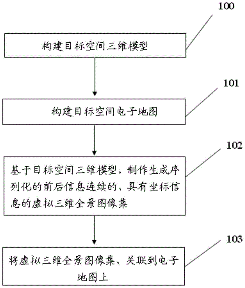
[0030] The present invention, namely a kind of construction method of virtual street view, comprises the following steps:

[0031] Step S1, constructing a three-dimensional model of the target space;

[0032] Step S2, constructing an electronic map of the target space;

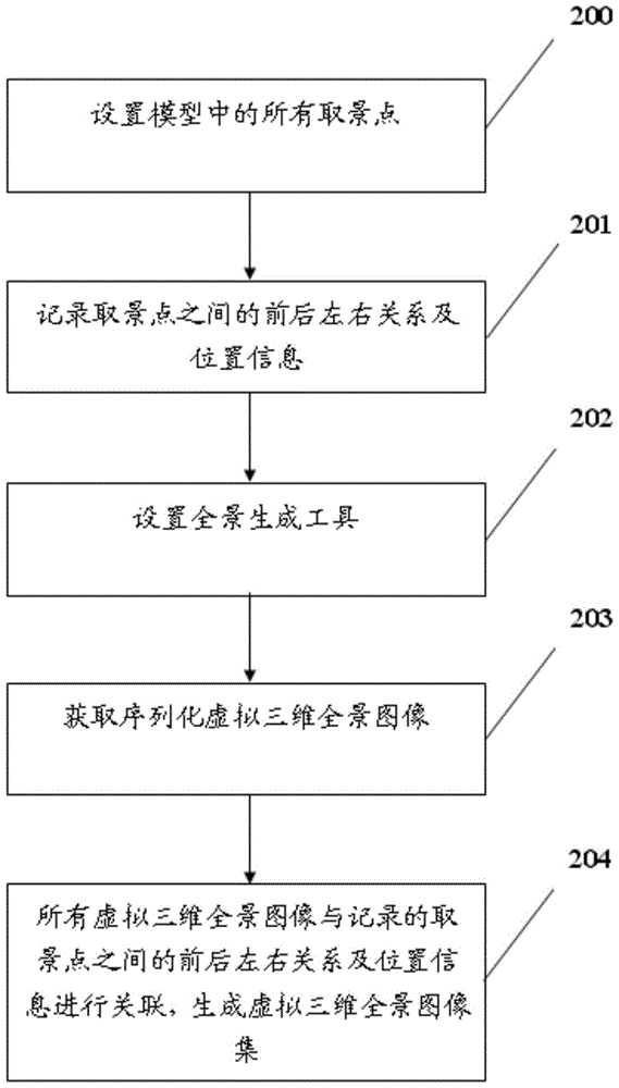
[0033] Step S3, based on the 3D model of the target space, create and generate a sequenced virtual 3D panoramic image set with continuous front and rear information and coordinate information;

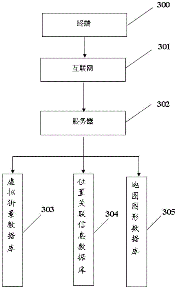
[0034] Step S4, associating the virtual three-dimensional panoramic image set in step S3 with the electronic map in step S2, and publishing it on the web based on the browser.

[0035] First, the following concepts in the present invention are explained:

[0036] 1. The target space includes but is not limited to: the real environment that exists in reality, cities under planning or cons...


PUM


Abstract

A method for constructing a virtual street view map disclosed by the present invention includes the following steps: step S1, constructing a three-dimensional model of the target space; step S2, constructing an electronic map of the target space; step S3, making a generation sequence based on the three-dimensional model of the target space A virtualized three-dimensional panoramic image set with continuous front and back information and coordinate information; step S4, associating the virtual three-dimensional panoramic image set in step S3 with the electronic map in step S2, and publishing it on the web based on the browser. The present invention realizes a new method for generating a virtual street view map, realizes the cross-platform and cross-terminal barrier-free transmission of three-dimensional model data, and greatly improves the information dissemination and user arrival rate of the target space.

Description

technical field [0001] The invention relates to a method for constructing a virtual street view map based on three-dimensional modeling technology and street view map technology. Background technique [0002] Street view map is a real map service that combines electronic map technology and 3D panorama technology. The street view car takes pictures at certain distances (usually 10 meters) during driving to obtain a 3D panoramic image centered on the shooting point, and at the same time records the GPS information at the time of collection, and calculates each panorama through the time stamp relationship According to the coordinate information, the three-dimensional panorama is integrated into the electronic map to provide street view map service for visitors to browse. The three-dimensional representation of the street view map forms a strong contrast with the 2D flat map, making the original boring map more vivid, more readable and entertaining. Users can browse high-defin...

Claims


Application Information

Patent Timeline
Patent Type & Authority Applications(China)
IPC IPC(8): G06T17/05
CPCG06T17/05
Inventor 刘小华马姚康
Owner SHANGHAI JIETU TIANXIA NETWORK SCI & TECH
Why Eureka
Try Eureka